Ledston in the Domesday Book (1086)
Ledston is named in the Domesday Book, compiled by Norman commissioners in 1086, entered under the hundred of Skyrack in Yorkshire.
Other Settlements in Skyrack
- Adel
- Allerton [Bywater]
- Alwoodley
- Arthington
- Austhorpe
- Baildon
- Bardsey
- Barwick [in Elmet]
- Bichertun
- Bicherun
- Bingley
- Birkby [Hill]
- Bramhope
- Burden [Head]
The Meaning of the Name
The name Ledston is of Anglo-Saxon origin. Its final element derives from the Old English word tūn, a farmstead or village. The first element is most likely a personal name or an early descriptive term, now difficult to recover with certainty. Taken together the name probably meant something close to ‘a farmstead’.
Remarkably, the name has changed little since 1086, when the Domesday scribes wrote it as Ledston.
Listed Buildings Near Ledston
Historic England records 18 listed buildings within about a mile of Ledston. Listing protects structures of special architectural or historic interest, graded I (exceptional), II* (particularly important) and II.
Grade I
- Entrance Gates and Lodges - 0.42 km
- Barn Forming East Side of Stable Yard Aproximately 100 Metres East of Ledston Hall - 0.44 km
- Stable Block Approximately 50 Metres East of Ledston Hall - 0.45 km
- Ledston Hall - 0.47 km
Grade II*
- Garden House at North End of West Terrace of Ledston Hall - 0.51 km
- Gate Piers on Former Drive Approximately 150 Metres North of Ledston Hall - 0.63 km
Grade II
- Barn Stables and Granary in Yard Immediately North of Manor Farmhouse With Yard Wall - 0.32 km
- Wall Bounding the South, West and North Sides of Stable Yard to East of Ledston Hall - 0.41 km
- Gate and Steps at South East Corner of Sunken Garden to West of Ledston Hall - 0.41 km
- Loggia in Sunken Garden Forming South End of Terrace to West of Ledston Hall - 0.42 km
- Statue in Sunken Garden Approximately 100 Metres West of Ledston Hall - 0.47 km
- Steps in Centre of Grassed Terraces of Sunken Garden to West of Ledston Hall - 0.47 km
- Two Sets of Steps Up Terraces to East of Ledston Hall - 0.48 km
- Low Lodge With Associated Gate Piers and Wall - 0.99 km
- Gate Piers to Former North Drive to Ledston Hall - 1.0 km
- Milepost at Se 427 282 - 1.0 km
- Remains of Newton Abbey at Se 444 277 - 1.1 km
- Barn Approximately 10 Metres West of Home Farm Farmhouse - 1.13 km
Scheduled Monuments Near Ledston
Scheduled monuments are nationally important archaeological sites given legal protection. 1 lies within roughly a mile of Ledston:
- Fairburn Ings (Newton Abbey) moat - 1.1 km
Ledston Today
Today Ledston lies within the administrative area of Leeds, and the settlement recorded a population of 349 at the 2021 census. Nine and a half centuries separate that figure from the small rural community the Domesday survey recorded here in 1086.
Read more about modern Ledston on Wikipedia .
Nearby Domesday Settlements
Other places recorded in the 1086 survey within a few miles:
- Newton Wallis - 1.4 km SE
- Ledsham - 2.2 km NE
- Allerton Bywater - 2.2 km SW
- Kippax - 2.8 km NW
- Wheldale - 2.8 km SE
- Water Fryston - 3.6 km SE
Heritage Around Ledston
Photographs of churches, listed buildings and monuments in the vicinity, contributed by volunteers to the Geograph project and reused here under a Creative Commons licence.
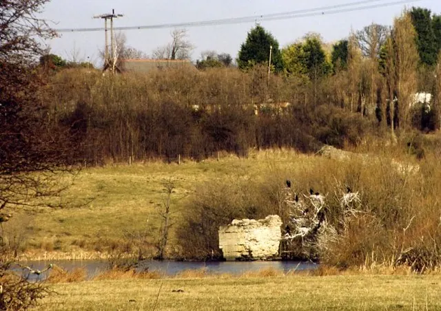
© David Pickersgill · Geograph · CC BY-SA 2.0
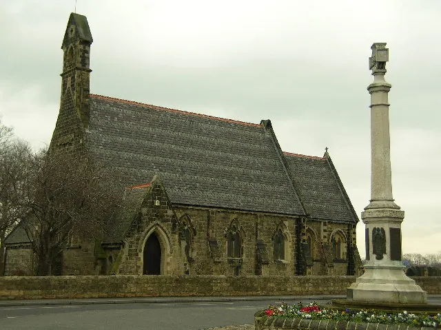
© Paul Johnston-Knight · Geograph · CC BY-SA 2.0
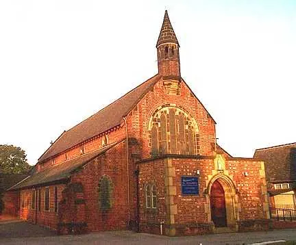
© Bill Henderson · Geograph · CC BY-SA 2.0
Images © their respective photographers, licensed under CC BY-SA 2.0 and reused here with attribution. Photographs depict listed buildings, churches and monuments near this settlement and may show neighbouring villages.
Data derived from the Open Domesday project (opendomesday.org), based on the Domesday Book dataset compiled by Professor J.J.N. Palmer and team. The Domesday Book (1086) is in the public domain.
Found an inaccuracy? [email protected]