Lancaster in the Domesday Book (1086)
Lancaster appears in the Domesday Book of 1086, entered under the hundred of Amounderness in Yorkshire.
Other Settlements in Amounderness
- Aighton
- Aldcliffe
- Aldingham
- Arkholme
- Aschebi
- Ashton [Hall]
- Ashton [on Ribble]
- Austwick
- Barbon
- Bardsea
- Bare
- Barnoldswick
- Barton
- Beetham
The Meaning of the Name
The name Lancaster is of Anglo-Saxon origin. Its final element derives from the Old English word ceaster (from Latin castra), a Roman fort or walled town. The first element is most likely a personal name or an early descriptive term, now difficult to recover with certainty. Taken together the name probably meant something close to ‘a Roman fort’.
Remarkably, the name has changed little since 1086, when the Domesday scribes wrote it as Lancaster.
Listed Buildings Near Lancaster
Historic England records 268 listed buildings within about a mile of Lancaster. Listing protects structures of special architectural or historic interest, graded I (exceptional), II* (particularly important) and II.
Grade I
- Ashton Memorial - 0.34 km
Grade II*
- Cathedral Church of St Peter - 0.49 km
Grade II
- Christ Church - 0.14 km
- War Memorial Approximately 5 Metres North of Christ Church - 0.14 km
- Christ Church Primary School - 0.19 km
- Royal Grammar School (Old School) - 0.23 km
- Cross in Roman Catholic Cemetery - 0.35 km
- Gate Piers, Gates and Walls to Williamson Park - 0.36 km
- Gate Piers, Gates and Walls to Williamson Park - 0.36 km
- Lodge to Williamson Park - 0.37 km
- Lodge to Williamson Park - 0.38 km
- Perimeter Walls and Gateway of Roman Catholic Cemetery - 0.39 km
- The Palm House - 0.39 km
- Bridge Over the Lake - 0.4 km
- Cathedral School Including Attached Wall, Rilings and Doorway - 0.41 km
- Tower Approximately 100 Metres South of the Ashton Memorial - 0.42 km
- St Walburga’s Convent - 0.44 km
- Bath House - 0.46 km
- Cathedral House - 0.48 km
- Golgotha With Attached Garden Walls - 0.49 km
- Golgotha With Attached Garden Walls - 0.5 km
- Golgotha With Attached Garden Walls - 0.51 km
- Golgotha With Attached Garden Walls - 0.51 km
- Row of Outhouses Approximately 3 Metres to Rear of Numbers 3-10 (Consecutive) Golgotha - 0.51 km
…and 244 more listed structures in the area.
Scheduled Monuments Near Lancaster
Scheduled monuments are nationally important archaeological sites given legal protection. 3 lie within roughly a mile of Lancaster:
- Skerton Bridge - 1.08 km
- Glass melting and annealing workshop; part of Shrigley and Hunt’s stained glass manufacturing workshops - 1.15 km
- Part of a Roman fort and its associated vicus and remains of a pre-Conquest monastery and a Benedictine priory on Castle Hill - 1.34 km
Nearby Domesday Settlements
Other places recorded in the 1086 survey within a few miles:
- Kirk Lancaster - 1.0 km W
- Newton - 1.0 km W
- Scotforth - 2.0 km S
- Aldcliffe - 2.2 km SW
- Skerton - 2.2 km NW
- Oxcliffe Hall - 3.0 km W
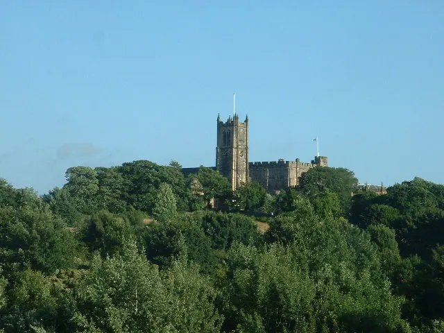
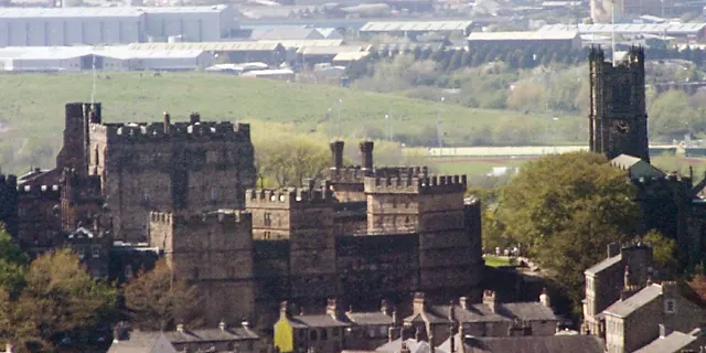
Heritage Around Lancaster
Photographs of churches, listed buildings and monuments in the vicinity, contributed by volunteers to the Geograph project and reused here under a Creative Commons licence.

© mym · Geograph · CC BY-SA 2.0
© David Medcalf · Geograph · CC BY-SA 2.0
© Dave Logan · Geograph · CC BY-SA 2.0
Images © their respective photographers, licensed under CC BY-SA 2.0 and reused here with attribution. Photographs depict listed buildings, churches and monuments near this settlement and may show neighbouring villages.
Data derived from the Open Domesday project (opendomesday.org), based on the Domesday Book dataset compiled by Professor J.J.N. Palmer and team. The Domesday Book (1086) is in the public domain.
Found an inaccuracy? [email protected]