Kirkby Malzeard in the Domesday Book (1086)
The settlement of Kirkby Malzeard is recorded in William I’s Domesday survey of 1086, entered under the hundred of Burghshire in Yorkshire.
Other Settlements in Burghshire
- Addlethorpe
- Aismunderby
- Aldfield
- Allerton [Mauleverer]
- Arkendale
- Askwith
- Azerley
- Barrowby [Grange]
- Beckwith [House]
- Besthaim
- Bestham
- Bewerley
- Bilton
- Birstwith
The Meaning of the Name
The name Kirkby Malzeard is of Scandinavian origin. Its final element derives from the Old Norse word bý, a farmstead or village, while the first element appears to represent the church (ON kirkja). Taken together the name probably meant something close to ’the church farmstead’.
Names of this type are a fingerprint of Scandinavian settlement: they cluster across the old Danelaw, where Norse-speaking settlers renamed or founded villages from the late 9th century onward.
Remarkably, the name has changed little since 1086, when the Domesday scribes wrote it as Kirkby Malzeard.
Listed Buildings Near Kirkby Malzeard
Historic England records 20 listed buildings within about a mile of Kirkby Malzeard. Listing protects structures of special architectural or historic interest, graded I (exceptional), II* (particularly important) and II.
Grade I
- Church of St Andrew - 0.07 km
Grade II
- Mowbray House - 0.03 km
- Medieval Cross Approximately 6 Metres to South East of Chancel of Church of St Andrew - 0.03 km
- Table Tomb Approximately 3 Metres to South East of Chancel of Church of St Andrew - 0.05 km
- Table Tomb to George Hewitt Approximately 5 Metres to South East of Chancel of Church of St Andrew - 0.05 km
- Table Tomb to Willam and Helen Holds, Approximately 3 Metres to South of Chancel of Church of St Andrew - 0.06 km
- The Old Rectory - 0.06 km
- Tombstone to Peter Save Approximately 2 Metres to South of West End of Nave of Church of St Andrew - 0.08 km
- Cottage to Right of Churchbye House - 0.09 km
- Churchbye House and Attached Railings - 0.09 km
- The Shoulder of Mutton - 0.09 km
- Barkways and Greystone - 0.1 km
- 1, Church Street - 0.11 km
- Market Cross - 0.12 km
- Rose Cottage and Adjoining House to Right - 0.32 km
- Barn at Junction With Long Swales Lane - 0.44 km
- Creets Bridge - 0.47 km
- Pinfold - 0.56 km
- Lawnwith Farmhouse - 0.74 km
- South View - 0.8 km
Scheduled Monuments Near Kirkby Malzeard
Scheduled monuments are nationally important archaeological sites given legal protection. 1 lies within roughly a mile of Kirkby Malzeard:
Kirkby Malzeard Today
Today Kirkby Malzeard lies within the administrative area of Harrogate, and the settlement recorded a population of 909 at the 2021 census. Nine and a half centuries separate that figure from the small rural community the Domesday survey recorded here in 1086.
Read more about modern Kirkby Malzeard on Wikipedia .
Nearby Domesday Settlements
Other places recorded in the 1086 survey within a few miles:
- Laverton - 1.4 km SW
- Azerley - 2.0 km E
- Grewelthorpe - 2.0 km N
- Kex Moor - 3.2 km W
- Hawcoat - 3.6 km SW
- Bramley Grange - 3.6 km NW
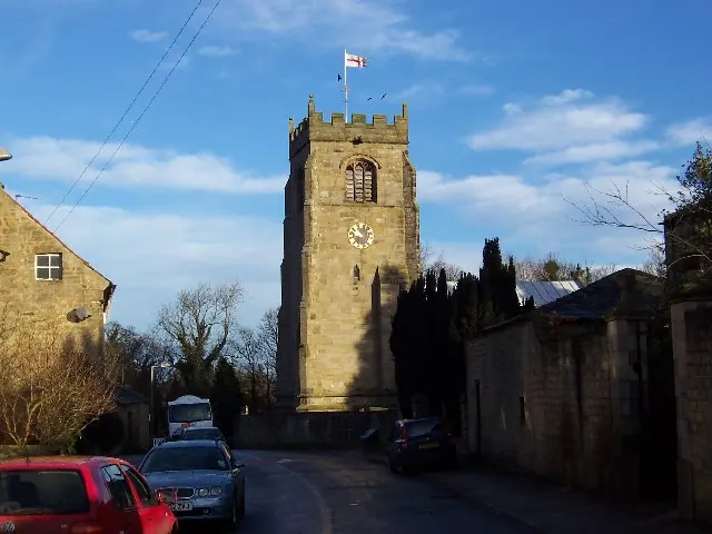
Heritage Around Kirkby [Malzeard]
Photographs of churches, listed buildings and monuments in the vicinity, contributed by volunteers to the Geograph project and reused here under a Creative Commons licence.
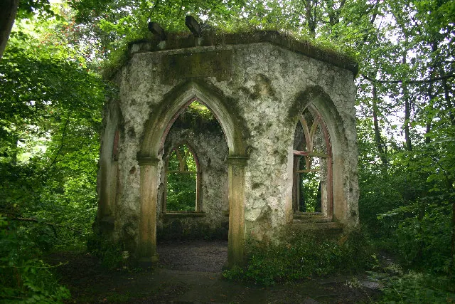
© Uncredited · Geograph · CC BY-SA 2.0
© Chris Heaton · Geograph · CC BY-SA 2.0
![Timekeeping in Kirkby Malzeard [1]](/domesday/kirkby-malzeard/geo-3.webp)
© Gordon Hatton · Geograph · CC BY-SA 2.0
Images © their respective photographers, licensed under CC BY-SA 2.0 and reused here with attribution. Photographs depict listed buildings, churches and monuments near this settlement and may show neighbouring villages.
Data derived from the Open Domesday project (opendomesday.org), based on the Domesday Book dataset compiled by Professor J.J.N. Palmer and team. The Domesday Book (1086) is in the public domain.
Found an inaccuracy? [email protected]