Kirk Bramwith in the Domesday Book (1086)
The 1086 Domesday survey records the settlement of Kirk Bramwith, entered under the hundred of Strafforth in Yorkshire. The survey assessed Kirk Bramwith at 4 carucates of taxable land.
At the time of the survey, Kirk Bramwith supported a recorded population of 2 villagers, working 3 ploughs between them.
By 1086 Kirk Bramwith was worth 2.5 shillings, up from 1.5 shillings before the Conquest – which sets it apart from the many nearby villages left waste or devalued.
The survey lists 2 manors at Kirk Bramwith under different lords. Splitting a single settlement between multiple tenants was common across the North – Saxon estates broken up and handed to William’s followers after 1066.
Other Settlements in Strafforth
- Adwick [le Street]
- Adwick [upon Dearne]
- Armthorpe
- Aston
- Attercliffe
- Auckley
- Aughton [Hall]
- Austerfield
- Balby
- Barnbrough
- Barnby [Dun]
- Bentley
- Bilham [House]
- Billingley
The Meaning of the Name
The name Kirk Bramwith is of Scandinavian origin. Its final element derives from the Old Norse word viðr, a wood. The first element is most likely a personal name or an early descriptive term, now difficult to recover with certainty. Taken together the name probably meant something close to ‘a wood’.
Names of this type are a fingerprint of Scandinavian settlement: they cluster across the old Danelaw, where Norse-speaking settlers renamed or founded villages from the late 9th century onward.
Remarkably, the name has changed little since 1086, when the Domesday scribes wrote it as Kirk Bramwith.
Listed Buildings Near Kirk Bramwith
Historic England records 16 listed buildings within about a mile of Kirk Bramwith. Listing protects structures of special architectural or historic interest, graded I (exceptional), II* (particularly important) and II.
Grade II*
- Church of St Mary - 0.65 km
Grade II
- Ha-ha Approximately 50 Metres to South East of Bramwith Hall and Attached Garden Wall at Its North Eastern End - 0.2 km
- Bramwith Hall - 0.26 km
- Gazebo Approximately 15 Metres to North of Bramwith Hall - 0.28 km
- Curtain wall to grounds of Bramwith Hall including gatepiers to northern entrance - 0.3 km
- Cartshed/granary Approximately 12 Metres to North West of Fox Farmhouse - 0.45 km
- L-shaped barn range at Fox Farm situated at junction with Bramwith Lane - 0.45 km
- Bramwith Bridge - 0.5 km
- Rose Cottage and attached outbuilding - 0.6 km
- The Old Rectory - 0.62 km
- Stone Font Approximately 12 Metres to South of Porch to Church of St Mary - 0.65 km
- Stone Coffin Adjacent to West Side of Tower at Church of St Mary - 0.66 km
- Two pairs of gate piers with linking wall on north side of churchyard at church of St Mary - 0.68 km
- Church Cottage - 0.69 km
- Drain Bridge - 0.7 km
- Barn immediately to west of Hermitage Farmhouse - 1.26 km
Kirk Bramwith Today
Today Kirk Bramwith lies within the administrative area of Doncaster, and the settlement recorded a population of 221 at the 2021 census. Nine and a half centuries separate that figure from the small rural community the Domesday survey recorded here in 1086.
Read more about modern Kirk Bramwith on Wikipedia .
Nearby Domesday Settlements
Other places recorded in the 1086 survey within a few miles:
- South Bramwith - 0.0 km N
- Stainforth - 2.0 km E
- Barnby Dun - 2.2 km SW
- Kirk Sandall - 3.2 km S
- Fishlake - 3.6 km NE
- Hatfield - 4.5 km SE
Heritage Around [Kirk] Bramwith
Photographs of churches, listed buildings and monuments in the vicinity, contributed by volunteers to the Geograph project and reused here under a Creative Commons licence.
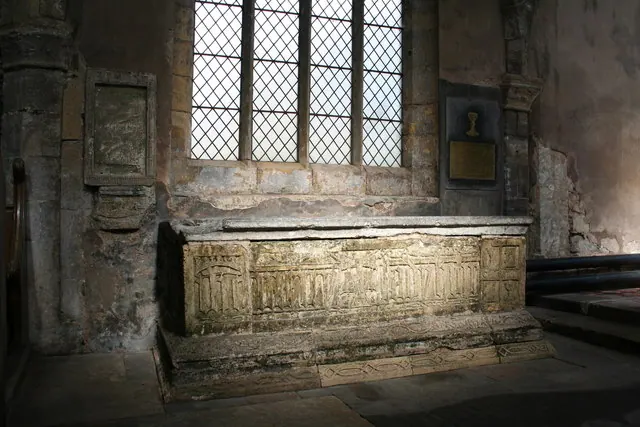
© Richard Croft · Geograph · CC BY-SA 2.0
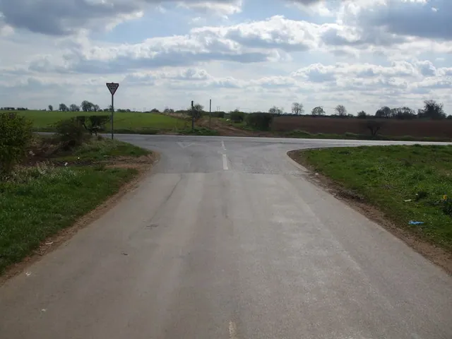
© Glyn Drury · Geograph · CC BY-SA 2.0
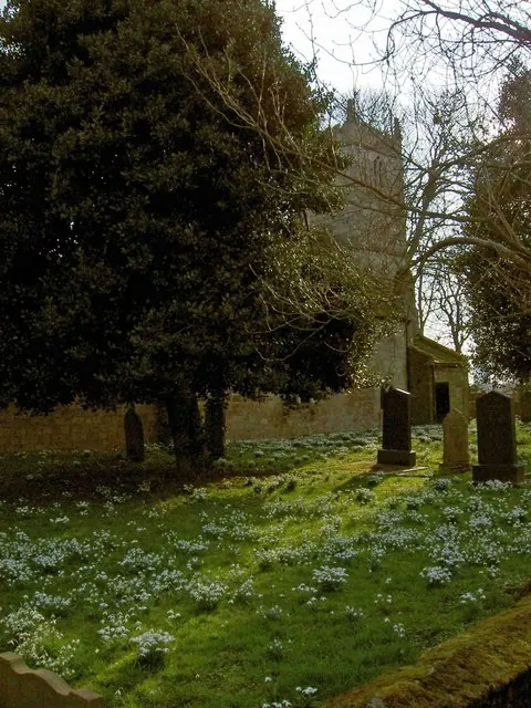
© Steve Fareham · Geograph · CC BY-SA 2.0
Images © their respective photographers, licensed under CC BY-SA 2.0 and reused here with attribution. Photographs depict listed buildings, churches and monuments near this settlement and may show neighbouring villages.
Data derived from the Open Domesday project (opendomesday.org), based on the Domesday Book dataset compiled by Professor J.J.N. Palmer and team. The Domesday Book (1086) is in the public domain.
Found an inaccuracy? [email protected]