Keresforth Hall in the Domesday Book (1086)
The settlement of Keresforth Hall is recorded in William I’s Domesday survey of 1086, entered under the hundred of Staincross in Yorkshire.
Other Settlements in Staincross
- Adlingfleet
- Barnby [Hall]
- Barnsley
- Barugh
- Brierley
- Carlton
- Cawthorne
- Chevet
- Clactone
- Clayton [West]
- Darton
- Dodworth
- Hemsworth
- Hoyland [Swaine]
The Meaning of the Name
The name Keresforth Hall is of Anglo-Saxon origin. Its final element derives from the Old English word ford, a river crossing. The first element is most likely a personal name or an early descriptive term, now difficult to recover with certainty. Taken together the name probably meant something close to ‘a ford’.
Remarkably, the name has changed little since 1086, when the Domesday scribes wrote it as Keresforth Hall.
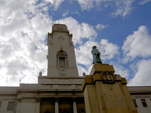
Listed Buildings Near Keresforth Hall
Historic England records 23 listed buildings within about a mile of Keresforth Hall. Listing protects structures of special architectural or historic interest, graded I (exceptional), II* (particularly important) and II.
Grade II*
- Houndhill - 0.35 km
- Locke Park Tower Locke Park - 0.9 km
Grade II
- Rob Royd - 0.11 km
- Tower and Roadside Wall to West of Houndhill Farmhouse - 0.33 km
- Genn House With Attached Outbuilding and Garden Wall - 0.34 km
- The Granary - 0.38 km
- Stable Block to Keresforth Hall - 0.4 km
- Timber Framed Farmbuilding Approximately 60 Metres to South of Houndhill Farmhouse - 0.42 km
- Wall Enclosing Garden to Left and Rear of Ouslethwaite Hall - 0.53 km
- Ouslethwaite Hall - 0.59 km
- Section of Roadside Wall With Steps Immediately to Front of Ouslethwaite Hall - 0.59 km
- L shaped range of farmbuildings immediately to east of Ouslethwaite Hall including Ouslethwaite Cottage - 0.62 km
- Park View Guest House - 0.68 km
- Bandstand in Locke Park - 0.8 km
- Church of St Edward - 0.96 km
- Keresforth Hill Farmhouse - 0.97 km
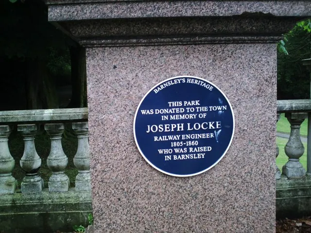
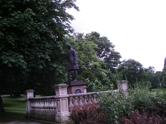
- Statue of Joseph Locke and enclosure - 0.98 km
- U Shaped Range of Farmbuildings Immediately to Rear of Round Green Farmhouse - 1.15 km
- The High Stone - 1.18 km
- Round Green Farmhouse - 1.18 km
- Kembla - 1.22 km
- The Strafford Arms - 1.28 km
- Entrance Gateway and Gates to Stainborough Park - 1.29 km
Nearby Domesday Settlements
Other places recorded in the 1086 survey within a few miles:
- Stainborough Castle - 2.2 km SW
- Worsborough - 2.2 km SE
- Dodworth - 2.2 km NW
- Barnsley - 2.2 km NE
- Pilley - 4.0 km S
- Silkstone - 4.1 km W
Heritage Around Keresforth [Hall]
Photographs of churches, listed buildings and monuments in the vicinity, contributed by volunteers to the Geograph project and reused here under a Creative Commons licence.
© Peter Beard · Geograph · CC BY-SA 2.0
© Peter Beard · Geograph · CC BY-SA 2.0
© Steve Fareham · Geograph · CC BY-SA 2.0
Images © their respective photographers, licensed under CC BY-SA 2.0 and reused here with attribution. Photographs depict listed buildings, churches and monuments near this settlement and may show neighbouring villages.
Data derived from the Open Domesday project (opendomesday.org), based on the Domesday Book dataset compiled by Professor J.J.N. Palmer and team. The Domesday Book (1086) is in the public domain.
Found an inaccuracy? [email protected]