Ingleton in the Domesday Book (1086)
Ingleton is named in the Domesday Book, compiled by Norman commissioners in 1086, entered under the hundred of Amounderness in Yorkshire.
Other Settlements in Amounderness
- Aighton
- Aldcliffe
- Aldingham
- Arkholme
- Aschebi
- Ashton [Hall]
- Ashton [on Ribble]
- Austwick
- Barbon
- Bardsea
- Bare
- Barnoldswick
- Barton
- Beetham
The Meaning of the Name
The name Ingleton is of Anglo-Saxon origin. Its final element derives from the Old English word tūn, a farmstead or village. The first element is most likely a personal name or an early descriptive term, now difficult to recover with certainty. Taken together the name probably meant something close to ‘a farmstead’.
Remarkably, the name has changed little since 1086, when the Domesday scribes wrote it as Ingleton.
Listed Buildings Near Ingleton
Historic England records 20 listed buildings within about a mile of Ingleton. Listing protects structures of special architectural or historic interest, graded I (exceptional), II* (particularly important) and II.
Grade II*
- Church of St Mary the Virgin - 0.79 km
Grade II
- Field House - 0.39 km
- Pan Well Cottage - 0.55 km
- Peartree Cottage - 0.59 km
- Slated Mansion - 0.61 km
- Police Station - 0.62 km
- Bank Hall - 0.65 km
- Toll House - 0.7 km
- Ingleton Viaduct - 0.71 km
- 1-3, Bell Horse Gate - 0.75 km
- Milestone - 0.76 km
- Yanham’s House - 0.76 km
- Three Chest Tombs in Churchyard to South of Entrance to Church of St Mary - 0.77 km
- Bridge End Bridge - 0.79 km
- Bridgeend Guest House - 0.81 km
- Seed Hill - 0.81 km
- Bridge to north east of Broadwood Cottage - 0.82 km
- Boundary Stone on Bridge to East of Broadwood Cottage - 0.84 km
- Yarlsber Farmhouse and House - 0.9 km
- Milestone - 1.25 km
Scheduled Monuments Near Ingleton
Scheduled monuments are nationally important archaeological sites given legal protection. 2 lie within roughly a mile of Ingleton:
- Meal Bank Quarry Hoffmann kiln, quarry and lime works - 1.1 km
- Yarlsber camp - 1.39 km
Ingleton Today
Today Ingleton lies within the administrative area of Craven, and the settlement recorded a population of 2,152 at the 2021 census. Nine and a half centuries separate that figure from the small rural community the Domesday survey recorded here in 1086.
Read more about modern Ingleton on Wikipedia .
Nearby Domesday Settlements
Other places recorded in the 1086 survey within a few miles:
- Thornton in Lonsdale - 2.2 km NW
- Barnoldswick - 3.2 km W
- Burton in Lonsdale - 4.0 km W
- Ireby - 5.0 km NW
- Clapham - 5.8 km SE
- High and Low Bentham - 5.8 km SW
Heritage Around Ingleton
Photographs of churches, listed buildings and monuments in the vicinity, contributed by volunteers to the Geograph project and reused here under a Creative Commons licence.
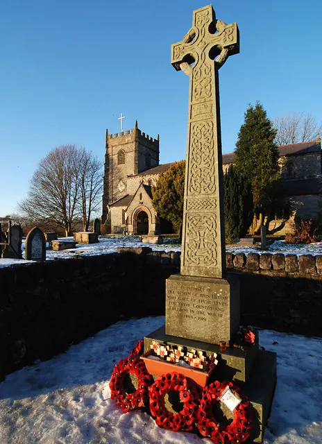
© Dave Croker · Geograph · CC BY-SA 2.0
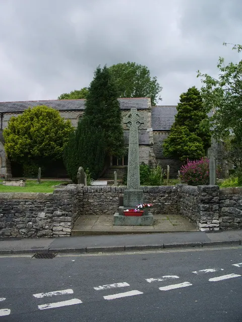
© Alexander P Kapp · Geograph · CC BY-SA 2.0
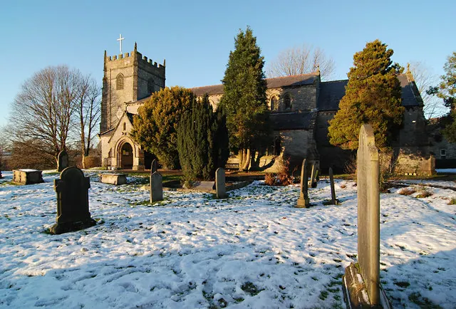
© Dave Croker · Geograph · CC BY-SA 2.0
Images © their respective photographers, licensed under CC BY-SA 2.0 and reused here with attribution. Photographs depict listed buildings, churches and monuments near this settlement and may show neighbouring villages.
Data derived from the Open Domesday project (opendomesday.org), based on the Domesday Book dataset compiled by Professor J.J.N. Palmer and team. The Domesday Book (1086) is in the public domain.
Found an inaccuracy? [email protected]