Ince in the Domesday Book (1086)
The 1086 Domesday survey records the settlement of Ince, entered under the hundred of Ruloe in Cheshire.
Other Settlements in Ruloe
- Aldredelie
- Alvanley
- Conersley
- Done
- Dunham [on the Hill]
- Eddisbury
- Elton
- Frodsham
- Hartford
- Helsby
- Kingsley
- Manley
- Thornton [le Moors]
- Weaverham
The Meaning of the Name
The origin of the name Ince is not securely established from its modern form alone; like many settlement names in the North it likely combines an Old English or Old Norse personal name with a landscape term.
Remarkably, the name has changed little since 1086, when the Domesday scribes wrote it as Ince.
Listed Buildings Near Ince
Historic England records 25 listed buildings within about a mile of Ince. Listing protects structures of special architectural or historic interest, graded I (exceptional), II* (particularly important) and II.
Grade I
Grade II*
- Church of St James - 0.41 km
Grade II
- Yew Tree Farmhouse and Attached Shippon - 0.21 km
- Park Cottages - 0.34 km
- Barn at Wood Farm 100 Metres South of Farmhouse - 0.37 km
- Farm Buildings Abutting Manor Houses to South East - 0.38 km
- Churchyard Wall at St James’ Church - 0.38 km
- Portion of Boundary Wall Between Junction of Kinsey’s Lane With Pool Lane and Park Cottages - 0.38 km
- Lamp Post in Churchyard by North Gate - 0.39 km
- Shippon on Wood Farm 30 Metres South of Farmhouse - 0.39 km
- Stocks Adjacent to Ince Manor House - 0.4 km
- Wood Farm Farmhouse - 0.41 km
- Portion of Boundary Wall Between the Square and Entrance to the Manor House - 0.41 km
- K6 Telephone Kiosk - 0.41 km
- 7, 8 and 9, the Square - 0.41 km
- Coronation Lamp Post and Lantern - 0.43 km
- 1, 2 and 3 With Attached Front Garden Walls - 0.45 km
- Outbuilding Attached to South End of Village Green Farm Facing the Square - 0.46 km
- Lower Green Farmhouse With Wall to Front Garden - 0.48 km
- L-shaped Shippon at Hall Farm 50 Metres South West of Farmhouse - 0.48 km
- Proffit’s Lodge - 0.5 km
- T-shaped Shippon at Hall Farm 30 Metres South of Farmhouse - 0.5 km
- Shippon at Lower Green Farm on East Side of Farmyard - 0.52 km
- Building 50 at Thornton Aero Engine Research Laboratory - 0.86 km
…and 1 more listed structures in the area.
Scheduled Monuments Near Ince
Scheduled monuments are nationally important archaeological sites given legal protection. 2 lie within roughly a mile of Ince:
- Ince Manor monastic grange and fishpond - 0.34 km
- Roman fortlet at Ince, 150m north east of Hall Farm - 0.68 km
Ince Today
Today Ince lies within the administrative area of Cheshire West and Chester, and the settlement recorded a population of 214 at the 2021 census. Nine and a half centuries separate that figure from the small rural community the Domesday survey recorded here in 1086.
Read more about modern Ince on Wikipedia .
Nearby Domesday Settlements
Other places recorded in the 1086 survey within a few miles:
- Elton - 1.4 km SE
- Thornton le Moors - 2.0 km S
- Stanney and Little Stanney - 3.6 km SW
- Wimbolds Trafford - 4.0 km S
- Helsby - 4.1 km E
- Dunham on the Hill - 5.0 km SE
Heritage Around Ince
Photographs of churches, listed buildings and monuments in the vicinity, contributed by volunteers to the Geograph project and reused here under a Creative Commons licence.
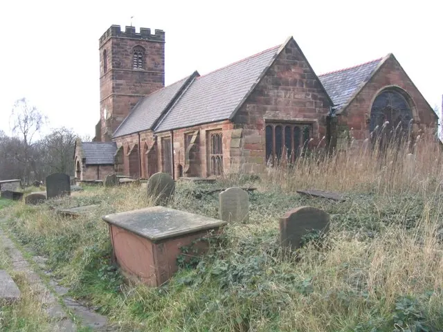
© John Lord · Geograph · CC BY-SA 2.0
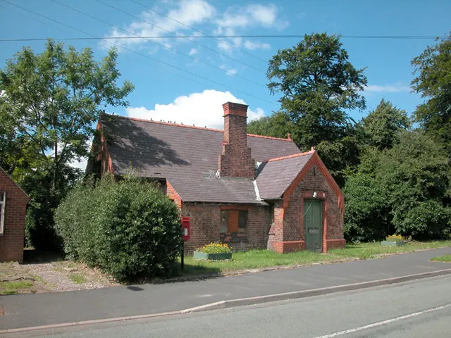
© Dennis Turner · Geograph · CC BY-SA 2.0
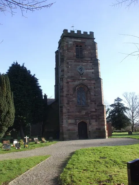
© John Lord · Geograph · CC BY-SA 2.0
Images © their respective photographers, licensed under CC BY-SA 2.0 and reused here with attribution. Photographs depict listed buildings, churches and monuments near this settlement and may show neighbouring villages.
Data derived from the Open Domesday project (opendomesday.org), based on the Domesday Book dataset compiled by Professor J.J.N. Palmer and team. The Domesday Book (1086) is in the public domain.
Found an inaccuracy? [email protected]