Ianulfestorp in the Domesday Book (1086)
Ianulfestorp is named in the Domesday Book, compiled by Norman commissioners in 1086, entered under the hundred of Sneculfcros in Yorkshire. The survey assessed Ianulfestorp at 1.5 carucates of taxable land.
At the time of the survey, Ianulfestorp supported a recorded population of 11 villagers, 3 slaves, working 6 ploughs between them.
The survey records Ianulfestorp’s value at 2.5 shillings in 1086. No pre-Conquest figure survives – not unusual in the North, where records were disrupted by the Harrying and by the patchy coverage of the survey.
Resources Recorded at Ianulfestorp (1086)
- Cattle: 6
- Sheep: 50
- Meadow: 4 acres
- Woodland: 8 acres
Other Settlements in Sneculfcros
- Aike
- Beswick
- Beverley
- Bracken
- Dunnington
- Etton
- Gardham
- Grimston
- Holme [on the Wolds]
- Kilnwick
- Leconfield
- Lockington
- Middleton [on the Wolds]
- Molescroft
The Meaning of the Name
The origin of the name Ianulfestorp is not securely established from its modern form alone; like many settlement names in the North it likely combines an Old English or Old Norse personal name with a landscape term.
Remarkably, the name has changed little since 1086, when the Domesday scribes wrote it as Ianulfestorp.
Listed Buildings Near Ianulfestorp
Historic England records 17 listed buildings within about a mile of Ianulfestorp. Listing protects structures of special architectural or historic interest, graded I (exceptional), II* (particularly important) and II.
Grade II*
- Church of Saint Nicholas - 0.31 km
Grade II
- 61, York Street - 0.19 km
- 41, York Street - 0.24 km
- 40, York Street - 0.25 km
- Cross Shaft in Churchyard of Saint Nicholas - 0.32 km
- 24, York Street - 0.33 km
- Cross in Grounds of Dunnington Rectory - 0.35 km
- Chapel Farm - 0.37 km
- Dunnington Lodge and Attached Stables and Coach House - 0.37 km
- 10, Church Street - 0.4 km
- 14, Church Street - 0.41 km
- 12, Church Street - 0.41 km
- Village Cross - 0.44 km
- Dunnington House and Walls Adjoining - 0.61 km
- Dunnington Hall - 1.2 km
- Grimston Court - 1.24 km
- Coach House to Dunnington Hall - 1.24 km
Ianulfestorp Today
Today Ianulfestorp lies within the administrative area of City of York, and the settlement recorded a population of 3,257 at the 2021 census. Nine and a half centuries separate that figure from the small rural community the Domesday survey recorded here in 1086.
Read more about modern Dunnington on Wikipedia .
Nearby Domesday Settlements
Other places recorded in the 1086 survey within a few miles:
- Dunnington - 0.0 km N
- Murton - 2.0 km W
- Grimston - 2.2 km SW
- Holtby - 2.2 km NE
- Scoreby Manor - 3.0 km E
- Osbaldwick - 3.2 km W
Heritage Around Ianulfestorp
Photographs of churches, listed buildings and monuments in the vicinity, contributed by volunteers to the Geograph project and reused here under a Creative Commons licence.
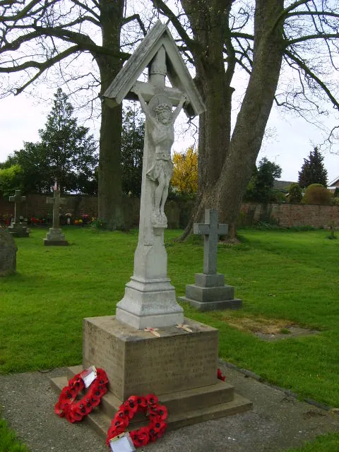
© William Metcalfe · Geograph · CC BY-SA 2.0
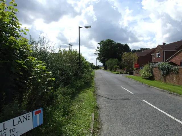
© Keith Laverack · Geograph · CC BY-SA 2.0
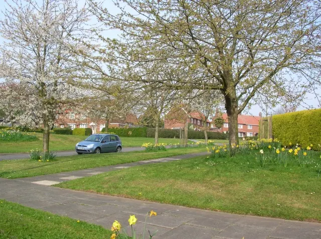
© DS Pugh · Geograph · CC BY-SA 2.0
Images © their respective photographers, licensed under CC BY-SA 2.0 and reused here with attribution. Photographs depict listed buildings, churches and monuments near this settlement and may show neighbouring villages.
Data derived from the Open Domesday project (opendomesday.org), based on the Domesday Book dataset compiled by Professor J.J.N. Palmer and team. The Domesday Book (1086) is in the public domain.
Found an inaccuracy? [email protected]