Huyton in the Domesday Book (1086)
The 1086 Domesday survey records the settlement of Huyton, entered under the hundred of [West] Derby in Cheshire. The survey assessed Huyton at 1.7 carucates of taxable land.
At the time of the survey, Huyton supported a recorded population of 12 smallholders, 2 slaves, working 4 ploughs between them.
The drop in value is hard to miss. Before 1066, Huyton was worth 5.6 shillings; by 1086 that had dropped to 5.1 shillings – a fall of 8%. Most Yorkshire villages that lost value on this scale were swept up in the Harrying of the North – William’s scorched-earth campaign of 1069–70.
The survey lists 3 manors at Huyton under different lords. Splitting a single settlement between multiple tenants was common across the North – Saxon estates broken up and handed to William’s followers after 1066.
Resources Recorded at Huyton (1086)
- Meadow: 1 ploughs
Other Settlements in [West] Derby
- Ainsdale
- Allerton
- Argarmeles
- Aughton
- Barton
- Bootle
- Childwall
- Dalton
- Downholland
- Formby
- Halsall
- Hurlston
- Ince [Blundell]
- Kirkby
The Meaning of the Name
The name Huyton is of Anglo-Saxon origin. Its final element derives from the Old English word tūn, a farmstead or village. The first element is most likely a personal name or an early descriptive term, now difficult to recover with certainty. Taken together the name probably meant something close to ‘a farmstead’.
Remarkably, the name has changed little since 1086, when the Domesday scribes wrote it as Huyton.
Listed Buildings Near Huyton
Historic England records 17 listed buildings within about a mile of Huyton. Listing protects structures of special architectural or historic interest, graded I (exceptional), II* (particularly important) and II.
Grade II*
- Church of St Michael - 0.47 km
Grade II
- Huyton Cricket and Bowling Club Pavilion - 0.24 km
- Entrance Gateway to Church of St Michael at North East Corner of Churchyard - 0.45 km
- Monument to East of North Aisle of Church of St Michael - 0.45 km
- Entrance Gateway to Church of St Michael at South Corner of Churchyard - 0.5 km
- Village Cross - 0.5 km
- United Reformed Church - 0.65 km
- Park Hall - 0.74 km
- Newland - 0.76 km
- 22, ST MARY’S ROAD (See details for further address information) - 0.91 km
- Milestone Approximately 2/3 of A Metre East of Lyme Cross Road Junction - 0.92 km
- Huyton Hey (Manor Farmhouse) - 0.95 km
- Hurst Hall, Huyton and Prescot Golf Club - 0.97 km
- Greenhill - 1.08 km
- Railway Bridge - 1.11 km
- Stables to west of The Hazels - 1.17 km
- The Hazels - 1.19 km
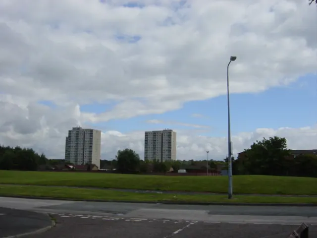
Huyton Today
Today Huyton lies within the administrative area of Knowsley, and the settlement recorded a population of 33,193 at recent figures. Nine and a half centuries separate that figure from the small rural community the Domesday survey recorded here in 1086.
Read more about modern Huyton on Wikipedia .
Nearby Domesday Settlements
Other places recorded in the 1086 survey within a few miles:
- Roby - 1.0 km W
- Childwall - 2.8 km SW
- Knowsley - 4.1 km N
- Little Woolton - 4.1 km S
- Tarbock - 4.5 km SE
- Wibaldeslei - 4.5 km SW
Heritage Around Huyton
Photographs of churches, listed buildings and monuments in the vicinity, contributed by volunteers to the Geograph project and reused here under a Creative Commons licence.
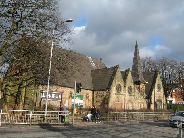
© Sue Adair · Geograph · CC BY-SA 2.0
© Sue Adair · Geograph · CC BY-SA 2.0
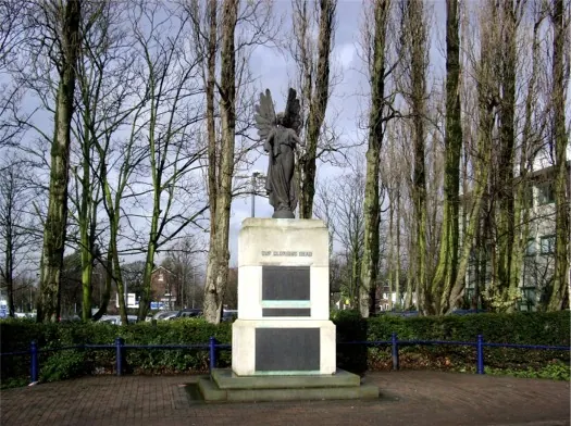
© Tom Pennington · Geograph · CC BY-SA 2.0
Images © their respective photographers, licensed under CC BY-SA 2.0 and reused here with attribution. Photographs depict listed buildings, churches and monuments near this settlement and may show neighbouring villages.
Data derived from the Open Domesday project (opendomesday.org), based on the Domesday Book dataset compiled by Professor J.J.N. Palmer and team. The Domesday Book (1086) is in the public domain.
Found an inaccuracy? [email protected]