Hutton Mulgrave in the Domesday Book (1086)
The 1086 Domesday survey records the settlement of Hutton Mulgrave, entered under the hundred of Langbaurgh in Yorkshire.
Other Settlements in Langbaurgh
- Acklam
- Airy [Holme]
- Aislaby
- Arnodestorp
- Baldebi
- Barnaby
- Barwick
- Battersby
- Bergolbi
- Berguluesbi
- Blaten [Carr]
- Borrowby
- Breck
- Brotton
The Meaning of the Name
The name Hutton Mulgrave is of Anglo-Saxon origin. Its final element derives from the Old English word tūn, a farmstead or village. The first element is most likely a personal name or an early descriptive term, now difficult to recover with certainty. Taken together the name probably meant something close to ‘a farmstead’.
Remarkably, the name has changed little since 1086, when the Domesday scribes wrote it as Hutton Mulgrave.
Listed Buildings Near Hutton Mulgrave
Historic England records 9 listed buildings within about a mile of Hutton Mulgrave. Listing protects structures of special architectural or historic interest, graded I (exceptional), II* (particularly important) and II.
Grade I
- Old Mulgrave Castle - 1.24 km
Grade II
- Byre and stable-cartshed to north of Low Farmhouse - 0.25 km
- Barn to North-east of Low Farmhouse - 0.26 km
- Stable/byre to North-west of Low Farmhouse - 0.28 km
- Low Farmhouse and Attached Outbuilding - 0.28 km
- Pigsty to East of Allerton Head Farmhouse - 0.85 km
- Espsyke Farmhouse - 0.86 km
- Allerton Head Farmhouse and Attached Outbuildings - 0.86 km
- Rock Head Cottage - 1.07 km
Scheduled Monuments Near Hutton Mulgrave
Scheduled monuments are nationally important archaeological sites given legal protection. 3 lie within roughly a mile of Hutton Mulgrave:
- Ash Holm alum works, 350m south east of Mulgrave Castle - 1.13 km
- Old Mulgrave Castle: an enclosure castle incorporated into an 18th century planned landscape - 1.26 km
- Foss Castle: a motte and bailey, precursor to Old Mulgrave Castle - 1.32 km
Hutton Mulgrave Today
Today Hutton Mulgrave lies within the administrative area of Scarborough, and the settlement recorded a population of 44 at the 2021 census. Nine and a half centuries separate that figure from the small rural community the Domesday survey recorded here in 1086.
Read more about modern Hutton Mulgrave on Wikipedia .
Nearby Domesday Settlements
Other places recorded in the 1086 survey within a few miles:
- Mulgrave Castle - 1.0 km N
- Dunsley - 2.2 km NE
- Aislaby - 2.8 km SE
- East and West Barnby - 2.8 km NW
- Newholm - 3.0 km E
- Lythe - 3.2 km N
Heritage Around Hutton [Mulgrave]
Photographs of churches, listed buildings and monuments in the vicinity, contributed by volunteers to the Geograph project and reused here under a Creative Commons licence.
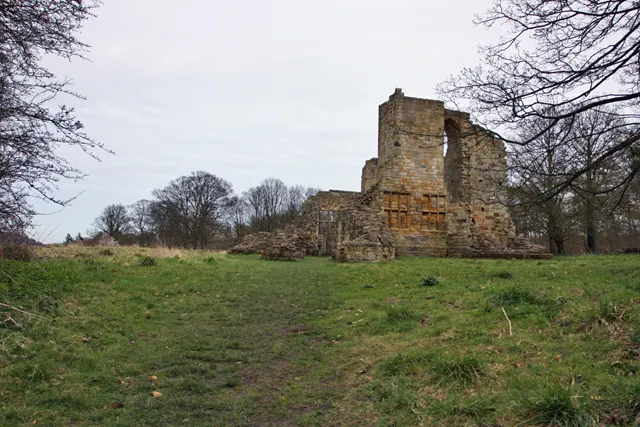
© Peter Church · Geograph · CC BY-SA 2.0
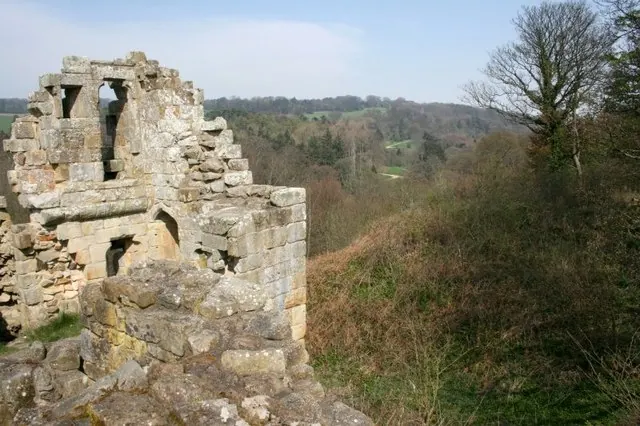
© Mick Garratt · Geograph · CC BY-SA 2.0
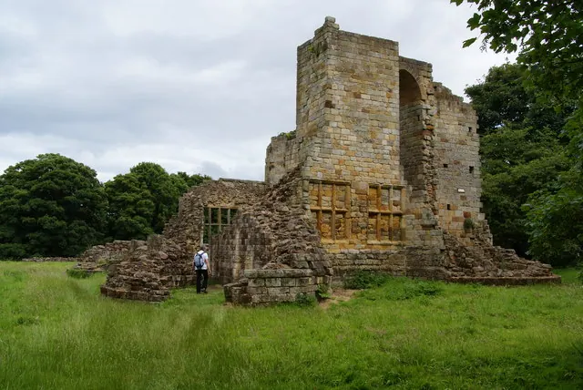
© Bill Boaden · Geograph · CC BY-SA 2.0
Images © their respective photographers, licensed under CC BY-SA 2.0 and reused here with attribution. Photographs depict listed buildings, churches and monuments near this settlement and may show neighbouring villages.
Data derived from the Open Domesday project (opendomesday.org), based on the Domesday Book dataset compiled by Professor J.J.N. Palmer and team. The Domesday Book (1086) is in the public domain.
Found an inaccuracy? [email protected]