Hutton Buscel in the Domesday Book (1086)
The settlement of Hutton Buscel is recorded in William I’s Domesday survey of 1086, entered under the hundred of Dic in Yorkshire.
Other Settlements in Dic
- Aislaby
- Allerston
- Appleton [le Moors]
- Aschelesmersc
- Aschilesmares
- Barton [le Street]
- Baschebi
- Baschesbi
- Brompton
- Burniston
- Burton [Dale]
- Cawthorn
- Cayton
- Chigogemers
The Meaning of the Name
The name Hutton Buscel is of Anglo-Saxon origin. Its final element derives from the Old English word tūn, a farmstead or village. The first element is most likely a personal name or an early descriptive term, now difficult to recover with certainty. Taken together the name probably meant something close to ‘a farmstead’.
Remarkably, the name has changed little since 1086, when the Domesday scribes wrote it as Hutton Buscel.
Listed Buildings Near Hutton Buscel
Historic England records 27 listed buildings within about a mile of Hutton Buscel. Listing protects structures of special architectural or historic interest, graded I (exceptional), II* (particularly important) and II.
Grade I
- Church of St Matthew - 0.56 km
Grade II
- Pasture Cottage - 0.14 km
- Bay Nigg - 0.2 km
- The Kennels - 0.22 km
- Mount Pleasant Farmhouse - 0.26 km
- The Forge and Attached Outbuildings - 0.32 km
- The Old Road House - 0.36 km
- Home Farmhouse - 0.4 km
- Outbuilding Approximately 10 Metres North of Cairnsmore - 0.4 km
- Church Lane Cottage - 0.41 km
- Manor Farmhouse - 0.46 km
- The Holt - 0.51 km
- Pinfold - 0.54 km
- Churchyard Cross Approximately 2 Metres South of Porch of Church of St Matthew - 0.56 km
- Village Hall and Attached House - 0.57 km
- Martin Garth - 0.63 km
- West End Farmhouse - 0.77 km
- The Elms - 1.01 km
- Burton House - 1.1 km
- Yedmandale Terrace - 1.1 km
- Candler House - 1.13 km
- Low Hall - 1.13 km
- High Hall - 1.13 km
- House Approximately 10 Metres North of Low Yedmandale Farmhouse - 1.14 km
…and 3 more listed structures in the area.
Scheduled Monuments Near Hutton Buscel
Scheduled monuments are nationally important archaeological sites given legal protection. 1 lies within roughly a mile of Hutton Buscel:
Hutton Buscel Today
Today Hutton Buscel lies within the administrative area of Scarborough, and the settlement recorded a population of 314 at the 2021 census. Nine and a half centuries separate that figure from the small rural community the Domesday survey recorded here in 1086.
Read more about modern Hutton Buscel on Wikipedia .
Nearby Domesday Settlements
Other places recorded in the 1086 survey within a few miles:
- Preston Hill - 0.0 km N
- Newton - 1.0 km E
- West Ayton - 1.0 km E
- Martin Garth - 1.0 km W
- Wykeham - 1.4 km SW
- East Ayton - 2.0 km E
Heritage Around Hutton [Buscel]
Photographs of churches, listed buildings and monuments in the vicinity, contributed by volunteers to the Geograph project and reused here under a Creative Commons licence.
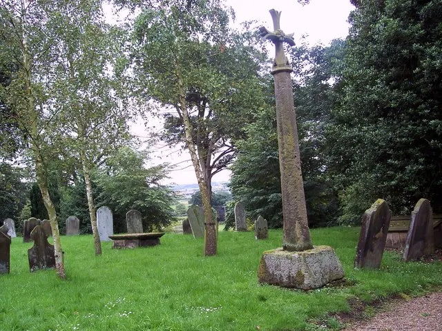
© Maigheach-gheal · Geograph · CC BY-SA 2.0
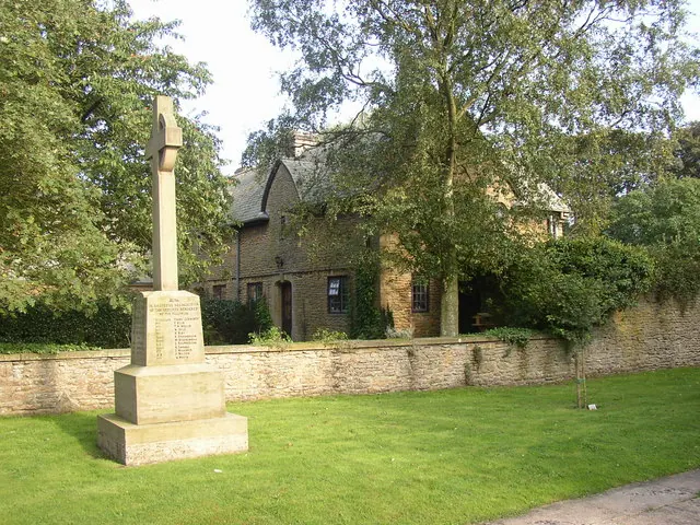
© Humphrey Bolton · Geograph · CC BY-SA 2.0
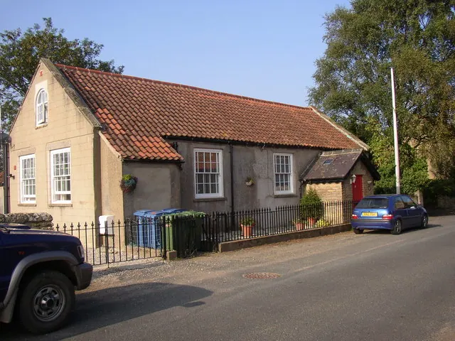
© Humphrey Bolton · Geograph · CC BY-SA 2.0
Images © their respective photographers, licensed under CC BY-SA 2.0 and reused here with attribution. Photographs depict listed buildings, churches and monuments near this settlement and may show neighbouring villages.
Data derived from the Open Domesday project (opendomesday.org), based on the Domesday Book dataset compiled by Professor J.J.N. Palmer and team. The Domesday Book (1086) is in the public domain.
Found an inaccuracy? [email protected]