Hutton Bonville in the Domesday Book (1086)
Hutton Bonville appears in the Domesday Book of 1086, entered under the hundred of Allerton in Yorkshire. The survey assessed Hutton Bonville at 3 carucates of taxable land.
At the time of the survey, Hutton Bonville supported a recorded population of 14 villagers, 2 smallholders, 7 slaves, working 7 ploughs between them.
By 1086 Hutton Bonville was worth 4 shillings, up from 2.5 shillings before the Conquest – one of the few settlements in the area to hold its value through the upheaval.
Resources Recorded at Hutton Bonville (1086)
- Mills: 2 mills (valued at 1.05 shillings)
- Meadow: 12 acres
Other Settlements in Allerton
- Ainderby [Steeple]
- Appleton [Wiske]
- Arncliffe [Hall]
- Birkby
- Borrowby
- Brompton
- Cowesby
- Crosby [Grange]
- Dale [Town]
- Deighton
- Ellerbeck
- Foxton
- Girsby
- Hawnby
The Meaning of the Name
The name Hutton Bonville is of Anglo-Saxon origin. Its final element derives from the Old English word tūn, a farmstead or village. The first element is most likely a personal name or an early descriptive term, now difficult to recover with certainty. Taken together the name probably meant something close to ‘a farmstead’.
Remarkably, the name has changed little since 1086, when the Domesday scribes wrote it as Hutton Bonville.
Listed Buildings Near Hutton Bonville
Historic England records 2 listed buildings within about a mile of Hutton Bonville. Listing protects structures of special architectural or historic interest, graded I (exceptional), II* (particularly important) and II.
Grade II
- Gate Piers Approximately 100 Metres to South of Hall Farm - 0.22 km
- Church of St Lawrence - 0.32 km
Hutton Bonville Today
Today Hutton Bonville lies within the administrative area of Hambleton, and the settlement recorded a population of 74 at the 2021 census. Nine and a half centuries separate that figure from the small rural community the Domesday survey recorded here in 1086.
Read more about modern Hutton Bonville on Wikipedia .
Nearby Domesday Settlements
Other places recorded in the 1086 survey within a few miles:
- Birkby - 2.0 km N
- Danby Wiske - 2.0 km S
- Lazenby Hall - 2.0 km S
- Little Smeaton - 3.2 km N
- Great Smeaton - 4.1 km N
- East Cowton - 4.2 km NW
Heritage Around Hutton [Bonville]
Photographs of churches, listed buildings and monuments in the vicinity, contributed by volunteers to the Geograph project and reused here under a Creative Commons licence.
© Roger Templeman · Geograph · CC BY-SA 2.0
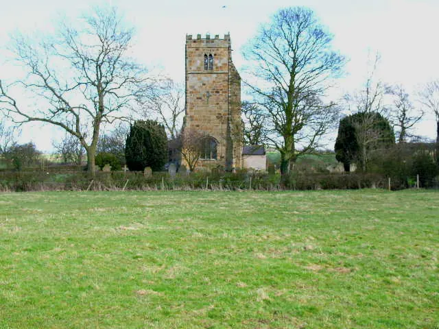
© Oliver Dixon · Geograph · CC BY-SA 2.0
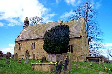
© Bill Henderson · Geograph · CC BY-SA 2.0
Images © their respective photographers, licensed under CC BY-SA 2.0 and reused here with attribution. Photographs depict listed buildings, churches and monuments near this settlement and may show neighbouring villages.
Data derived from the Open Domesday project (opendomesday.org), based on the Domesday Book dataset compiled by Professor J.J.N. Palmer and team. The Domesday Book (1086) is in the public domain.
Found an inaccuracy? [email protected]