Huntington in the Domesday Book (1086)
The 1086 Domesday survey records the settlement of Huntington, entered under the hundred of Duddeston in Cheshire.
Other Settlements in Duddeston
- Bettisfield
- Bickerton
- Bickley
- Boughton
- Broxton
- Burwardestone
- Burwardsley and [Higher] Burwardsley
- Caldecott
- Calvintone
- Cheaveley
- Cholmondeley
- Chowley
- Christleton
- Clutton
The Meaning of the Name
The name Huntington is of Anglo-Saxon origin. Its final element derives from the Old English word tūn, a farmstead or village. The first element is most likely a personal name or an early descriptive term, now difficult to recover with certainty. Taken together the name probably meant something close to ‘a farmstead’.
Remarkably, the name has changed little since 1086, when the Domesday scribes wrote it as Huntington.
Listed Buildings Near Huntington
Historic England records 22 listed buildings within about a mile of Huntington. Listing protects structures of special architectural or historic interest, graded I (exceptional), II* (particularly important) and II.
Grade II
- Grange Farmhouse - 0.37 km
- L-shaped Range of Farmbuildings at Cheaveley Hall Farm - 0.94 km
- Cheaveley Hall Farmhouse - 0.95 km
- Eccleston Ferry Farmhouse - 1.02 km
- Bandstand in Eccleston Ferry Farmhouse Garden - 1.04 km
- Larger L-shaped Farmbuilding of Huntington Old Hall - 1.04 km
- Smaller L-shaped Farmbuilding at Huntington Old Hall - 1.07 km
- Saighton Hall - 1.1 km
- Riverside House - 1.19 km
- Coachman’s Cottage and Attached Coach-house Riverside House - 1.19 km
- Garden Walls, Gateposts and Gates Along Church Road to Riverside and Coach-house - 1.21 km
- Manor House - 1.24 km
- Church House - 1.27 km
- The Rectory and Attached Coach House - 1.27 km
- Bee House in Rectory Garden - 1.27 km
- Morris Oak Cottages - 1.28 km
- House East of Stud - 1.28 km
- Former Institute (Now Office of Chartered Surveyor) - 1.29 km
- Walls and Gates Between Old Church Lane and Old Churchyard - 1.29 km
- Remains of Former Church of St Mary - 1.29 km
- Churchyard Gates, Piers and Wing Walls - 1.29 km
- Tomb of Edward George Hugh, Earl Grosvenor - 1.29 km
Scheduled Monuments Near Huntington
Scheduled monuments are nationally important archaeological sites given legal protection. 3 lie within roughly a mile of Huntington:
- Moated site and fishpond S of Huntington Hall - 0.59 km
- Huntington Hall moated site - 1.18 km
- Motte and associated earthworks east of Old Rectory - 1.21 km
Huntington Today
Today Huntington lies within the administrative area of Cheshire West and Chester, and the settlement recorded a population of 4,445 at the 2021 census. Nine and a half centuries separate that figure from the small rural community the Domesday survey recorded here in 1086.
Read more about modern Huntington on Wikipedia .
Nearby Domesday Settlements
Other places recorded in the 1086 survey within a few miles:
Heritage Around Huntington
Photographs of churches, listed buildings and monuments in the vicinity, contributed by volunteers to the Geograph project and reused here under a Creative Commons licence.
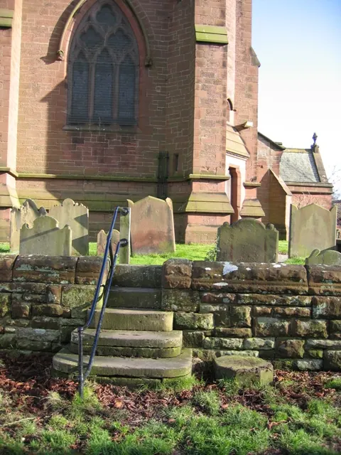
© John S Turner · Geograph · CC BY-SA 2.0
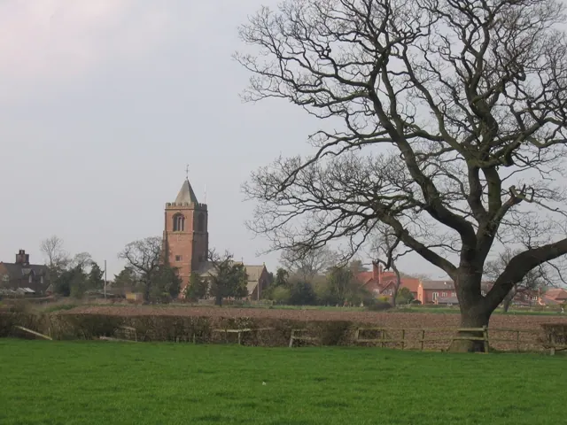
© John S Turner · Geograph · CC BY-SA 2.0
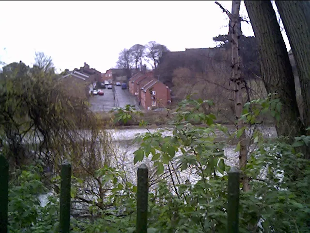
© chestertouristcom · Geograph · CC BY-SA 2.0
Images © their respective photographers, licensed under CC BY-SA 2.0 and reused here with attribution. Photographs depict listed buildings, churches and monuments near this settlement and may show neighbouring villages.
Data derived from the Open Domesday project (opendomesday.org), based on the Domesday Book dataset compiled by Professor J.J.N. Palmer and team. The Domesday Book (1086) is in the public domain.
Found an inaccuracy? [email protected]