Hunslet in the Domesday Book (1086)
The 1086 Domesday survey records the settlement of Hunslet, entered under the hundred of Morley in Yorkshire.
Other Settlements in Morley
- Allerton
- Armley
- Batley
- Beeston
- Bolton
- Bowling
- Bradford
- Bramley
- Calverley
- Carlton
- Chellow [Grange]
- Clayton
- Clifton
- Cruttonstall
The Meaning of the Name
The origin of the name Hunslet is not securely established from its modern form alone; like many settlement names in the North it likely combines an Old English or Old Norse personal name with a landscape term.
Remarkably, the name has changed little since 1086, when the Domesday scribes wrote it as Hunslet.
Listed Buildings Near Hunslet
Historic England records 29 listed buildings within about a mile of Hunslet. Listing protects structures of special architectural or historic interest, graded I (exceptional), II* (particularly important) and II.
Grade II*
- The Garden Gate Public House - 0.45 km
- Hunslet Mill - 0.69 km
Grade II
- Hunslet Baptist Tabernacle - 0.47 km
- Tower and Spire of Church of St Mary - 0.51 km
- Mill Range Attached to West Side of Number 21A - 0.69 km
- Victoria Works Range - 0.7 km
- Former Drying House Part of Victoria Flax Mill Complex - 0.73 km
- Victoria Flax Mill Entrance Range and Bollards - 0.74 km
- 1, 2 and 3 Scott’s Almshouses - 1.01 km
- 4-7 Scott’s Almshouses - 1.02 km
- Scott’s Almshouses, Boundary Wall With Gate Piers - 1.02 km
- Bust of John Scott, Scott’s Almshouses - 1.02 km
- 8, 9 and 10 Scott’s Almshouses - 1.03 km
- Church of St Hilda - 1.05 km
- Vicarage to Church of St Hilda - 1.05 km
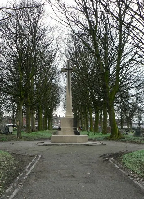
- Lodges, Gate Piers, Gates and Walls to Hunslet Cemetery - 1.1 km
- Hunslet Cemetery Chapels - 1.11 km
- Gateway and Flanking Walls to Former Railway Foundry - 1.18 km
- Memorial in Hunslet Cemetery - 1.19 km
- Hunslet Engine Company Offices - 1.19 km
- Thwaite House - 1.2 km
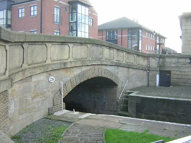
- Thwaite Mill - 1.21 km
- Bridge Over Mill Stream to East of Thwaite Mill With Retaining Wall on South Side of Mill Race - 1.22 km
- Machine Shop to East of Thwaite Mill - 1.23 km
…and 5 more listed structures in the area.
Hunslet Today
Today Hunslet lies within the administrative area of Leeds, and the settlement recorded a population of 33,705 at recent figures. Nine and a half centuries separate that figure from the small rural community the Domesday survey recorded here in 1086.
Read more about modern Hunslet on Wikipedia .
Nearby Domesday Settlements
Other places recorded in the 1086 survey within a few miles:
- Skelton Grange - 2.0 km E
- Leeds - 2.2 km NW
- Snitertun - 2.2 km NW
- Beeston - 3.2 km W
- Thorpe Stapleton - 3.2 km E
- Middleton - 3.2 km S
Heritage Around Hunslet
Photographs of churches, listed buildings and monuments in the vicinity, contributed by volunteers to the Geograph project and reused here under a Creative Commons licence.

© Mike Wallis · Geograph · CC BY-SA 2.0
© Rich Tea · Geograph · CC BY-SA 2.0
© Mark Morton · Geograph · CC BY-SA 2.0
Images © their respective photographers, licensed under CC BY-SA 2.0 and reused here with attribution. Photographs depict listed buildings, churches and monuments near this settlement and may show neighbouring villages.
Data derived from the Open Domesday project (opendomesday.org), based on the Domesday Book dataset compiled by Professor J.J.N. Palmer and team. The Domesday Book (1086) is in the public domain.
Found an inaccuracy? [email protected]