Hunderthwaite in the Domesday Book (1086)
Hunderthwaite appears in the Domesday Book of 1086, entered under the hundred of Land of Count Alan in Yorkshire.
Other Settlements in Land of Count Alan
- Achebi
- Agglethorpe
- Ainderby [Mires]
- Ainderby [Quernhow]
- Aiskew
- Aldbrough
- Allerthorpe [Hall]
- Ascam
- Ascham
- Asebi
- Aske [Hall]
- Askrigg
- Aysgarth
- Baldersby
The Meaning of the Name
The name Hunderthwaite is of Scandinavian origin. Its final element derives from the Old Norse word þveit, a clearing or meadow. The first element is most likely a personal name or an early descriptive term, now difficult to recover with certainty. Taken together the name probably meant something close to ‘a clearing’.
Names of this type are a fingerprint of Scandinavian settlement: they cluster across the old Danelaw, where Norse-speaking settlers renamed or founded villages from the late 9th century onward.
Remarkably, the name has changed little since 1086, when the Domesday scribes wrote it as Hunderthwaite.
Listed Buildings Near Hunderthwaite
Historic England records 50 listed buildings within about a mile of Hunderthwaite. Listing protects structures of special architectural or historic interest, graded I (exceptional), II* (particularly important) and II.
Grade II
- Field Barn, 350 Metres North East of Moor View - 0.44 km
- Hunderthwaite Farmhouse and Attached Farmbuildings - 0.46 km
- Road Bridge, 400 Metres West of Town Head Farmhouse, on Road to Mickleton - 0.78 km
- Carrowcroft - 0.87 km
- Field Barn, 700 Metres East of Hunderthwaite Farmhouse - 0.88 km
- Former Farmbuilding, 35 Metres West of Inglenook - 0.9 km
- Jesmond House - 0.92 km
- Bland Nook - 0.93 km
- Water Pump and Trough, 6 Metres North of Greenside - 0.94 km
- Inglenook Jesmond Cottage - 0.95 km
- Rose Cottage and Front Garden Wall and Gate Piers - 0.96 km
- Fell Cottage Ivyholme Cottage Ivyholme Stores (Including Post Office) - 0.97 km
- K6 Telephone Kiosk Oppposite Rose and Crown Public House - 1.0 km
- Field Barn, 20 Metres South of Village Hall - 1.0 km
- Ivy Cottage South View - 1.01 km
- Water Pump and Trough, 30 Metres North of Rose and Crown Hotel - 1.04 km
- Rose and Crown Hotel - 1.05 km
- Monks Cottage - 1.06 km
- Linked Outbuildings and Wall Attached to Left of Wildon Grange - 1.06 km
- 2 and 3, the Square - 1.06 km
- Arkendale Number 5 and Wall to Left - 1.07 km
- Wildon Grange - 1.08 km
- The Shieling - 1.08 km
- Kirkstile - 1.09 km
…and 26 more listed structures in the area.
Hunderthwaite Today
Today Hunderthwaite lies within the administrative area of County Durham, and the settlement recorded a population of 110 at the 2021 census. Nine and a half centuries separate that figure from the small rural community the Domesday survey recorded here in 1086.
Read more about modern Hunderthwaite on Wikipedia .
Nearby Domesday Settlements
Other places recorded in the 1086 survey within a few miles:
- Romaldkirk - 1.4 km NE
- Mickleton - 2.8 km NW
- Cotherstone - 3.6 km SE
- Lonton - 4.2 km NW
- Lartington - 5.6 km SE
- Startforth - 8.5 km SE
Heritage Around Hunderthwaite
Photographs of churches, listed buildings and monuments in the vicinity, contributed by volunteers to the Geograph project and reused here under a Creative Commons licence.
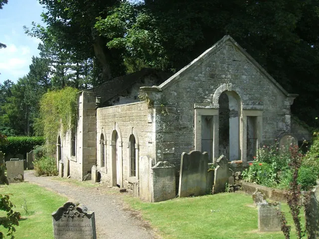
© Bill Henderson · Geograph · CC BY-SA 2.0
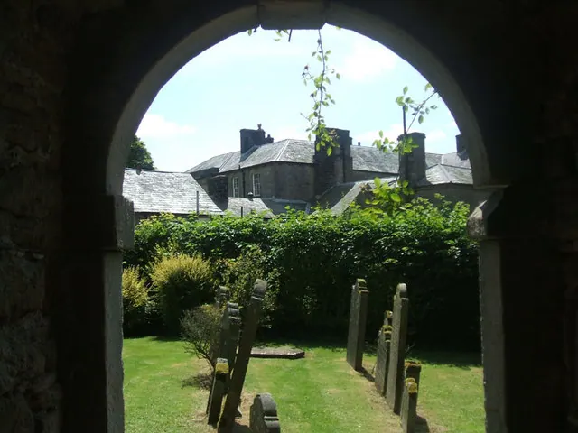
© Bill Henderson · Geograph · CC BY-SA 2.0
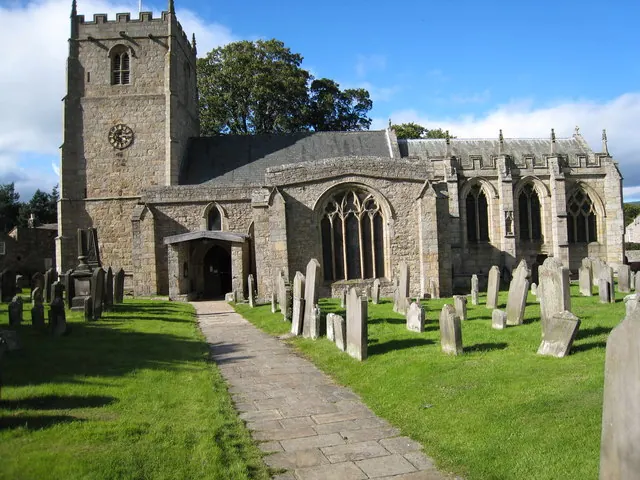
© Philip Barker · Geograph · CC BY-SA 2.0
Images © their respective photographers, licensed under CC BY-SA 2.0 and reused here with attribution. Photographs depict listed buildings, churches and monuments near this settlement and may show neighbouring villages.
Location
54.5886°N, -2.0232°W · Land of Count Alan hundred, Yorkshire
View larger map on OpenStreetMap →Data derived from the Open Domesday project (opendomesday.org), based on the Domesday Book dataset compiled by Professor J.J.N. Palmer and team. The Domesday Book (1086) is in the public domain.
Found an inaccuracy? [email protected]