How Hill in the Domesday Book (1086)
The 1086 Domesday survey records the settlement of How Hill, entered under the hundred of Burghshire in Yorkshire.
Other Settlements in Burghshire
- Addlethorpe
- Aismunderby
- Aldfield
- Allerton [Mauleverer]
- Arkendale
- Askwith
- Azerley
- Barrowby [Grange]
- Beckwith [House]
- Besthaim
- Bestham
- Bewerley
- Bilton
- Birstwith
The Meaning of the Name
The origin of the name How Hill is not securely established from its modern form alone; like many settlement names in the North it likely combines an Old English or Old Norse personal name with a landscape term.
Remarkably, the name has changed little since 1086, when the Domesday scribes wrote it as How Hill.
Listed Buildings Near How Hill
Historic England records 23 listed buildings within about a mile of How Hill. Listing protects structures of special architectural or historic interest, graded I (exceptional), II* (particularly important) and II.
Grade I
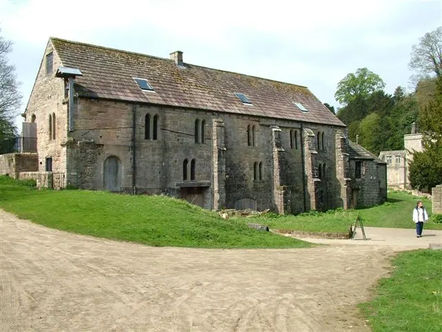
- Abbey Mill - 0.79 km
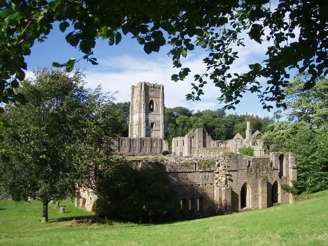
- Fountains Abbey, With Ancillary Buildings - 0.82 km
- Fountains Hall - 0.93 km
Grade II*
Grade II
- Robin Hood’s Well - 0.82 km
- Weir on River Skell Approximately 10 Metres East of the Infirmary at Fountains Abbey - 0.83 km
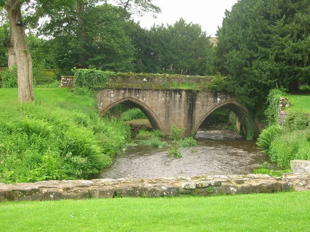
- Galand Bridge - 0.9 km
- Steps, Gate Piers and Flanking Walls to Fountains Hall - 0.92 km
- Weir on River Skell Approximately 120 Metres West of the Reservoir - 0.92 km
- Park House - 0.93 km
- Gate Piers Approximately 80 Metres to North of Park House - 0.93 km
- Revetment Walls, Terraces and Steps on North Side of Fountains Hall - 0.94 km
- The Cottage - 0.95 km
- Rough House, Also Called Ruffehouse, With Flanking Walls - 1.08 km
- Foal Cote House - 1.1 km
- Rustic Bridge at South End of the Canal, With Culvert and Arch to Reservoir - 1.17 km
- Statue and Pedestal on West Side of the Canal, South End - 1.18 km
- Bridge Approximately 200 Metres North of Rough House - 1.2 km
- Weir and Reservoir Below Tent Hill - 1.2 km
- Quebec Monument - 1.22 km
- Grotto on North Side of Reservoir - 1.24 km
- Ann Boleyn’s Seat at the Surprise View - 1.24 km
- Temple of Fame on Cliff Top at South Side of Moon Pond - 1.29 km
Scheduled Monuments Near How Hill
Scheduled monuments are nationally important archaeological sites given legal protection. 5 lie within roughly a mile of How Hill:
- Medieval monastic grange and site of medieval settlement at Ninevah - 0.18 km
- Site of medieval chapel and section of Fountains Park park pale, 170m south west of How Hill Farm - 0.43 km
- Fountains Cistercian Abbey; monastic precinct, mill, water management works, agricultural and industrial features and 18th century gardens - 0.75 km
- Medieval monastic fishponds immediately east of Park House - 0.86 km
- Medieval deer park pale surrounding Fountains Park - 1.13 km
Nearby Domesday Settlements
Other places recorded in the 1086 survey within a few miles:
- Markenfield Hall - 2.0 km E
- Aldfield - 2.2 km NW
- Markington - 2.8 km SE
- Sawley - 3.0 km W
- Studley Royal - 3.0 km N
- Aismunderby - 3.2 km E
Heritage Around How [Hill]
Photographs of churches, listed buildings and monuments in the vicinity, contributed by volunteers to the Geograph project and reused here under a Creative Commons licence.
© J Scott · Geograph · CC BY-SA 2.0
© P Glenwright · Geograph · CC BY-SA 2.0
© Pete burnett · Geograph · CC BY-SA 2.0
Images © their respective photographers, licensed under CC BY-SA 2.0 and reused here with attribution. Photographs depict listed buildings, churches and monuments near this settlement and may show neighbouring villages.
Data derived from the Open Domesday project (opendomesday.org), based on the Domesday Book dataset compiled by Professor J.J.N. Palmer and team. The Domesday Book (1086) is in the public domain.
Found an inaccuracy? [email protected]