Hornby in the Domesday Book (1086)
Hornby appears in the Domesday Book of 1086, entered under the hundred of Amounderness in Yorkshire.
Other Settlements in Amounderness
- Aighton
- Aldcliffe
- Aldingham
- Arkholme
- Aschebi
- Ashton [Hall]
- Ashton [on Ribble]
- Austwick
- Barbon
- Bardsea
- Bare
- Barnoldswick
- Barton
- Beetham
The Meaning of the Name
The name Hornby is of Scandinavian origin. Its final element derives from the Old Norse word bý, a farmstead or village. The first element is most likely a personal name or an early descriptive term, now difficult to recover with certainty. Taken together the name probably meant something close to ‘a farmstead’.
Names of this type are a fingerprint of Scandinavian settlement: they cluster across the old Danelaw, where Norse-speaking settlers renamed or founded villages from the late 9th century onward.
Remarkably, the name has changed little since 1086, when the Domesday scribes wrote it as Hornby.
Listed Buildings Near Hornby
Historic England records 32 listed buildings within about a mile of Hornby. Listing protects structures of special architectural or historic interest, graded I (exceptional), II* (particularly important) and II.
Grade I
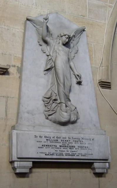
- Church of St Margaret - 0.13 km
- Hornby Castle - 0.19 km
Grade II*
Grade II
- Wall With 3 Gateways Approx. 90 Metres South-east of No.56 - 0.06 km
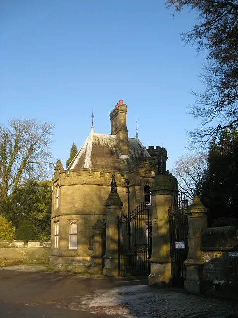
- No.54, 2 Pairs of Gate Piers, and Walls Adjoining Forming Entrance to Hornby Castle Drive - 0.07 km
- 56, Main Street - 0.09 km
- Milestone - 0.1 km
- Nos. 41 and 43 (Monteagle House) - 0.1 km
- 45 and 47, Main Street - 0.11 km
- 58 and 60, Main Street - 0.11 km
- Castle Hotel - 0.12 km
- Hornby Bridge - 0.12 km
- House Adjoining to North of Castle Hotel - 0.13 km
- Terrace Wall on South-west and South-east Sides of Hornby Castle - 0.16 km
- War Memorial - 0.16 km
- Nos 26 and 28 (National Westminster Bank) and no 30 (Riverside Cottage) - 0.17 km
- Church of St Mary - 0.17 km
- The Presbytery, Church of St Mary - 0.17 km
- Yew Tree Cottage - 0.18 km
- Hornby Village Institute - 0.18 km
- Mossmire House and 21 Main Street - 0.19 km
- 11 and 13, Main Street - 0.21 km
- Hornby Hall Cottage - 0.24 km
- Drinking Fountain Adjoining No.2 (Lambs’ Garage) - 0.26 km
…and 8 more listed structures in the area.
Scheduled Monuments Near Hornby
Scheduled monuments are nationally important archaeological sites given legal protection. 3 lie within roughly a mile of Hornby:
- Hornby Bridge - 0.11 km
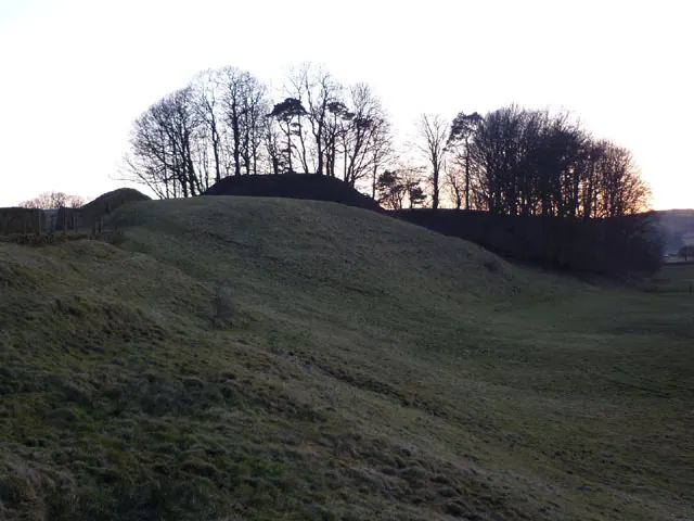
- Castle Stede motte and bailey, Hornby - 1.31 km
- Loyn Bridge - 1.32 km
Hornby Today
Today Hornby lies within the administrative area of Hornby-with-Farleton.
Read more about modern Hornby on Wikipedia .
Nearby Domesday Settlements
Other places recorded in the 1086 survey within a few miles:
- Gressingham - 1.4 km NW
- Farleton - 1.4 km SW
- Tatham - 2.2 km NE
- Claughton - 2.8 km SW
- Melling - 3.2 km N
- Wennington - 3.6 km NE
Heritage Around Hornby
Photographs of churches, listed buildings and monuments in the vicinity, contributed by volunteers to the Geograph project and reused here under a Creative Commons licence.
© Karl and Ali · Geograph · CC BY-SA 2.0
© Alison Rawson · Geograph · CC BY-SA 2.0
© Humphrey Bolton · Geograph · CC BY-SA 2.0
Images © their respective photographers, licensed under CC BY-SA 2.0 and reused here with attribution. Photographs depict listed buildings, churches and monuments near this settlement and may show neighbouring villages.
Data derived from the Open Domesday project (opendomesday.org), based on the Domesday Book dataset compiled by Professor J.J.N. Palmer and team. The Domesday Book (1086) is in the public domain.
Found an inaccuracy? [email protected]