Hooton Pagnell in the Domesday Book (1086)
The 1086 Domesday survey records the settlement of Hooton Pagnell, entered under the hundred of Strafforth in Yorkshire.
Other Settlements in Strafforth
- Adwick [le Street]
- Adwick [upon Dearne]
- Armthorpe
- Aston
- Attercliffe
- Auckley
- Aughton [Hall]
- Austerfield
- Balby
- Barnbrough
- Barnby [Dun]
- Bentley
- Bilham [House]
- Billingley
The Meaning of the Name
The name Hooton Pagnell is of Anglo-Saxon origin. Its final element derives from the Old English word tūn, a farmstead or village. The first element is most likely a personal name or an early descriptive term, now difficult to recover with certainty. Taken together the name probably meant something close to ‘a farmstead’.
Remarkably, the name has changed little since 1086, when the Domesday scribes wrote it as Hooton Pagnell.
Listed Buildings Near Hooton Pagnell
Historic England records 33 listed buildings within about a mile of Hooton Pagnell. Listing protects structures of special architectural or historic interest, graded I (exceptional), II* (particularly important) and II.
Grade I
- Church of All Saints - 0.49 km
Grade II*
Grade II
- Garden House Including Adjoining Steps and Wall Linking to Double Gatepiers East Side - 0.34 km
- Tithe Barn at Hooton Pagnell Hall - 0.35 km
- Coach House and Dovecote at Hooton Pagnell Hall (Known As the Watertower) Including Attached Houses Known As Tower Cottage and Numbers 1 and 2 the Beeches - 0.38 km
- Stable Block Adjoining Tithe Barn at Hooton Pagnell Hall - 0.38 km
- Gateway to Hooton Pagnell Hall Including Wall on Right of Driveway and Roadside Wall Linking to Garden Cloakroom - 0.43 km
- Crossbase With Shaft, Situated Immediately to South of Porch to Church of All Saints - 0.47 km
- Falcon House - 0.53 km
- Ivy House and Corner Cottage - 0.55 km
- Wheatcroft House - 0.59 km
- Barn Approximately 20 Metres to South West of Ivy Cottage - 0.6 km
- Ivy Cottage - 0.62 km
- Twitchell Corner - 0.63 km
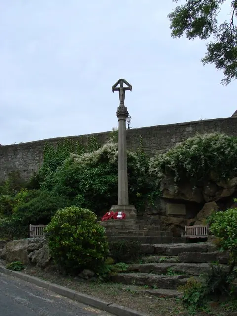
- Village Cross Immediately to North West of Ivy Cottage - 0.63 km
- Wayside Cottage - 0.69 km
- Barn Approximately 10 Metres to North of Mappleyard Farmhouse - 0.73 km
- Lowfold and Lowfold Cottage - 0.74 km
- Roadside Cottage - 0.75 km
- Appleloft Cottage - 0.76 km
- The Old Forge - 0.77 km
- Forge Cottage - 0.78 km
- Home Farmhouse - 0.79 km
- The Hostel - 0.79 km
…and 9 more listed structures in the area.
Scheduled Monuments Near Hooton Pagnell
Scheduled monuments are nationally important archaeological sites given legal protection. 2 lie within roughly a mile of Hooton Pagnell:
- Cross in the churchyard of All Saints’ Church - 0.48 km
- Market cross - 0.63 km
Hooton Pagnell Today
Today Hooton Pagnell lies within the administrative area of Doncaster, and the settlement recorded a population of 187 at the 2021 census. Nine and a half centuries separate that figure from the small rural community the Domesday survey recorded here in 1086.
Read more about modern Hooton Pagnell on Wikipedia .
Nearby Domesday Settlements
Other places recorded in the 1086 survey within a few miles:
- Bilham House - 1.0 km S
- Stotfold - 1.4 km SW
- Brodsworth - 2.0 km E
- Hickleton - 2.0 km S
- Deightonby Fields - 2.2 km SW
- Frickley - 2.2 km NW
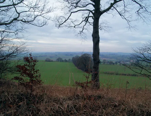
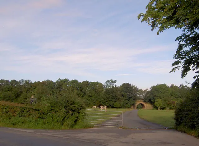
Heritage Around Hooton [Pagnell]
Photographs of churches, listed buildings and monuments in the vicinity, contributed by volunteers to the Geograph project and reused here under a Creative Commons licence.
© Bill Henderson · Geograph · CC BY-SA 2.0
© Steve Fareham · Geograph · CC BY-SA 2.0
© Steve Fareham · Geograph · CC BY-SA 2.0
Images © their respective photographers, licensed under CC BY-SA 2.0 and reused here with attribution. Photographs depict listed buildings, churches and monuments near this settlement and may show neighbouring villages.
Data derived from the Open Domesday project (opendomesday.org), based on the Domesday Book dataset compiled by Professor J.J.N. Palmer and team. The Domesday Book (1086) is in the public domain.
Found an inaccuracy? [email protected]