Holme in the Domesday Book (1086)
The 1086 Domesday survey records the settlement of Holme, entered under the hundred of Blackwell in Derbyshire.
Other Settlements in Blackwell
- Abney
- Ashford [-in-the-Water]
- Aston
- Bakewell
- Bamford
- Baslow
- Beeley
- Birchills
- Birchover
- Blackwell
- Bradwell
- Bubnell
- Burley
- Burton
The Meaning of the Name
The origin of the name Holme is not securely established from its modern form alone; like many settlement names in the North it likely combines an Old English or Old Norse personal name with a landscape term.
Remarkably, the name has changed little since 1086, when the Domesday scribes wrote it as Holme.
Listed Buildings Near Holme
Historic England records 171 listed buildings within about a mile of Holme. Listing protects structures of special architectural or historic interest, graded I (exceptional), II* (particularly important) and II.
Grade I
- Holme Hall - 0.36 km
- Holme Bridge - 0.48 km
Grade II
- Gazebo at Holme Hall - 0.28 km
- Terrace Walls With Associated Steps and Gateways to East of Holme Hall - 0.33 km
- Gate Piers and Attached Gate at West End of Main Avenue Approach to Holme Hall - 0.35 km
- Aldern House (Eastern Part Only) - 0.36 km
- Summerhouse at Holme Hall With Attached Walled Enclosure - 0.37 km
- Section of West Boundary Wall of Holme Hall Grounds With Attached Gate Piers - 0.39 km
- Burre House (Excluding C20 Garages at Rear of Eastern Wing) - 0.39 km
- Perimeter Wall of Garden to East of Holme Grange - 0.4 km
- The Cottage the East Lodge and Attached Rear Garden Wall Facing Drive to Holme Hall - 0.42 km
- The Lodge the West Lodge - 0.42 km
- Entrance Gate Piers and Attached Walls at East and West Lodges to Holme Hall - 0.43 km
- Lumford House Numbers 1, 2 and 3 - 0.43 km
- Holme Grange the Mews Cottage and Linking Wall With Attached Mounting Block - 0.43 km
- Entrance Walls and Gate Piers to Holme Grange - 0.44 km
- Stable Building at West End of Water Meadow to South of Holme Grange - 0.46 km
- Newholme Hospital Porters Lodge - 0.46 km
- Main Entrance Gateway to Burre House With Attached Wing Walls - 0.47 km
- Community Transport Office at Newholme Hospital - 0.48 km
- Northern Part of the Busy Bee Day Nursery at Newholme Hospital - 0.49 km
- Newholme Hospital (Main Building) - 0.5 km
- Sheepwash Enclosure to South West of Holme Bridge - 0.51 km
- Nurses Home at Rear of Newholme Hospital - 0.53 km
…and 147 more listed structures in the area.
Scheduled Monuments Near Holme
Scheduled monuments are nationally important archaeological sites given legal protection. 7 lie within roughly a mile of Holme:
- Holm Bridge - 0.48 km
- Lumford Mill, Bakewell - 0.67 km
- Motte and bailey castle on Castle Hill - 0.86 km
- Bakewell Bridge - 0.89 km
- Anglian high cross in the churchyard of All Saints’ Church - 1.0 km
- Anglo-Scandinavian high cross from Two Dales, Darley, now in the churchyard of All Saints’ Church - 1.01 km
- Promontory fort south of Ballcross Farm - 1.23 km
Nearby Domesday Settlements
Other places recorded in the 1086 survey within a few miles:
- Bakewell - 1.0 km S
- Birchills - 1.4 km NE
- Ashford -in-the-Water - 2.0 km W
- Burton - 2.2 km SW
- Great Longstone - 2.2 km NW
- Little? Longstone - 2.8 km NW
Heritage Around Holme
Photographs of churches, listed buildings and monuments in the vicinity, contributed by volunteers to the Geograph project and reused here under a Creative Commons licence.
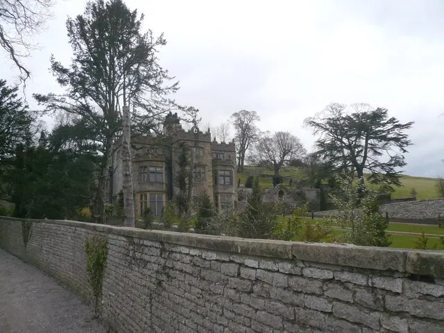
© Alan Heardman · Geograph · CC BY-SA 2.0
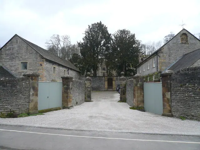
© Alan Heardman · Geograph · CC BY-SA 2.0
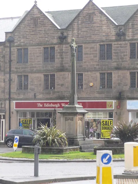
© Eirian Evans · Geograph · CC BY-SA 2.0
Images © their respective photographers, licensed under CC BY-SA 2.0 and reused here with attribution. Photographs depict listed buildings, churches and monuments near this settlement and may show neighbouring villages.
Data derived from the Open Domesday project (opendomesday.org), based on the Domesday Book dataset compiled by Professor J.J.N. Palmer and team. The Domesday Book (1086) is in the public domain.
Found an inaccuracy? [email protected]