Holbrook in the Domesday Book (1086)
The 1086 Domesday survey records the settlement of Holbrook, entered under the hundred of Morleystone in Derbyshire.
Other Settlements in Morleystone
- Bradley
- Breadsall
- Breaston
- Cellesdene
- Chaddesden
- Codnor
- Crich
- Denby
- Derby
- Draycott
- Duffield
- Hallam
- Heanor
- Herdebi
The Meaning of the Name
The origin of the name Holbrook is not securely established from its modern form alone; like many settlement names in the North it likely combines an Old English or Old Norse personal name with a landscape term.
Remarkably, the name has changed little since 1086, when the Domesday scribes wrote it as Holbrook.
Listed Buildings Near Holbrook
Historic England records 16 listed buildings within about a mile of Holbrook. Listing protects structures of special architectural or historic interest, graded I (exceptional), II* (particularly important) and II.
Grade II*
- Holbrook Hall - 0.91 km
Grade II
- Highfields Farmhouse and Attached Outbuildings - 0.46 km
- Farmbuildings to South of Highfield Farmhouse - 0.48 km
- Stocking Frame Knitters Workshop to Rear of Numbers 18 and 20 - 0.55 km
- Brook House - 0.57 km
- Stocking Frame Knitter’s Workshop to Rear of Number 10 - 0.62 km
- Nether Cottage and Attached Outbuildings - 0.64 km
- Gates, Attached Wall and War Memorial to North of St Michael’s Church - 0.79 km
- Oakdene Cottage - 0.8 km
- Church of St Michael - 0.84 km
- The Stables to North of Holbrook Hall - 0.87 km
- White Hart Public House - 0.93 km
- Milepost Opposite Sewage Works Drive at Lower Kilburn Sk 374 449 - 0.95 km
- Turn Pike Cottage - 1.11 km
- Cruck Barn and Attached Outbuildings at Manor Court - 1.2 km
- Kilburn Hall - 1.26 km
Holbrook Today
Today Holbrook lies within the administrative area of Amber Valley, and the settlement recorded a population of 1,610 at the 2021 census. Nine and a half centuries separate that figure from the small rural community the Domesday survey recorded here in 1086.
Read more about modern Holbrook on Wikipedia .
Nearby Domesday Settlements
Other places recorded in the 1086 survey within a few miles:
Heritage Around Holbrook
Photographs of churches, listed buildings and monuments in the vicinity, contributed by volunteers to the Geograph project and reused here under a Creative Commons licence.
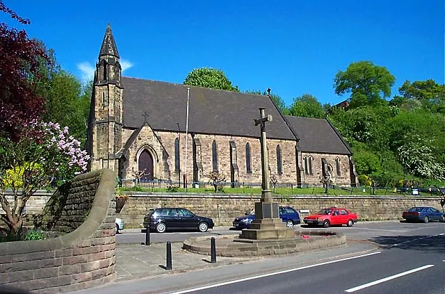
© Garth Newton · Geograph · CC BY-SA 2.0
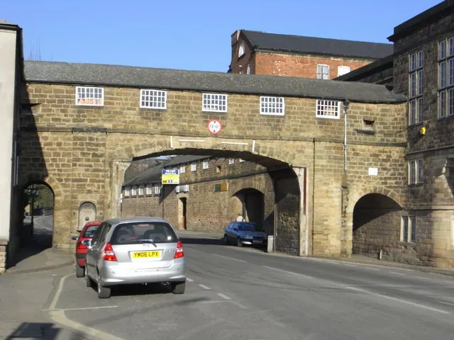
© Chris Allen · Geograph · CC BY-SA 2.0
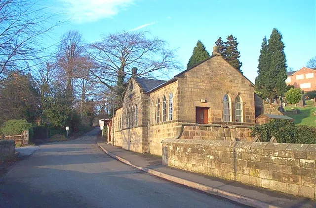
© Garth Newton · Geograph · CC BY-SA 2.0
Images © their respective photographers, licensed under CC BY-SA 2.0 and reused here with attribution. Photographs depict listed buildings, churches and monuments near this settlement and may show neighbouring villages.
Data derived from the Open Domesday project (opendomesday.org), based on the Domesday Book dataset compiled by Professor J.J.N. Palmer and team. The Domesday Book (1086) is in the public domain.
Found an inaccuracy? [email protected]