Higher and Lower Whitley in the Domesday Book (1086)
Higher and Lower Whitley appears in the Domesday Book of 1086, entered under the hundred of Bucklow in Cheshire.
Other Settlements in Bucklow
- Appleton
- Ashley
- Aston [by Budworth]
- Aston [by Sutton]
- Bartington
- Clifton
- Dunham [Massey]
- Eanley
- Grappenhall
- Lymm
- Mobberley
- Northenden
- Norton
- Ollerton
The Meaning of the Name
The name Higher and Lower Whitley is of Anglo-Saxon origin. Its final element derives from the Old English word lēah, a woodland clearing or glade. The first element is most likely a personal name or an early descriptive term, now difficult to recover with certainty. Taken together the name probably meant something close to ‘a clearing’.
Remarkably, the name has changed little since 1086, when the Domesday scribes wrote it as Higher and Lower Whitley.
Listed Buildings Near Higher and Lower Whitley
Historic England records 12 listed buildings within about a mile of Higher and Lower Whitley. Listing protects structures of special architectural or historic interest, graded I (exceptional), II* (particularly important) and II.
Grade II*
- Church of St Luke - 0.62 km
Grade II
- Wall Enclosing Friends’ Burial Ground - 0.21 km
- Chetwode Arms Inn - 0.55 km
- Towngate House and Attached Garden Wall - 0.56 km
- Sundial - 0.6 km
- Mallard Cottage and Damson Cottage - 0.69 km
- Former Lodging For Farm Workers, 6 Metres West of Willow Bank Farmhouse - 0.74 km
- Willow Bank Farmhouse - 0.74 km
- Marbury House Farmhouse - 0.93 km
- The Thatched Cottage - 0.94 km
- Barn 60 Metres South of Greenhills Farmhouse - 1.22 km
- Greenhills Farmhouse - 1.24 km
Scheduled Monuments Near Higher and Lower Whitley
Scheduled monuments are nationally important archaeological sites given legal protection. 1 lies within roughly a mile of Higher and Lower Whitley:
- Bowl barrow 120m east of Village Lane - 0.16 km
Higher and Lower Whitley Today
Today Higher and Lower Whitley lies within the administrative area of Whitley.
Read more about modern Lower Whitley on Wikipedia .
Nearby Domesday Settlements
Other places recorded in the 1086 survey within a few miles:
- Cogshall - 2.8 km SE
- Antrobus - 3.2 km E
- Bartington - 3.2 km S
- Dutton - 4.0 km W
- Little Leigh - 4.0 km S
- Appleton - 4.5 km NE
Heritage Around [Higher and Lower] Whitley
Photographs of churches, listed buildings and monuments in the vicinity, contributed by volunteers to the Geograph project and reused here under a Creative Commons licence.
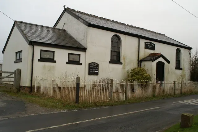
© David Long · Geograph · CC BY-SA 2.0
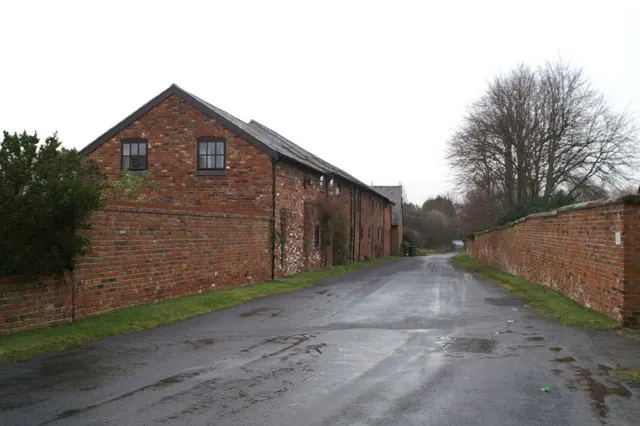
© David Long · Geograph · CC BY-SA 2.0
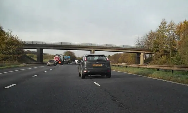
© David Dixon · Geograph · CC BY-SA 2.0
Images © their respective photographers, licensed under CC BY-SA 2.0 and reused here with attribution. Photographs depict listed buildings, churches and monuments near this settlement and may show neighbouring villages.
Data derived from the Open Domesday project (opendomesday.org), based on the Domesday Book dataset compiled by Professor J.J.N. Palmer and team. The Domesday Book (1086) is in the public domain.
Found an inaccuracy? [email protected]