Higher and Lower Dinting in the Domesday Book (1086)
The settlement of Higher and Lower Dinting is recorded in William I’s Domesday survey of 1086, entered under the hundred of Blackwell in Derbyshire.
Other Settlements in Blackwell
- Abney
- Ashford [-in-the-Water]
- Aston
- Bakewell
- Bamford
- Baslow
- Beeley
- Birchills
- Birchover
- Blackwell
- Bradwell
- Bubnell
- Burley
- Burton
The Meaning of the Name
The origin of the name Higher and Lower Dinting is not securely established from its modern form alone; like many settlement names in the North it likely combines an Old English or Old Norse personal name with a landscape term.
Remarkably, the name has changed little since 1086, when the Domesday scribes wrote it as Higher and Lower Dinting.
Listed Buildings Near Higher and Lower Dinting
Historic England records 42 listed buildings within about a mile of Higher and Lower Dinting. Listing protects structures of special architectural or historic interest, graded I (exceptional), II* (particularly important) and II.
Grade II
- Higher Dinting Farmhouse - 0.29 km
- Wren Nest Mill and Chimney and Attached Stone Wall - 0.43 km
- Holy Trinity Church - 0.5 km
- Former Methodist Chapel and sunday school with attached walls and railings - 0.55 km
- Glossop Gas Works - 0.66 km
- Roman Catholic Church of St Mary Crowned - 0.74 km
- The Oakwood and Oakwood Restaurant - 0.76 km
- Victoria Hall and Public Library - 0.81 km
- The Adult Education Centre - 0.81 km
- 8, Henry Street - 0.86 km
- 10-18, Henry Street - 0.88 km
- Bank House - 0.9 km
- Former Dollars Public House - 0.9 km
- War Memorial - 0.9 km
- Partington Theatre - 0.92 km
- National Westminster Bank - 0.93 km
- Glossop Railway Station and Co-op Building - 0.94 km
- Town Hall and Market Hall With Attached Railings and Piers - 0.95 km
- Norfolk Arms Public House - 0.95 km
- Pair of Telephone Kiosks to West of Drinking Trough Outside Norfolk Arms Public House - 0.95 km
- Drinking Trough Outside the Norfolk Arms Public House - 0.96 km
- Conservative Club - 0.99 km
- 3-9, Ellison Street - 1.0 km
- Two Lodges and Gates to Woods Mill and Attached Wall (Woods Mill Not Included) - 1.0 km
…and 18 more listed structures in the area.
Scheduled Monuments Near Higher and Lower Dinting
Scheduled monuments are nationally important archaeological sites given legal protection. 1 lies within roughly a mile of Higher and Lower Dinting:
- Ringwork in Castlehill Wood - 1.06 km
Higher and Lower Dinting Today
Today Higher and Lower Dinting lies within the administrative area of Derbyshire.
Read more about modern Dinting on Wikipedia .
Nearby Domesday Settlements
Other places recorded in the 1086 survey within a few miles:
- Whitfield - 1.4 km SE
- Old Glossop - 2.0 km E
- Hadfield - 2.0 km N
- Padfield and Little Padfield - 2.2 km NE
- Hollingworth - 2.8 km NW
- Charlesworth - 2.8 km SW
Heritage Around [Higher and Lower] Dinting
Photographs of churches, listed buildings and monuments in the vicinity, contributed by volunteers to the Geograph project and reused here under a Creative Commons licence.
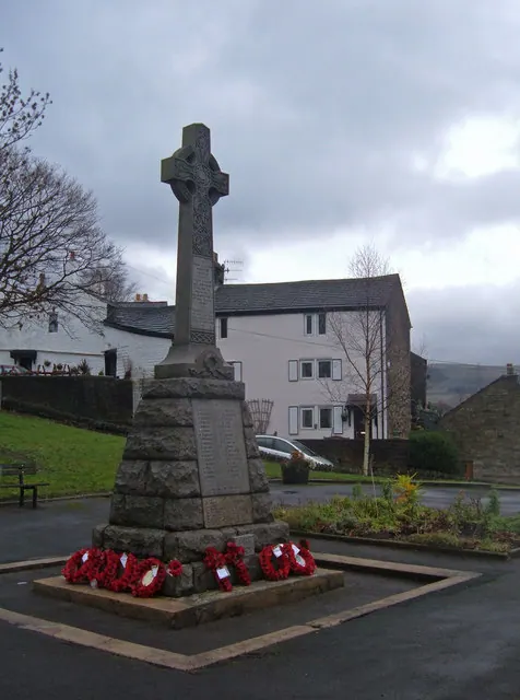
© michael ely · Geograph · CC BY-SA 2.0
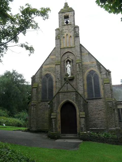
© Gerald England · Geograph · CC BY-SA 2.0
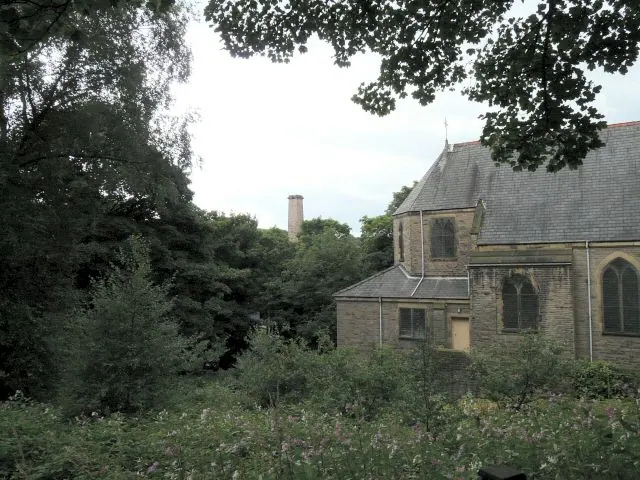
© Gerald England · Geograph · CC BY-SA 2.0
Images © their respective photographers, licensed under CC BY-SA 2.0 and reused here with attribution. Photographs depict listed buildings, churches and monuments near this settlement and may show neighbouring villages.
Data derived from the Open Domesday project (opendomesday.org), based on the Domesday Book dataset compiled by Professor J.J.N. Palmer and team. The Domesday Book (1086) is in the public domain.
Found an inaccuracy? [email protected]