Hepworth in the Domesday Book (1086)
Hepworth appears in the Domesday Book of 1086, entered under the hundred of Agbrigg in Yorkshire. The survey assessed Hepworth at 2.2 carucates of taxable land.
At the time of the survey, Hepworth supported a recorded population of 10 villagers, 1 smallholder, 8 freemanmen, working 3 ploughs between them.
The survey records Hepworth’s value at 19d in 1086. No pre-Conquest figure survives – not unusual in the North, where records were disrupted by the Harrying and by the patchy coverage of the survey.
The survey lists 2 manors at Hepworth under different lords. Splitting a single settlement between multiple tenants was common across the North – Saxon estates broken up and handed to William’s followers after 1066.
Resources Recorded at Hepworth (1086)
- Mills: 0 mills
- Meadow: 4 acres
Other Settlements in Agbrigg
- Ackton
- Almondbury
- Austonley
- Bradley
- Cartworth
- Crigglestone
- Crofton
- Dalton
- Emley
- Farnley [Tyas]
- Flockton
- Fulstone
- Golcar
- Holme
The Meaning of the Name
The name Hepworth is of Anglo-Saxon origin. Its final element derives from the Old English word worð, an enclosure or homestead. The first element is most likely a personal name or an early descriptive term, now difficult to recover with certainty. Taken together the name probably meant something close to ‘a enclosure’.
Remarkably, the name has changed little since 1086, when the Domesday scribes wrote it as Hepworth.
Listed Buildings Near Hepworth
Historic England records 39 listed buildings within about a mile of Hepworth. Listing protects structures of special architectural or historic interest, graded I (exceptional), II* (particularly important) and II.
Grade II
- 78, 79, 80 and 81, Far Lane - 0.23 km
- 64,65,66, Town Gate - 0.29 km
- Former Co Op Building Opposite no 59A - 0.3 km
- 58,59A, Town Gate - 0.34 km
- 56 AND 59, TOWN GATE (See details for further address information) - 0.34 km
- Barn Opposite no 58 - 0.34 km
- Former Dwellings and Barn Adjoining to Right of no 42 - 0.35 km
- 7.5 Miles Post Between Meal Hill Lane and Foster Place Lane - 0.39 km
- K6 Telephone Kiosk Outside Butchers Arms - 0.43 km
- Butchers Arms - 0.43 km
- Barn, South Part of Carr Farm - 0.44 km
- Cruck Building to North Part of Carr Farm - 0.45 km
- 28,29, Upper Gate - 0.47 km
- Weavers Cottage - 0.47 km
- 34, Town Gate - 0.48 km
- Nos 13/14 and 15 (South East Part) and Adjoining Barns - 0.51 km
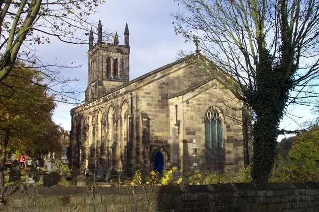
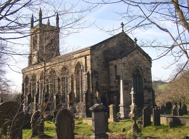
- Church of the Holy Trinity - 0.57 km
- Barn to North West of Nos 5 and 6 (Barnside) - 0.7 km
- Barnside - 0.73 km
- Barnside - 0.74 km
- Barnside - 0.75 km
- Ward Boundary Stone South of Junction With South View - 0.92 km
- 5 and 6, East Street and 17, Chapel Bank - 0.95 km
- Ward Boundary Stone on Bridge Over Jackson Bridge Dike - 0.96 km
…and 15 more listed structures in the area.
Hepworth Today
Today Hepworth lies within the administrative area of Holme Valley.
Read more about modern Hepworth on Wikipedia .
Nearby Domesday Settlements
Other places recorded in the 1086 survey within a few miles:
- Cartworth - 2.2 km NW
- Wooldale - 2.2 km NW
- Fulstone - 3.2 km N
- Thurstonland - 4.0 km N
- Shepley - 4.2 km NE
- Upperthong - 4.5 km NW
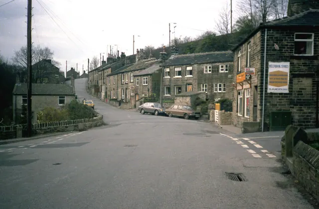
Heritage Around Hepworth
Photographs of churches, listed buildings and monuments in the vicinity, contributed by volunteers to the Geograph project and reused here under a Creative Commons licence.
© Dr Neil Clifton · Geograph · CC BY-SA 2.0
© Geoff Pick · Geograph · CC BY-SA 2.0
© Humphrey Bolton · Geograph · CC BY-SA 2.0
Images © their respective photographers, licensed under CC BY-SA 2.0 and reused here with attribution. Photographs depict listed buildings, churches and monuments near this settlement and may show neighbouring villages.
Data derived from the Open Domesday project (opendomesday.org), based on the Domesday Book dataset compiled by Professor J.J.N. Palmer and team. The Domesday Book (1086) is in the public domain.
Found an inaccuracy? [email protected]