Hemsworth in the Domesday Book (1086)
Hemsworth appears in the Domesday Book of 1086, entered under the hundred of Staincross in Yorkshire. The survey assessed Hemsworth at 1.3 carucates of taxable land.
At the time of the survey, Hemsworth supported a recorded population of 9 smallholders, 2 slaves, working 2 ploughs between them.
The numbers record a sharp fall. Before 1066, Hemsworth was worth 2 shillings; by 1086 that had dropped to 1.5 shillings – a fall of 25%. Most Yorkshire villages that lost value on this scale were swept up in the Harrying of the North – William’s scorched-earth campaign of 1069–70.
Resources Recorded at Hemsworth (1086)
- Pigs: 10
- Sheep: 16
- Meadow: 5 acres
Other Settlements in Staincross
- Adlingfleet
- Barnby [Hall]
- Barnsley
- Barugh
- Brierley
- Carlton
- Cawthorne
- Chevet
- Clactone
- Clayton [West]
- Darton
- Dodworth
- Hoyland [Swaine]
- Hunshelf [Hall]
The Meaning of the Name
The name Hemsworth is of Anglo-Saxon origin. Its final element derives from the Old English word worð, an enclosure or homestead. The first element is most likely a personal name or an early descriptive term, now difficult to recover with certainty. Taken together the name probably meant something close to ‘a enclosure’.
Remarkably, the name has changed little since 1086, when the Domesday scribes wrote it as Hemsworth.
Listed Buildings Near Hemsworth
Historic England records 7 listed buildings within about a mile of Hemsworth. Listing protects structures of special architectural or historic interest, graded I (exceptional), II* (particularly important) and II.
Grade II
- 28 and 30, Barnsley Road - 0.29 km
- Railings Forming Front Boundary to Garden of Number 32 - 0.31 km
- Church of St Helen - 0.35 km
- Hemsworth High School: that part which was formerly Hemsworth High Hall - 0.49 km
- Town End Cottage - 0.65 km
- Milepost at Se 432 133 - 0.69 km
- Milepost in Front of Arundel at Se 419 126 - 1.03 km
Hemsworth Today
Today Hemsworth lies within the administrative area of Wakefield, and the settlement recorded a population of 14,165 at the 2021 census. Nine and a half centuries separate that figure from the small rural community the Domesday survey recorded here in 1086.
Read more about modern Hemsworth on Wikipedia .
Nearby Domesday Settlements
Other places recorded in the 1086 survey within a few miles:
- Kinsley - 1.4 km NW
- Brierley - 2.2 km SW
- South Hiendley - 3.2 km W
- Shafton - 3.6 km SW
- South Kirkby - 3.6 km SE
- Badsworth - 4.1 km E
Heritage Around Hemsworth
Photographs of churches, listed buildings and monuments in the vicinity, contributed by volunteers to the Geograph project and reused here under a Creative Commons licence.
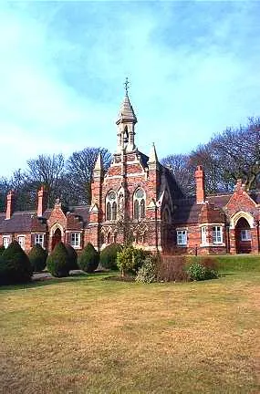
© Bill Henderson · Geograph · CC BY-SA 2.0
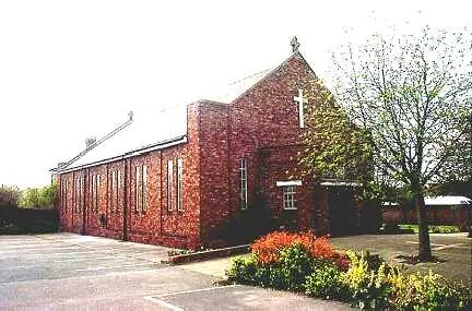
© Bill Henderson · Geograph · CC BY-SA 2.0
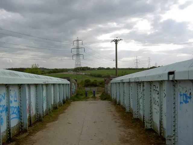
© Steve Fareham · Geograph · CC BY-SA 2.0
Images © their respective photographers, licensed under CC BY-SA 2.0 and reused here with attribution. Photographs depict listed buildings, churches and monuments near this settlement and may show neighbouring villages.
Data derived from the Open Domesday project (opendomesday.org), based on the Domesday Book dataset compiled by Professor J.J.N. Palmer and team. The Domesday Book (1086) is in the public domain.
Found an inaccuracy? [email protected]