Hashundebi in the Domesday Book (1086)
The settlement of Hashundebi is recorded in William I’s Domesday survey of 1086, entered under the hundred of Hallikeld in Yorkshire.
Other Settlements in Hallikeld
- Brampton [Hall]
- Caldeuuelle
- Cundall
- Dishforth
- Ellenthorpe [Hall]
- Givendale
- Holme
- Howgrave
- Hutton [Conyers]
- Kirby [Hill]
- Leckby [Palace]
- Markington
- Milby
- Norton [Conyers]
The Meaning of the Name
The origin of the name Hashundebi is not securely established from its modern form alone; like many settlement names in the North it likely combines an Old English or Old Norse personal name with a landscape term.
Remarkably, the name has changed little since 1086, when the Domesday scribes wrote it as Hashundebi.
Listed Buildings Near Hashundebi
Historic England records 68 listed buildings within about a mile of Hashundebi. Listing protects structures of special architectural or historic interest, graded I (exceptional), II* (particularly important) and II.
Grade I
Grade II*
- Sharow Cross Sharow Cross (National Trust) - 0.56 km
- Deans Croft - 1.05 km
Grade II
- Sharow Grange - 0.38 km
- The Manor House - 0.4 km
- Sharow Hall - 0.41 km
- Stables to Sharow Hall - 0.44 km
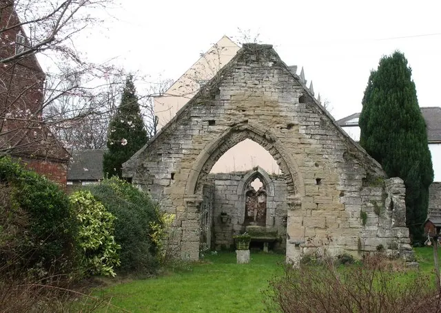
- Church of St John the Evangelist - 0.63 km
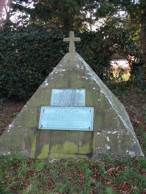
- Memorial to Charles and Jessie Piazzi Smyth approximately 15 metres west of the Church of St John the Evangelist - 0.63 km
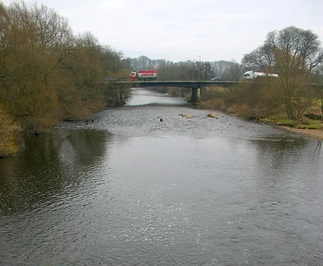
- Railway Bridge Near the Recreation Ground - 0.76 km
- Railway Bridge Near Hillshaw House - 0.77 km
- Railway Bridge Near the Beeches - 0.79 km
- Skell Railway Bridge - 0.84 km
- Almshouses of Hospital of St Mary Magdalene - 0.93 km
- Albion Terrace - 0.97 km
- Warehouse at Hbc Depot - 1.0 km
- Chapel of St Mary Magdalene - 1.0 km
- North Bridge - 1.04 km
- 30, 31 and 32, St Marygate - 1.05 km
- 28 and 29, St Marygate - 1.05 km
- The Fleece Public House - 1.06 km
- ‘Abbot Huby’s’ Wall From Number 26 As Far As Minster Road - 1.08 km
- Stretch of Wall on West Side Running From Junction With Minster Road For Approximately One Hundred Yards - 1.08 km
- Lock House - 1.08 km
…and 44 more listed structures in the area.
Scheduled Monuments Near Hashundebi
Scheduled monuments are nationally important archaeological sites given legal protection. 3 lie within roughly a mile of Hashundebi:
- Ailey Hill - 0.95 km
- Ripon Minster Close - 1.18 km
- St Anne’s Chapel - 1.23 km
Hashundebi Today
Today Hashundebi lies within the administrative area of Harrogate, and the settlement recorded a population of 574 at the 2021 census. Nine and a half centuries separate that figure from the small rural community the Domesday survey recorded here in 1086.
Read more about modern Sharow on Wikipedia .
Nearby Domesday Settlements
Other places recorded in the 1086 survey within a few miles:
- Ripon - 1.0 km W
- Copt Hewick - 1.4 km SE
- Suthauuic - 1.4 km SE
- Sutheuuic - 1.4 km SE
- Bridge Hewick - 2.0 km E
- Hutton Conyers - 2.0 km N
Heritage Around Hashundebi
Photographs of churches, listed buildings and monuments in the vicinity, contributed by volunteers to the Geograph project and reused here under a Creative Commons licence.
© Gordon Hatton · Geograph · CC BY-SA 2.0
© Gordon Hatton · Geograph · CC BY-SA 2.0
© Peter Crump · Geograph · CC BY-SA 2.0
Images © their respective photographers, licensed under CC BY-SA 2.0 and reused here with attribution. Photographs depict listed buildings, churches and monuments near this settlement and may show neighbouring villages.
Data derived from the Open Domesday project (opendomesday.org), based on the Domesday Book dataset compiled by Professor J.J.N. Palmer and team. The Domesday Book (1086) is in the public domain.
Found an inaccuracy? [email protected]