Halton in the Domesday Book (1086)
Halton appears in the Domesday Book of 1086, entered under the hundred of Amounderness in Yorkshire. The survey assessed Halton at 6 carucates of taxable land.
At the time of the survey, Halton supported a recorded population of 16 villagers, working 12 ploughs between them.
The numbers record a sharp fall. Before 1066, Halton was worth 6 shillings; by 1086 that had dropped to 4 shillings – a fall of 33%. Most Yorkshire villages that lost value on this scale were swept up in the Harrying of the North – William’s scorched-earth campaign of 1069–70.
Resources Recorded at Halton (1086)
- Meadow: 8 acres
- Woodland: 1 league 2 furlongs * 1 league mixed measures
Other Settlements in Amounderness
- Aighton
- Aldcliffe
- Aldingham
- Arkholme
- Aschebi
- Ashton [Hall]
- Ashton [on Ribble]
- Austwick
- Barbon
- Bardsea
- Bare
- Barnoldswick
- Barton
- Beetham
The Meaning of the Name
The name Halton is of Anglo-Saxon origin. Its final element derives from the Old English word tūn, a farmstead or village. The first element is most likely a personal name or an early descriptive term, now difficult to recover with certainty. Taken together the name probably meant something close to ‘a farmstead’.
Remarkably, the name has changed little since 1086, when the Domesday scribes wrote it as Halton.
Listed Buildings Near Halton
Historic England records 26 listed buildings within about a mile of Halton. Listing protects structures of special architectural or historic interest, graded I (exceptional), II* (particularly important) and II.
Grade II*
- Manor House - 0.48 km
Grade II
- Town End Farmhouse - 0.44 km
- Farm Building to the East of Town End Farmhouse - 0.44 km
- Gate Piers West of Manor House - 0.48 km
- Millers Farmhouse - 0.6 km
- Lime Tree House - 0.62 km
- Field Cottage - 0.62 km
- No 2 Rectory Cottages - 0.63 km
- No 1 Rectory Cottages - 0.63 km
- Barn 30 Metres North of Farmhouse at Pedlers Farm - 0.64 km
- The Boat House - 0.65 km
- Tower House and Former Stables and Barn Adjoining - 0.67 km
- White Lion Hotel and Coach House Adjoining to North-east - 0.68 km
- Clock House and Flanking Walls - 0.69 km
- Pair of Gate Piers and Gates to Churchyard of Church of St Wilfrid - 0.69 km
- Chain Lodge (Or North Lodge) - 0.71 km
- Archway to Former Halton Hall - 0.72 km
- 6 Gatepiers and Railings North of Chain Lodge - 0.73 km
- Pair of Gatepiers at Entrance to Churchyard to South of the Church of St Wilfrid - 0.73 km
- Bradshaw Mausoleum, Halton Churchyard - 0.74 km
- Church of St. Wilfrid - 0.74 km
- Sundial, About 4 Metres South-east of Church Porch of the Church of St Wilfrid - 0.74 km
- Pair of Gatepiers to Former Halton Hall - 0.77 km
- Milestone - 0.92 km
…and 2 more listed structures in the area.
Scheduled Monuments Near Halton
Scheduled monuments are nationally important archaeological sites given legal protection. 2 lie within roughly a mile of Halton:
- High cross in St Wilfrid’s churchyard, Halton - 0.71 km
- Castle Hill motte and bailey, Halton - 0.71 km
Halton Today
Today Halton lies within the administrative area of Halton-with-Aughton.
Read more about modern Halton on Wikipedia .
Nearby Domesday Settlements
Other places recorded in the 1086 survey within a few miles:
- Newsham - 2.0 km W
- Caton - 3.0 km E
- Slyne - 3.2 km W
- Skerton - 3.2 km W
- Bolton le Sands - 3.6 km NW
- Stapleton Terne - 3.6 km NW
Heritage Around Halton
Photographs of churches, listed buildings and monuments in the vicinity, contributed by volunteers to the Geograph project and reused here under a Creative Commons licence.
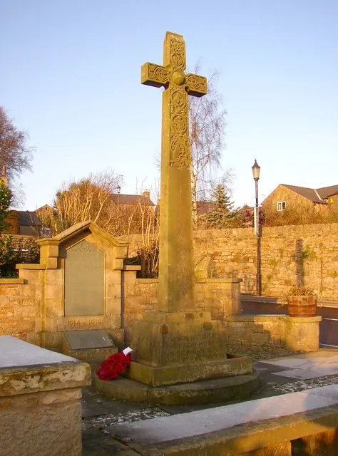
© Humphrey Bolton · Geograph · CC BY-SA 2.0
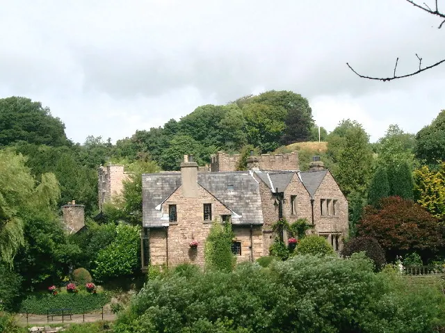
© Mike and Kirsty Grundy · Geograph · CC BY-SA 2.0
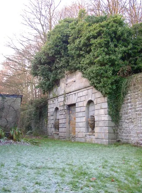
© Humphrey Bolton · Geograph · CC BY-SA 2.0
Images © their respective photographers, licensed under CC BY-SA 2.0 and reused here with attribution. Photographs depict listed buildings, churches and monuments near this settlement and may show neighbouring villages.
Data derived from the Open Domesday project (opendomesday.org), based on the Domesday Book dataset compiled by Professor J.J.N. Palmer and team. The Domesday Book (1086) is in the public domain.
Found an inaccuracy? [email protected]