Guisborough in the Domesday Book (1086)
The 1086 Domesday survey records the settlement of Guisborough, entered under the hundred of Langbaurgh in Yorkshire.
Other Settlements in Langbaurgh
- Acklam
- Airy [Holme]
- Aislaby
- Arnodestorp
- Baldebi
- Barnaby
- Barwick
- Battersby
- Bergolbi
- Berguluesbi
- Blaten [Carr]
- Borrowby
- Breck
- Brotton
The Meaning of the Name
The name Guisborough is of Anglo-Saxon origin. Its final element derives from the Old English word burh, a fortified place. The first element is most likely a personal name or an early descriptive term, now difficult to recover with certainty. Taken together the name probably meant something close to ‘a stronghold’.
Remarkably, the name has changed little since 1086, when the Domesday scribes wrote it as Guisborough.
Listed Buildings Near Guisborough
Historic England records 110 listed buildings within about a mile of Guisborough. Listing protects structures of special architectural or historic interest, graded I (exceptional), II* (particularly important) and II.
Grade I
- St Mary’s Priory Gatehouse (Ruins) - 0.39 km
Grade II*
- Church of St Nicholas - 0.37 km
Grade II
- Barn, Stables, Byre, Loose Boxes, Cart Shed and Horse Gin, to South West of Church Lane Farmhouse - 0.12 km
- Boundary Walls Adjoining East and West Sides of Church Lane Farmhouse - 0.13 km
- Church Lane Farmhouse and West Wing - 0.14 km
- Guisborough General Hospital (West Block) and Adjoining Wing - 0.29 km
- Boundary Wall to North and West Sides of Guisborough General Hospital, and Railings to Entrance - 0.3 km
- 66, Church Street - 0.31 km
- Prior Pursglove College, Including Master’s House, Gymnasium and Assembly Hall - 0.32 km
- 70 and 72, Church Street - 0.32 km
- 76, Church Street - 0.32 km
- 50 and 52, Church Street - 0.33 km
- 51 and 53, Northgate - 0.33 km
- Studley House - 0.34 km
- 63 and 65, Church Street - 0.34 km
- Boundary Wall, Between Number 46 Church Street and Prior Pursglove College - 0.34 km
- Numbers 55 and 57 and Outhouse Adjoining North Side of Number 57 - 0.36 km
- War Memorial, to West of St Nicholas Church - 0.37 km
- 47, 49 and 51, Church Street - 0.37 km
- 53, Church Street - 0.37 km
- 45, Church Street - 0.37 km
- Boundary Wall Alongside Garden of the Rectory - 0.41 km
- Boundary Walls, Gates and Gatepiers Adjoining North Lodge - 0.41 km
- (The Buck Hotel) and Extensions and Outbuildings Adjoining North Side - 0.42 km
…and 86 more listed structures in the area.
Scheduled Monuments Near Guisborough
Scheduled monuments are nationally important archaeological sites given legal protection. 1 lies within roughly a mile of Guisborough:
Guisborough Today
Today Guisborough lies within the administrative area of Redcar and Cleveland, and the settlement recorded a population of 18,874 at the 2021 census. Nine and a half centuries separate that figure from the small rural community the Domesday survey recorded here in 1086.
Read more about modern Guisborough on Wikipedia .
Nearby Domesday Settlements
Other places recorded in the 1086 survey within a few miles:
- Middleton - 0.0 km N
- Tocketts Farm - 1.0 km N
- Rawcliff Banks - 2.0 km E
- Thornton Fields - 2.0 km N
- Hutton Lowcross - 3.2 km S
- Upleatham - 3.6 km NE
Heritage Around Guisborough
Photographs of churches, listed buildings and monuments in the vicinity, contributed by volunteers to the Geograph project and reused here under a Creative Commons licence.
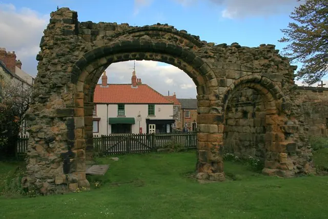
© Mick Garratt · Geograph · CC BY-SA 2.0
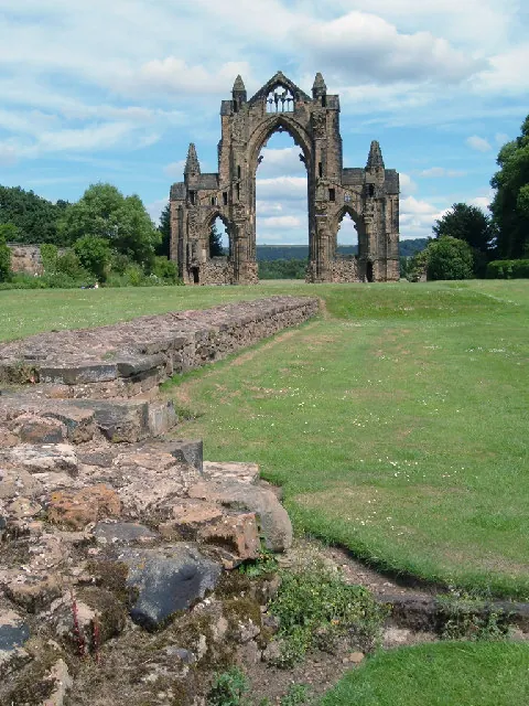
© Alison Stamp · Geograph · CC BY-SA 2.0
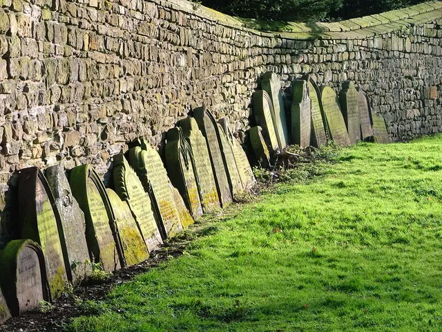
© Mick Garratt · Geograph · CC BY-SA 2.0
Images © their respective photographers, licensed under CC BY-SA 2.0 and reused here with attribution. Photographs depict listed buildings, churches and monuments near this settlement and may show neighbouring villages.
Data derived from the Open Domesday project (opendomesday.org), based on the Domesday Book dataset compiled by Professor J.J.N. Palmer and team. The Domesday Book (1086) is in the public domain.
Found an inaccuracy? [email protected]