Grimeshou in the Domesday Book (1086)
The 1086 Domesday survey records the settlement of Grimeshou, entered under the hundred of Strafforth in Yorkshire.
Other Settlements in Strafforth
- Adwick [le Street]
- Adwick [upon Dearne]
- Armthorpe
- Aston
- Attercliffe
- Auckley
- Aughton [Hall]
- Austerfield
- Balby
- Barnbrough
- Barnby [Dun]
- Bentley
- Bilham [House]
- Billingley
The Meaning of the Name
The origin of the name Grimeshou is not securely established from its modern form alone; like many settlement names in the North it likely combines an Old English or Old Norse personal name with a landscape term.
Remarkably, the name has changed little since 1086, when the Domesday scribes wrote it as Grimeshou.
Listed Buildings Near Grimeshou
Historic England records 18 listed buildings within about a mile of Grimeshou. Listing protects structures of special architectural or historic interest, graded I (exceptional), II* (particularly important) and II.
Grade II
- Trinity Fir Vale Methodist Church - 0.2 km
- 18, 20 and 22, Page Hall Road - 0.21 km
- Church of St Cuthbert - 0.22 km
- Abbeygrange Nursing Home and Adjoining Former Stable Entrance - 0.27 km
- Goddard Hall - 0.49 km
- Chesterman House, Wycliffe House, main outbuilding range and boundary walls - 0.51 km
- Sheffield City Council Sport and Development Section District Office - 0.57 km
- Caretaker’s House to Earl Marshal Training Centre - 0.85 km
- Grimesthorpe Pump - 0.88 km
- Earl Marshal Training Centre and attached boundary walls - 0.88 km
- Longley Hall - 0.91 km
- Cottage, barn, coach house and stables, Norwood Grange - 0.92 km
- Firth Park Methodist Church, Adjoining Meeting Room and Boundary Wall - 0.99 km
- Lodge at North East Entrance to Bungreave Cemetery - 1.04 km
- War Memorial 400 Metres North East of Chapel at Burngreave Cemetery - 1.14 km
- Carr Wood House and Attached Wall and Gate Piers - 1.14 km
- War Memorial Cross 400 Metres North East of Chapel at Burngreave Cemetery - 1.14 km
- Greentop Circus Training Centre - 1.29 km
Scheduled Monuments Near Grimeshou
Scheduled monuments are nationally important archaeological sites given legal protection. 1 lies within roughly a mile of Grimeshou:
- Wincobank slight univallate hillfort and World War II anti-aircraft gun and searchlight emplacement - 1.28 km
Grimeshou Today
Today Grimeshou lies within the administrative area of Sheffield.
Read more about modern Page Hall on Wikipedia .
Nearby Domesday Settlements
Other places recorded in the 1086 survey within a few miles:
- Attercliffe - 2.2 km SE
- Sheffield - 3.6 km SW
- Tinsley - 4.0 km E
- Wadsley - 4.0 km W
- Ecclesfield - 4.1 km N
- Kimberworth - 5.0 km NE
Heritage Around Grimeshou
Photographs of churches, listed buildings and monuments in the vicinity, contributed by volunteers to the Geograph project and reused here under a Creative Commons licence.
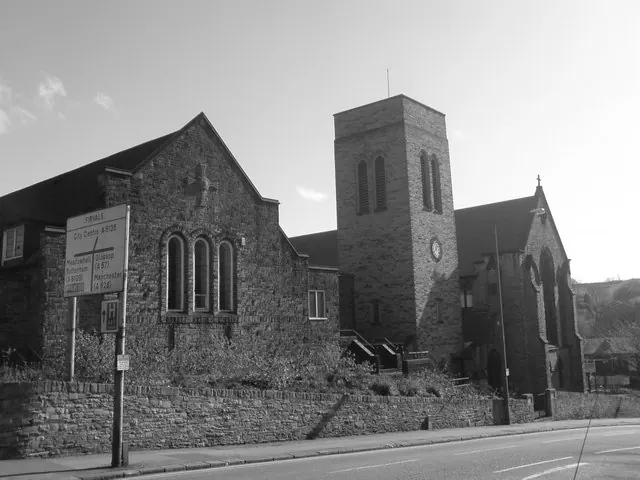
© Richard Newall · Geograph · CC BY-SA 2.0
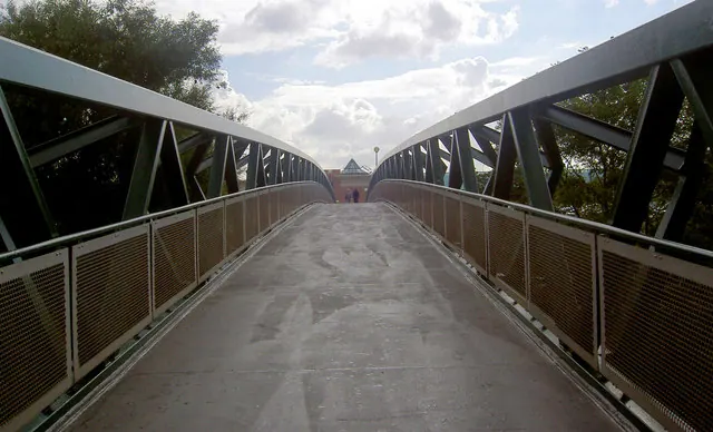
© Steve Fareham · Geograph · CC BY-SA 2.0
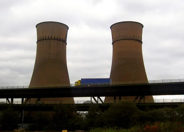
© Steve Fareham · Geograph · CC BY-SA 2.0
Images © their respective photographers, licensed under CC BY-SA 2.0 and reused here with attribution. Photographs depict listed buildings, churches and monuments near this settlement and may show neighbouring villages.
Data derived from the Open Domesday project (opendomesday.org), based on the Domesday Book dataset compiled by Professor J.J.N. Palmer and team. The Domesday Book (1086) is in the public domain.
Found an inaccuracy? [email protected]