Great Crakehall in the Domesday Book (1086)
Great Crakehall appears in the Domesday Book of 1086, entered under the hundred of Land of Count Alan in Yorkshire.
Other Settlements in Land of Count Alan
- Achebi
- Agglethorpe
- Ainderby [Mires]
- Ainderby [Quernhow]
- Aiskew
- Aldbrough
- Allerthorpe [Hall]
- Ascam
- Ascham
- Asebi
- Aske [Hall]
- Askrigg
- Aysgarth
- Baldersby
The Meaning of the Name
The origin of the name Great Crakehall is not securely established from its modern form alone; like many settlement names in the North it likely combines an Old English or Old Norse personal name with a landscape term.
Remarkably, the name has changed little since 1086, when the Domesday scribes wrote it as Great Crakehall.
Listed Buildings Near Great Crakehall
Historic England records 28 listed buildings within about a mile of Great Crakehall. Listing protects structures of special architectural or historic interest, graded I (exceptional), II* (particularly important) and II.
Grade II*
- Crakehall Hall and Garden Walls - 0.59 km
Grade II
- White Cross - 0.39 km
- Firby House - 0.46 km
- Hall Farmhouse - 0.46 km
- War Memorial - 0.49 km
- Barn to Hall Farm - 0.49 km
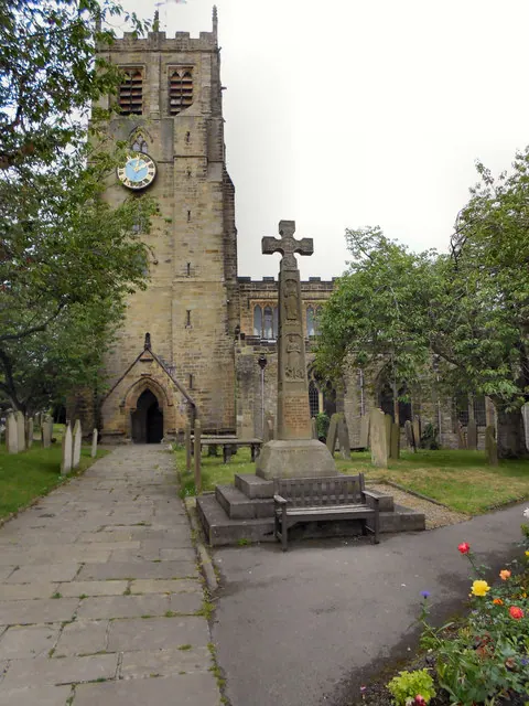
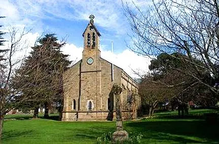
- Church of St Gregory - 0.5 km
- The Old Chapel - 0.5 km
- Village Farmhouse - 0.6 km
- Barn Approximately 5 Metres to West of Crakehall House - 0.61 km
- Holly Cottage Old Cottage - 0.62 km
- Greyriggs Sydal Cottage - 0.62 km
- Crakehall House - 0.62 km
- Stables to Crakehall Hall - 0.62 km
- Hilltop Cottage - 0.63 km
- Barn Approximately 7 Metres to North-west of Crakehall House - 0.63 km
- St Edmonds Cottage - 0.64 km
- Cottage to Rear of St Edmunds Cottage - 0.65 km
- Hawdene Little Garth - 0.65 km
- Little Crakehall Bridge - 0.7 km
- Crakehall Corn Mill - 0.75 km
- Crakehall Mill House - 0.77 km
- Guyzance - 0.89 km
- The Willows - 0.9 km
…and 4 more listed structures in the area.
Scheduled Monuments Near Great Crakehall
Scheduled monuments are nationally important archaeological sites given legal protection. 1 lies within roughly a mile of Great Crakehall:
Great Crakehall Today
Today Great Crakehall lies within the administrative area of Crakehall.
Read more about modern Great Crakehall on Wikipedia .
Nearby Domesday Settlements
Other places recorded in the 1086 survey within a few miles:
- Bedale - 2.2 km SE
- Langthorne - 2.2 km NE
- Burrill - 2.2 km SW
- Cowling - 2.2 km SW
- Newton le Willows - 3.0 km W
- Aiskew - 3.2 km E
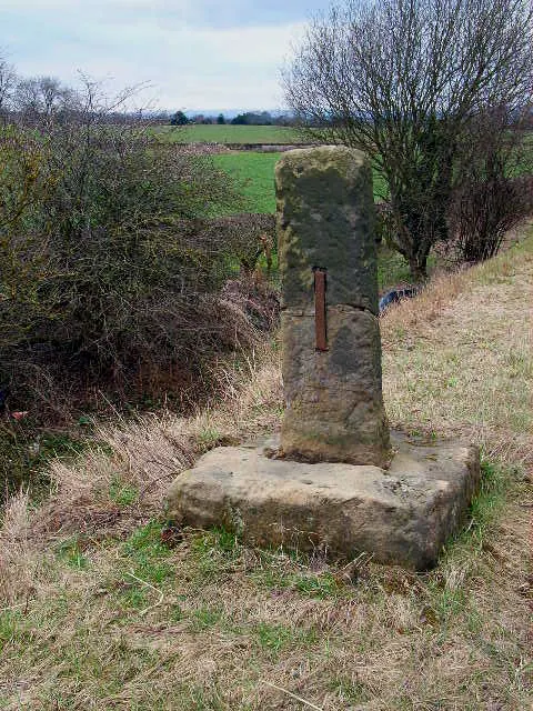
Heritage Around [Great] Crakehall
Photographs of churches, listed buildings and monuments in the vicinity, contributed by volunteers to the Geograph project and reused here under a Creative Commons licence.
© David Dixon · Geograph · CC BY-SA 2.0
© Bill Henderson · Geograph · CC BY-SA 2.0
© Oliver Dixon · Geograph · CC BY-SA 2.0
Images © their respective photographers, licensed under CC BY-SA 2.0 and reused here with attribution. Photographs depict listed buildings, churches and monuments near this settlement and may show neighbouring villages.
Location
54.3003°N, -1.6235°W · Land of Count Alan hundred, Yorkshire
View larger map on OpenStreetMap →Data derived from the Open Domesday project (opendomesday.org), based on the Domesday Book dataset compiled by Professor J.J.N. Palmer and team. The Domesday Book (1086) is in the public domain.
Found an inaccuracy? [email protected]