Greasbrough in the Domesday Book (1086)
The settlement of Greasbrough is recorded in William I’s Domesday survey of 1086, entered under the hundred of Strafforth in Yorkshire.
Other Settlements in Strafforth
- Adwick [le Street]
- Adwick [upon Dearne]
- Armthorpe
- Aston
- Attercliffe
- Auckley
- Aughton [Hall]
- Austerfield
- Balby
- Barnbrough
- Barnby [Dun]
- Bentley
- Bilham [House]
- Billingley
The Meaning of the Name
The name Greasbrough is of Anglo-Saxon origin. Its final element derives from the Old English word burh, a fortified place. The first element is most likely a personal name or an early descriptive term, now difficult to recover with certainty. Taken together the name probably meant something close to ‘a stronghold’.
Remarkably, the name has changed little since 1086, when the Domesday scribes wrote it as Greasbrough.
Listed Buildings Near Greasbrough
Historic England records 11 listed buildings within about a mile of Greasbrough. Listing protects structures of special architectural or historic interest, graded I (exceptional), II* (particularly important) and II.
Grade II
- 33-39, Coach Road - 0.24 km
- Greasbrough War Memorial and Railed Enclosure - 0.27 km
- Church of St Mary - 0.3 km
- No 6 and Adjoining Carriage Arches on West Side - 0.39 km
- 1, Greenside - 0.42 km
- Barn and Horse-engine House at Manor Farm Situated Immediately North of Farmhouse - 0.46 km
- Numbers 2 and 4 Dam Head - 0.67 km
- Morley Bridge - 1.02 km
- Barbot Hall Farmhouse - 1.05 km
- Glossop Lodge - 1.14 km
- L-shaped Farmbuilding at Bassingthorpe Farm Approximately 20 Metres to North of Farmhouse - 1.17 km
Scheduled Monuments Near Greasbrough
Scheduled monuments are nationally important archaeological sites given legal protection. 4 lie within roughly a mile of Greasbrough:
- Roman Ridge (Roman road): section 300yds (270m) long on Clay Hill - 0.83 km
- Roman Ridge: section 330yds (300m) long, S of Dog Kennel Pond, Wentworth Park - 1.22 km
- Roman Ridge: section 110yds (100m) long, 450yds (410m) NNE of Kimberworth Park Farm - 1.31 km
- Roman Ridge: section 500yds (460m) long, N of Dog Kennel Pond, Wentworth Park - 1.37 km
Greasbrough Today
Today Greasbrough lies within the administrative area of Rotherham, and the settlement recorded a population of 2,038 at recent figures. Nine and a half centuries separate that figure from the small rural community the Domesday survey recorded here in 1086.
Read more about modern Greasbrough on Wikipedia .
Nearby Domesday Settlements
Other places recorded in the 1086 survey within a few miles:
- Rawmarsh - 2.2 km NE
- Kimberworth - 2.2 km SW
- Rotherham - 3.6 km SE
- Dalton - 4.1 km E
- Thorpe Hesley - 4.1 km W
- Wentworth - 4.2 km NW
Heritage Around Greasbrough
Photographs of churches, listed buildings and monuments in the vicinity, contributed by volunteers to the Geograph project and reused here under a Creative Commons licence.
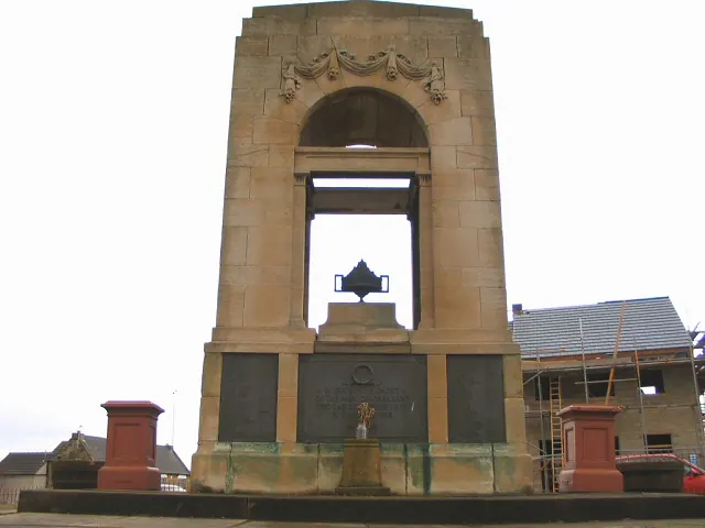
© Roger May · Geograph · CC BY-SA 2.0
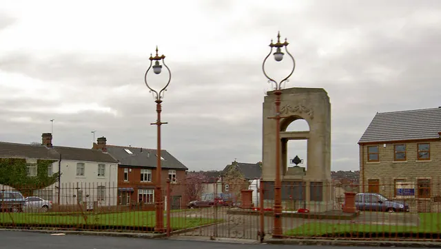
© Steve Fareham · Geograph · CC BY-SA 2.0
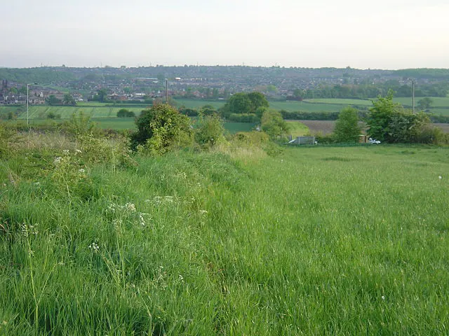
© Alan Murray-Rust · Geograph · CC BY-SA 2.0
Images © their respective photographers, licensed under CC BY-SA 2.0 and reused here with attribution. Photographs depict listed buildings, churches and monuments near this settlement and may show neighbouring villages.
Data derived from the Open Domesday project (opendomesday.org), based on the Domesday Book dataset compiled by Professor J.J.N. Palmer and team. The Domesday Book (1086) is in the public domain.
Found an inaccuracy? [email protected]