Garstang in the Domesday Book (1086)
The 1086 Domesday survey records the settlement of Garstang, entered under the hundred of Amounderness in Yorkshire.
Other Settlements in Amounderness
- Aighton
- Aldcliffe
- Aldingham
- Arkholme
- Aschebi
- Ashton [Hall]
- Ashton [on Ribble]
- Austwick
- Barbon
- Bardsea
- Bare
- Barnoldswick
- Barton
- Beetham
The Meaning of the Name
The origin of the name Garstang is not securely established from its modern form alone; like many settlement names in the North it likely combines an Old English or Old Norse personal name with a landscape term.
Remarkably, the name has changed little since 1086, when the Domesday scribes wrote it as Garstang.
Listed Buildings Near Garstang
Historic England records 29 listed buildings within about a mile of Garstang. Listing protects structures of special architectural or historic interest, graded I (exceptional), II* (particularly important) and II.
Grade II
- Arts Centre - 0.33 km
- 43, High Street - 0.38 km
- Nos 44 and 45 With Mounting Block - 0.38 km
- 11, 12 and 13, High Street - 0.39 km
- Coffee Inn - 0.39 km
- Market House - 0.45 km
- Outbuilding Behind Market House - 0.45 km
- Bonds Fold Farmhouse and Greenhalgh Cottage - 0.49 km
- 2, Bridge Street - 0.52 km
- 4, Bridge Street - 0.52 km
- Royal Oak Hotel - 0.52 km
- Wheatsheaf Inn - 0.56 km
- Garstang Bridge - 0.59 km
- Pump North of Greenhalgh Castle Farmhouse - 0.63 km
- Church of St Mary and St Michael - 0.63 km
- Greenhalgh Castle Farmhouse - 0.64 km
- Church of St Thomas - 0.65 km
- Cross Base With Part of Shaft, West of Tower of Church of St Thomas - 0.66 km
- Canal Bridge (Number 62) - 0.81 km
- Wyre Aqueduct - 0.87 km
- Boundary Stone - 0.87 km
- Dimples Bridge (Number 58) - 0.87 km
- Greenhalgh Castle Bridge (No.57) - 0.87 km
- Milestone - 0.89 km
…and 5 more listed structures in the area.
Scheduled Monuments Near Garstang
Scheduled monuments are nationally important archaeological sites given legal protection. 2 lie within roughly a mile of Garstang:
- Garstang market cross - 0.49 km
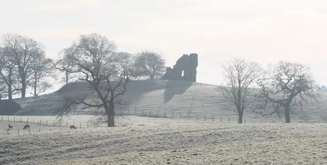
- Greenhalgh Castle, cultivation terraces south east of the castle, and site of Greenhalgh manor house - 0.59 km
Garstang Today
Today Garstang lies within the administrative area of Wyre, and the settlement recorded a population of 4,425 at the 2021 census. Nine and a half centuries separate that figure from the small rural community the Domesday survey recorded here in 1086.
Read more about modern Garstang on Wikipedia .
Nearby Domesday Settlements
Other places recorded in the 1086 survey within a few miles:
- Catterall - 3.0 km S
- Claughton - 5.0 km SE
- Aschebi - 5.0 km SW
- St Michael’s on Wyre - 5.0 km SW
- Great and Little Crimbles - 5.8 km NW
- Forton - 6.1 km N
Heritage Around Garstang
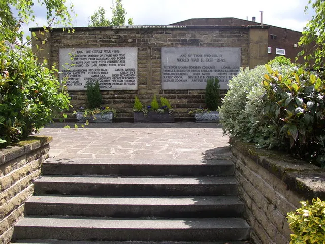
Photographs of churches, listed buildings and monuments in the vicinity, contributed by volunteers to the Geograph project and reused here under a Creative Commons licence.
© Bob Jenkins · Geograph · CC BY-SA 2.0
© Humphrey Bolton · Geograph · CC BY-SA 2.0

© Alexander P Kapp · Geograph · CC BY-SA 2.0
Images © their respective photographers, licensed under CC BY-SA 2.0 and reused here with attribution. Photographs depict listed buildings, churches and monuments near this settlement and may show neighbouring villages.
Data derived from the Open Domesday project (opendomesday.org), based on the Domesday Book dataset compiled by Professor J.J.N. Palmer and team. The Domesday Book (1086) is in the public domain.
Found an inaccuracy? [email protected]