Garriston in the Domesday Book (1086)
The 1086 Domesday survey records the settlement of Garriston, entered under the hundred of Land of Count Alan in Yorkshire. The survey assessed Garriston at 3.5 carucates of taxable land.
At the time of the survey, Garriston supported a recorded population of 6 villagers, 2 smallholders, 2 slaves, working 4 ploughs between them.
The survey puts Garriston’s value at 3 shillings, the same as before the Conquest. Unchanged valuations are relatively rare in the North, where disruption was widespread.
Other Settlements in Land of Count Alan
- Achebi
- Agglethorpe
- Ainderby [Mires]
- Ainderby [Quernhow]
- Aiskew
- Aldbrough
- Allerthorpe [Hall]
- Ascam
- Ascham
- Asebi
- Aske [Hall]
- Askrigg
- Aysgarth
- Baldersby
The Meaning of the Name
The name Garriston is of Anglo-Saxon origin. Its final element derives from the Old English word tūn, a farmstead or village. The first element is most likely a personal name or an early descriptive term, now difficult to recover with certainty. Taken together the name probably meant something close to ‘a farmstead’.
Remarkably, the name has changed little since 1086, when the Domesday scribes wrote it as Garriston.
Listed Buildings Near Garriston
Historic England records 13 listed buildings within about a mile of Garriston. Listing protects structures of special architectural or historic interest, graded I (exceptional), II* (particularly important) and II.
Grade I
- Church of Saint Oswald - 1.13 km
Grade II*
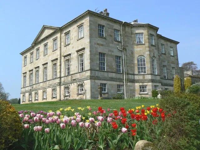
- Hauxwell Hall - 1.03 km
Grade II
- Obelisk - 0.85 km
- Bell Tower, Approximately 7 Metres West of South Front of Hauxwell Hall - 1.02 km
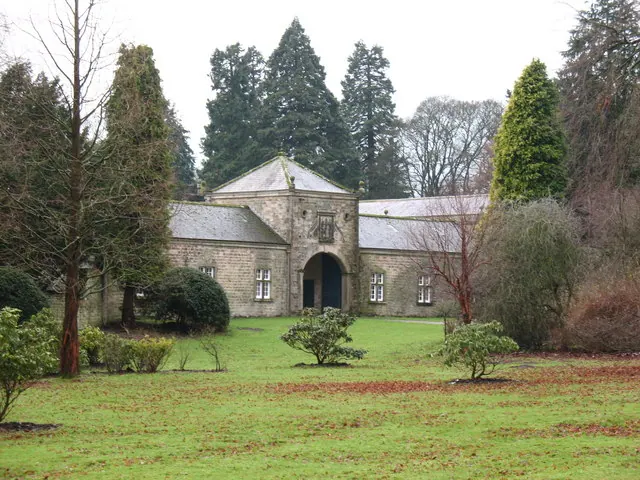
- Stable Block Adjoining Hauxwell Hall at Right Angles on North-west Corner - 1.05 km
- Archway Approximately 15 Metres North of North-east Corner of Hauxwell Hall - 1.05 km
- Office Range Approximately 50 Metres to North of Hauxwell Hall - 1.08 km
- Tomb Approximately 10 Metres South of Tower of Church of Saint Oswald - 1.11 km
- Group of 10 Medieval Tombstones and 1 Column Base at Church of Saint Oswald - 1.12 km
- Saxon Cross Shaft Approximately 10 Metres to South of Church of Saint Oswald’s - 1.12 km
- Two Small Tombstones Flanking Priest’s Door of Church of Saint Oswald’s - 1.14 km
- Hauxwell Mill - 1.17 km
- Gate Piers, Gates and Railings Approximately 100 Metres East of Church of Saint Oswald’s - 1.22 km
Scheduled Monuments Near Garriston
Scheduled monuments are nationally important archaeological sites given legal protection. 1 lies within roughly a mile of Garriston:
- West Hauxwell churchyard cross - 1.12 km
Garriston Today
Today Garriston lies within the administrative area of Richmondshire, and the settlement recorded a population of 23 at the 2021 census. Nine and a half centuries separate that figure from the small rural community the Domesday survey recorded here in 1086.
Read more about modern Garriston on Wikipedia .
Nearby Domesday Settlements
Other places recorded in the 1086 survey within a few miles:
- East Hauxwell - 1.4 km NE
- West Hauxwell - 1.4 km NE
- Barden - 1.4 km NW
- Constable Burton - 2.2 km SE
- Hunton - 3.0 km E
- Bellerby - 4.0 km W
Heritage Around Garriston
Photographs of churches, listed buildings and monuments in the vicinity, contributed by volunteers to the Geograph project and reused here under a Creative Commons licence.
© Gordon Hatton · Geograph · CC BY-SA 2.0
© Don Barber · Geograph · CC BY-SA 2.0
© John Firth · Geograph · CC BY-SA 2.0
Images © their respective photographers, licensed under CC BY-SA 2.0 and reused here with attribution. Photographs depict listed buildings, churches and monuments near this settlement and may show neighbouring villages.
Location
54.3277°N, -1.7616°W · Land of Count Alan hundred, Yorkshire
View larger map on OpenStreetMap →Data derived from the Open Domesday project (opendomesday.org), based on the Domesday Book dataset compiled by Professor J.J.N. Palmer and team. The Domesday Book (1086) is in the public domain.
Found an inaccuracy? [email protected]