Gargrave in the Domesday Book (1086)
The settlement of Gargrave is recorded in William I’s Domesday survey of 1086, entered under the hundred of Craven in Yorkshire.
Other Settlements in Craven
- Addingham
- Airton
- Anley
- Appletreewick
- Arncliffe
- Arnford
- Barnoldswick
- Bashall [Eaves]
- Battersby [Barn]
- Beamsley
- Birkby [Hall]
- Bogeuurde
- Bolton [Abbey]
- Bolton [by Bowland]
The Meaning of the Name
The origin of the name Gargrave is not securely established from its modern form alone; like many settlement names in the North it likely combines an Old English or Old Norse personal name with a landscape term.
Remarkably, the name has changed little since 1086, when the Domesday scribes wrote it as Gargrave.
Listed Buildings Near Gargrave
Historic England records 39 listed buildings within about a mile of Gargrave. Listing protects structures of special architectural or historic interest, graded I (exceptional), II* (particularly important) and II.
Grade II
- Paget Hall - 0.49 km
- Outbuilding Immediately North West of Paget Hall - 0.51 km
- Church of St Andrew - 0.59 km
- Number 13 and Taira House - 0.59 km
- Church Close and attached barn - 0.61 km
- 5, Church Street - 0.66 km
- 3, Church Street - 0.68 km
- 11, South Street - 0.71 km
- Numbers 16 and 18 With Attached Barn - 0.72 km
- 17, 18 South Street and 25 High Street - 0.72 km
- Ivy House Farm - 0.73 km
- Gargrave Bridge - 0.76 km
- K6 Telephone Kiosk 30m east of Gargrave Bridges - 0.76 km
- Numbers 1, 2 and 3 the Grouse - 0.78 km
- Endsleigh House - 0.8 km
- The Dalesman Cafe - 0.8 km
- Brideholme - 0.81 km
- 64, 66 and 68, High Street - 0.83 km
- The Old Swan Hotel - 0.84 km
- Sunnyside - 0.84 km
- Park House and Park Cottage - 0.85 km
- Story’s House - 0.88 km
- 12 and 14, North Street - 0.89 km
- 8 and 10, North Street - 0.89 km
…and 15 more listed structures in the area.
Scheduled Monuments Near Gargrave
Scheduled monuments are nationally important archaeological sites given legal protection. 2 lie within roughly a mile of Gargrave:
- Roman villa at Kirk Sink - 0.37 km
- Moated site W of Paget Hall - 0.61 km
Gargrave Today
Today Gargrave lies within the administrative area of North Yorkshire, and the settlement recorded a population of 1,738 at the 2021 census. Nine and a half centuries separate that figure from the small rural community the Domesday survey recorded here in 1086.
Read more about modern Gargrave on Wikipedia .
Nearby Domesday Settlements
Other places recorded in the 1086 survey within a few miles:
- Holme House - 1.4 km NE
- Bank Newton - 2.0 km W
- Broughton - 2.2 km SE
- Eshton - 3.0 km N
- Thorlby - 3.2 km E
- Flasby - 3.2 km N
Heritage Around Gargrave
Photographs of churches, listed buildings and monuments in the vicinity, contributed by volunteers to the Geograph project and reused here under a Creative Commons licence.
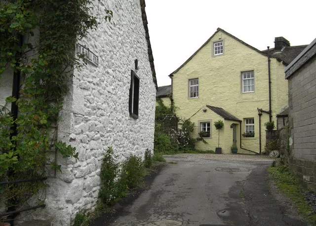
© michael ely · Geograph · CC BY-SA 2.0
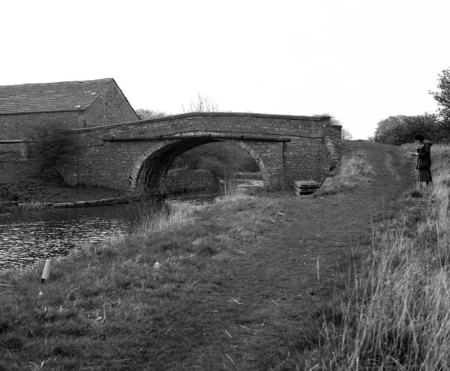
© Dr Neil Clifton · Geograph · CC BY-SA 2.0
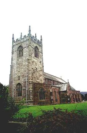
© Bill Henderson · Geograph · CC BY-SA 2.0
Images © their respective photographers, licensed under CC BY-SA 2.0 and reused here with attribution. Photographs depict listed buildings, churches and monuments near this settlement and may show neighbouring villages.
Data derived from the Open Domesday project (opendomesday.org), based on the Domesday Book dataset compiled by Professor J.J.N. Palmer and team. The Domesday Book (1086) is in the public domain.
Found an inaccuracy? [email protected]