Garforth in the Domesday Book (1086)
Garforth is named in the Domesday Book, compiled by Norman commissioners in 1086, entered under the hundred of Skyrack in Yorkshire.
Other Settlements in Skyrack
- Adel
- Allerton [Bywater]
- Alwoodley
- Arthington
- Austhorpe
- Baildon
- Bardsey
- Barwick [in Elmet]
- Bichertun
- Bicherun
- Bingley
- Birkby [Hill]
- Bramhope
- Burden [Head]
The Meaning of the Name
The name Garforth is of Anglo-Saxon origin. Its final element derives from the Old English word ford, a river crossing. The first element is most likely a personal name or an early descriptive term, now difficult to recover with certainty. Taken together the name probably meant something close to ‘a ford’.
Remarkably, the name has changed little since 1086, when the Domesday scribes wrote it as Garforth.
Listed Buildings Near Garforth
Historic England records 6 listed buildings within about a mile of Garforth. Listing protects structures of special architectural or historic interest, graded I (exceptional), II* (particularly important) and II.
Grade II
- Aberford Road Bridge, HUL4/18 - 0.17 km
- Footbridge at Garforth Station - 0.18 km
- Milepost at Se 412 335 - 0.27 km
- Bridge Carrying Leeds Selby Railway Line Over Road - 0.36 km
- Church of St Mary the Blessed Virgin - 0.55 km
- Milepost at Se 394 329 - 1.3 km
Garforth Today
Today Garforth lies within the administrative area of Leeds, and the settlement recorded a population of 19,811 at recent figures. Nine and a half centuries separate that figure from the small rural community the Domesday survey recorded here in 1086.
Read more about modern Garforth on Wikipedia .
Nearby Domesday Settlements
Other places recorded in the 1086 survey within a few miles:
- Sturton Grange - 2.0 km E
- Shippen House - 2.2 km NW
- Austhorpe - 3.0 km W
- Kippax - 3.2 km S
- Parlington - 3.6 km NE
- Great and Little Preston - 3.6 km SW
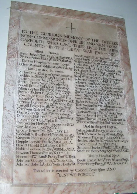
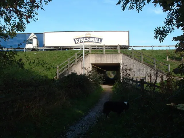
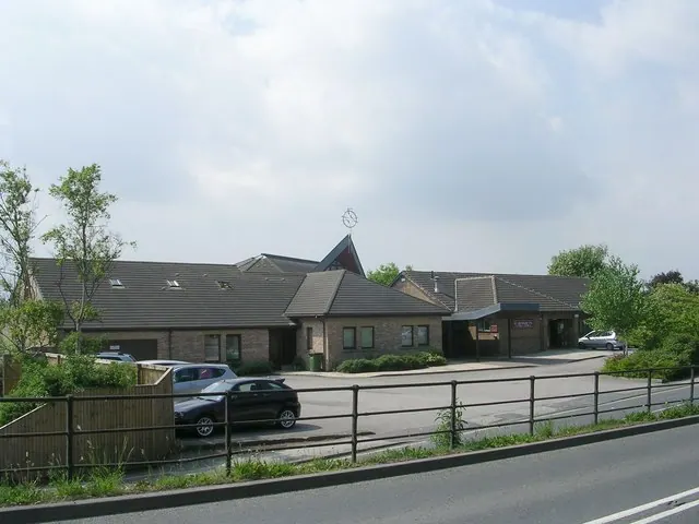
Heritage Around Garforth
Photographs of churches, listed buildings and monuments in the vicinity, contributed by volunteers to the Geograph project and reused here under a Creative Commons licence.
© John Readman · Geograph · CC BY-SA 2.0
© vernon wood · Geograph · CC BY-SA 2.0
© Betty Longbottom · Geograph · CC BY-SA 2.0
Images © their respective photographers, licensed under CC BY-SA 2.0 and reused here with attribution. Photographs depict listed buildings, churches and monuments near this settlement and may show neighbouring villages.
Data derived from the Open Domesday project (opendomesday.org), based on the Domesday Book dataset compiled by Professor J.J.N. Palmer and team. The Domesday Book (1086) is in the public domain.
Found an inaccuracy? [email protected]