Fordbottle in the Domesday Book (1086)
Fordbottle appears in the Domesday Book of 1086, entered under the hundred of Amounderness in Yorkshire.
Other Settlements in Amounderness
- Aighton
- Aldcliffe
- Aldingham
- Arkholme
- Aschebi
- Ashton [Hall]
- Ashton [on Ribble]
- Austwick
- Barbon
- Bardsea
- Bare
- Barnoldswick
- Barton
- Beetham
The Meaning of the Name
The origin of the name Fordbottle is not securely established from its modern form alone; like many settlement names in the North it likely combines an Old English or Old Norse personal name with a landscape term.
Remarkably, the name has changed little since 1086, when the Domesday scribes wrote it as Fordbottle.
Listed Buildings Near Fordbottle
Historic England records 14 listed buildings within about a mile of Fordbottle. Listing protects structures of special architectural or historic interest, graded I (exceptional), II* (particularly important) and II.
Grade I
- Furness Abbey Wall - 1.2 km
Grade II*
- Park House Farmhouse - 0.6 km
Grade II
- Cow House and Barn With Attached Horse Engine House North East of Crofters Public House - 0.49 km
- Former Cow House and Attached Shelter Shed Immediately North of Crofters Public House - 0.52 km
- Group of 3 Former Pigsties and Midden Wall at Crofters Public House - 0.53 km
- Crofters Public House - 0.55 km
- Wall Enclosing Garden to Front and South Side of Crofters Public House - 0.57 km
- Entrance Gateways to Glenfield House Including Attached Side Gate to Rose Cottage - 0.64 km
- Rose Cottage - 0.64 km
- Glenfield House - 0.65 km
- Former Mine Building Immediately to North of Glenfield House - 0.68 km
- Engine House at Ngr Sd 2325 7080 to North East of Glenfield House - 0.75 km
- Barn on Roadside to North West of Stank Farmhouse - 0.79 km
- Stank Farmhouse and Attached Farm Buildings - 0.8 km
Scheduled Monuments Near Fordbottle
Scheduled monuments are nationally important archaeological sites given legal protection. 2 lie within roughly a mile of Fordbottle:
- Bow Bridge medieval multi-span bridge - 1.02 km
- Furness Abbey Savignac and Cistercian monasteries: precinct wall, great gatehouse, ‘chapel outside the gates’, south west gateway and earthworks. - 1.48 km
Nearby Domesday Settlements
Other places recorded in the 1086 survey within a few miles:
Heritage Around Fordbottle
Photographs of churches, listed buildings and monuments in the vicinity, contributed by volunteers to the Geograph project and reused here under a Creative Commons licence.
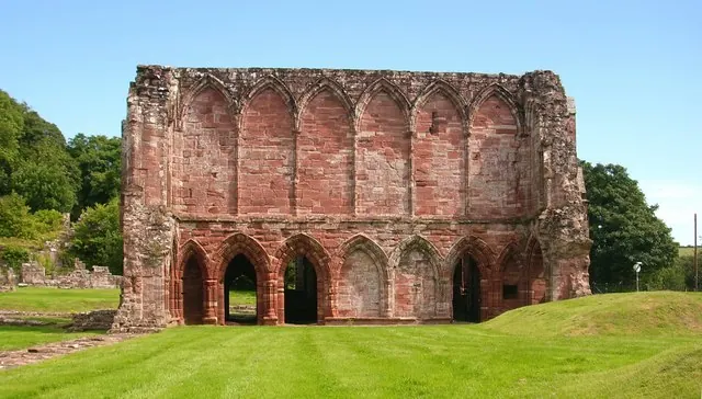
© Stephen Middlemiss · Geograph · CC BY-SA 2.0
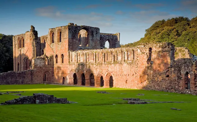
© George Hopkins · Geograph · CC BY-SA 2.0
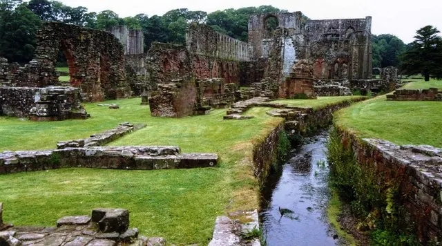
© David Gearing · Geograph · CC BY-SA 2.0
Images © their respective photographers, licensed under CC BY-SA 2.0 and reused here with attribution. Photographs depict listed buildings, churches and monuments near this settlement and may show neighbouring villages.
Data derived from the Open Domesday project (opendomesday.org), based on the Domesday Book dataset compiled by Professor J.J.N. Palmer and team. The Domesday Book (1086) is in the public domain.
Found an inaccuracy? [email protected]