Forcett in the Domesday Book (1086)
Forcett appears in the Domesday Book of 1086, entered under the hundred of Land of Count Alan in Yorkshire. The survey assessed Forcett at 29.5 carucates of taxable land.
At the time of the survey, Forcett supported a recorded population of 26 villagers, 13 smallholders, 6 slaves, working 22 ploughs between them.
The numbers record a sharp fall. Before 1066, Forcett was worth 20 shillings; by 1086 that had dropped to 14.25 shillings – a fall of 28%. Most Yorkshire villages that lost value on this scale were swept up in the Harrying of the North – William’s scorched-earth campaign of 1069–70.
The survey lists 3 manors at Forcett under different lords. Splitting a single settlement between multiple tenants was common across the North – Saxon estates broken up and handed to William’s followers after 1066.
Resources Recorded at Forcett (1086)
- Meadow: 2 ploughs
- Woodland: 105 pigs
Other Settlements in Land of Count Alan
- Achebi
- Agglethorpe
- Ainderby [Mires]
- Ainderby [Quernhow]
- Aiskew
- Aldbrough
- Allerthorpe [Hall]
- Ascam
- Ascham
- Asebi
- Aske [Hall]
- Askrigg
- Aysgarth
- Baldersby
The Meaning of the Name
The origin of the name Forcett is not securely established from its modern form alone; like many settlement names in the North it likely combines an Old English or Old Norse personal name with a landscape term.
Remarkably, the name has changed little since 1086, when the Domesday scribes wrote it as Forcett.
Listed Buildings Near Forcett
Historic England records 25 listed buildings within about a mile of Forcett. Listing protects structures of special architectural or historic interest, graded I (exceptional), II* (particularly important) and II.
Grade I
- Forcett Hall - 0.4 km
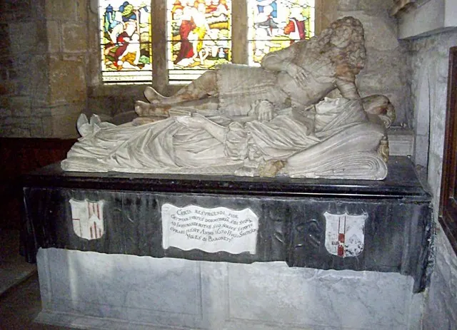
- Church of St John the Baptist - 1.04 km
Grade II*
- Dovecote - 0.13 km
- East Gateway and Lodges - 0.2 km
- Stable Block to East of Forcett Hall - 0.34 km
- Grotto and Icehouse - 0.69 km
Grade II
- Sundial in Centre of Walled Kitchen Garden - 0.21 km
- Garden Walls With Gates and Garden House - 0.23 km
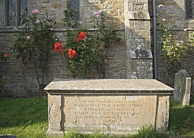
- Church of St Cuthbert - 0.24 km
- Walker tombstone approximately 4 metres south-east of south-east corner of nave of Church of St Cuthbert - 0.25 km
- Two Panelled Chest Tombs Approximately Three Metres South of East End of Chancel of Church of St Cuthbert - 0.25 km
- Ambrose Pierson Panelled Chest Tomb Approximately Six Metres South of Nave of Church of St Cuthbert - 0.25 km
- The Kennels - 0.44 km
- North Gateway - 0.69 km
- Village Farmhouse - 0.95 km
- Deer Shelter - 0.95 km
- Well Approximately One Hundred and Fifty Metres North North East St John the Baptist* - 1.0 km
- Four Tombstones in A Line Approximately Five Metres South of South West Corner of South Aisle of Church of St John the Baptist - 1.03 km
- Saxon Cross-shaft Approximately 3 Metres South of Chancel of Church of St John the Baptist - 1.05 km
- Newcomb Memorial Approximately Seven Metres South of Porch of Church of St John the Baptist * - 1.05 km
- Group of Four Tombstones Approximately Two Metres East of Porch of Church of St John Baptist - 1.05 km
- Slater Memorial Approximately Six Metres South of Porch of Church of St John the Baptist - 1.05 km
- Well Approximately One Hundred Metres North East East of Church of St John the Baptist - 1.09 km
- Kirk Bridge - 1.09 km
…and 1 more listed structures in the area.
Scheduled Monuments Near Forcett
Scheduled monuments are nationally important archaeological sites given legal protection. 1 lies within roughly a mile of Forcett:
Forcett Today
Today Forcett lies within the administrative area of Richmondshire, and the settlement recorded a population of 92 at the 2021 census. Nine and a half centuries separate that figure from the small rural community the Domesday survey recorded here in 1086.
Read more about modern Forcett on Wikipedia .
Nearby Domesday Settlements
Other places recorded in the 1086 survey within a few miles:
Heritage Around Forcett
Photographs of churches, listed buildings and monuments in the vicinity, contributed by volunteers to the Geograph project and reused here under a Creative Commons licence.

© Hugh Mortimer · Geograph · CC BY-SA 2.0
© Stanley Howe · Geograph · CC BY-SA 2.0
© Stanley Howe · Geograph · CC BY-SA 2.0
Images © their respective photographers, licensed under CC BY-SA 2.0 and reused here with attribution. Photographs depict listed buildings, churches and monuments near this settlement and may show neighbouring villages.
Location
54.5074°N, -1.7297°W · Land of Count Alan hundred, Yorkshire
View larger map on OpenStreetMap →Data derived from the Open Domesday project (opendomesday.org), based on the Domesday Book dataset compiled by Professor J.J.N. Palmer and team. The Domesday Book (1086) is in the public domain.
Found an inaccuracy? [email protected]