Flowergate in the Domesday Book (1086)
Flowergate is named in the Domesday Book, compiled by Norman commissioners in 1086, entered under the hundred of Langbaurgh in Yorkshire. The survey assessed Flowergate at 3 carucates of taxable land.
At the time of the survey, Flowergate supported a recorded population of 24 villagers, 8 smallholders, working 11 ploughs between them.
By 1086 Flowergate was worth 12 shillings, up from 11 shillings before the Conquest – in contrast to many Yorkshire neighbours whose valuations collapsed.
Resources Recorded at Flowergate (1086)
- Mills: 2 mills (valued at 1 shilling)
- Meadow: 24 acres
Other Settlements in Langbaurgh
- Acklam
- Airy [Holme]
- Aislaby
- Arnodestorp
- Baldebi
- Barnaby
- Barwick
- Battersby
- Bergolbi
- Berguluesbi
- Blaten [Carr]
- Borrowby
- Breck
- Brotton
The Meaning of the Name
The origin of the name Flowergate is not securely established from its modern form alone; like many settlement names in the North it likely combines an Old English or Old Norse personal name with a landscape term.
Remarkably, the name has changed little since 1086, when the Domesday scribes wrote it as Flowergate.
Listed Buildings Near Flowergate
Historic England records 417 listed buildings within about a mile of Flowergate. Listing protects structures of special architectural or historic interest, graded I (exceptional), II* (particularly important) and II.
Grade II*
- Church of St Hilda - 0.27 km
Grade II
- Statue of Captain Cook - 0.13 km
- Royal Hotel - 0.15 km
- Kirbys Hotel and Numbers 5 and 6 East Parade - 0.19 km
- Area Railings to Kirbys Hotel and Numbers 5 and 6 - 0.2 km
- 2 Customs Look Outs - 0.24 km
- 17 and 18, The Cragg - 0.25 km
- 34, the Cragg - 0.26 km
- 23, Pier Road - 0.26 km
- 10-13, the Cragg - 0.27 km
- West Pier - 0.28 km
- 14, Pier Road - 0.28 km
- 15 and 16, Pier Road - 0.28 km
- 1, Cliff Street - 0.32 km
- 2, Mission Hall Yard - 0.32 km
- 41 and 43, Skinner Street - 0.32 km
- Edwardian Shelter 15 Metres East of Cliff Lift - 0.32 km
- 4, Cliff Street - 0.33 km
- 1, Mission Hall Yard - 0.33 km
- 4, Pier Lane - 0.33 km
- 4, Pier Road - 0.33 km
- Pier Hotel - 0.33 km
- Whitby Conservative Club - 0.33 km
- 19, Wellclose Square - 0.33 km
…and 393 more listed structures in the area.
Scheduled Monuments Near Flowergate
Scheduled monuments are nationally important archaeological sites given legal protection. 2 lie within roughly a mile of Flowergate:
- Whitby Abbey: Saxon double-house, post-Conquest Benedictine monastery, C17 manor house and C14 cross. - 0.75 km
- The Wishing Chair Cross cross base at junction of Stakesby Road and Westbourne Road - 1.22 km
Flowergate Today
Today Flowergate lies within the administrative area of North Yorkshire, and the settlement recorded a population of 13,130 at the 2021 census. Nine and a half centuries separate that figure from the small rural community the Domesday survey recorded here in 1086.
Read more about modern Whitby on Wikipedia .
Nearby Domesday Settlements
Other places recorded in the 1086 survey within a few miles:
Heritage Around Flower[gate]
Photographs of churches, listed buildings and monuments in the vicinity, contributed by volunteers to the Geograph project and reused here under a Creative Commons licence.
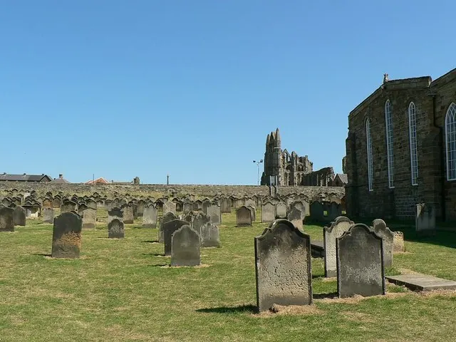
© Rich Tea · Geograph · CC BY-SA 2.0
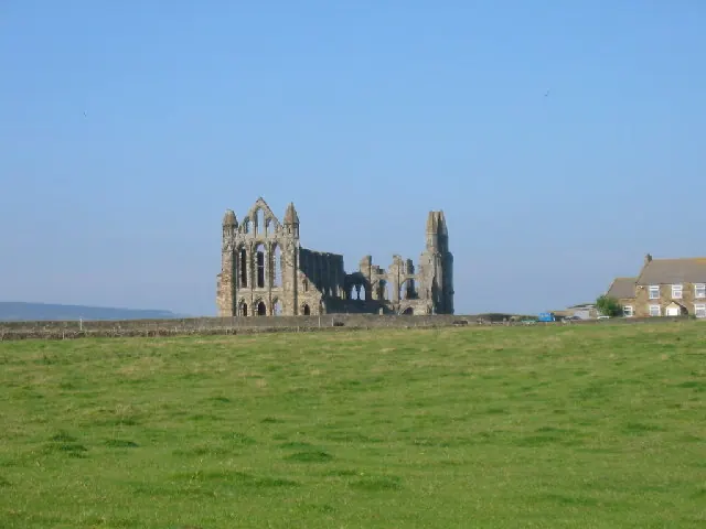
© Colin Westley · Geograph · CC BY-SA 2.0
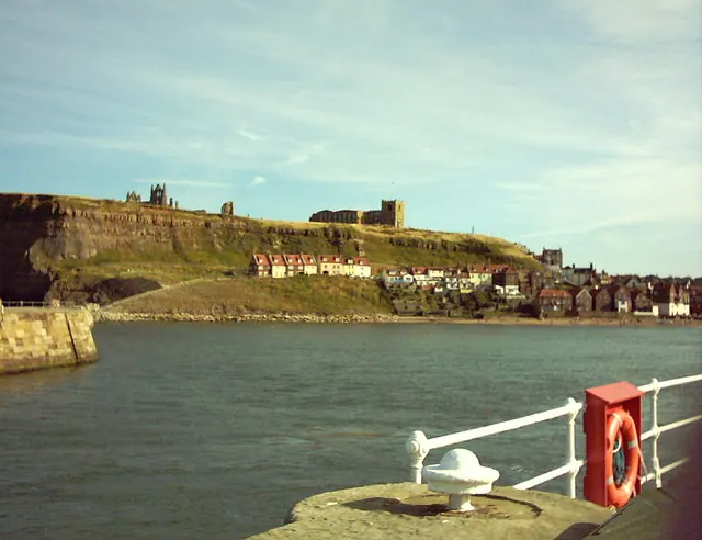
© Bill Turnpenny · Geograph · CC BY-SA 2.0
Images © their respective photographers, licensed under CC BY-SA 2.0 and reused here with attribution. Photographs depict listed buildings, churches and monuments near this settlement and may show neighbouring villages.
Data derived from the Open Domesday project (opendomesday.org), based on the Domesday Book dataset compiled by Professor J.J.N. Palmer and team. The Domesday Book (1086) is in the public domain.
Found an inaccuracy? [email protected]