Farnhill in the Domesday Book (1086)
Farnhill appears in the Domesday Book of 1086, entered under the hundred of Craven in Yorkshire.
Other Settlements in Craven
- Addingham
- Airton
- Anley
- Appletreewick
- Arncliffe
- Arnford
- Barnoldswick
- Bashall [Eaves]
- Battersby [Barn]
- Beamsley
- Birkby [Hall]
- Bogeuurde
- Bolton [Abbey]
- Bolton [by Bowland]
The Meaning of the Name
The origin of the name Farnhill is not securely established from its modern form alone; like many settlement names in the North it likely combines an Old English or Old Norse personal name with a landscape term.
Remarkably, the name has changed little since 1086, when the Domesday scribes wrote it as Farnhill.
Listed Buildings Near Farnhill
Historic England records 33 listed buildings within about a mile of Farnhill. Listing protects structures of special architectural or historic interest, graded I (exceptional), II* (particularly important) and II.
Grade I
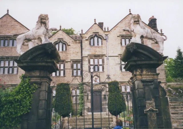
- Farnhill Hall - 0.27 km
- Church of St Andrew - 0.8 km
Grade II*
- Kildwick Hall With Kitchen Block to Rear - 0.61 km
Grade II
- Milestone at Junction of Main Street and Grange Road - 0.18 km
- Barn at Farnhill Hall Farm - 0.22 km
- Crag Top Farmhouse - 0.42 km
- Leeds and Liverpool Canal Farnhill Bridge 183A at Se0020 4663 - 0.44 km
- Stonegate Cottage - 0.49 km
- Milestone 300 M North of Farnhill Bridge, on A629 - 0.57 km
- The Old Barn and the Cottage - 0.58 km
- The Justice Room Approximately 5 Metres South of Kildwick Hall - 0.6 km
- Two Urns at Base of Steps in Courtyard at Kildwick Hall - 0.6 km
- Garden Wall, Gatepiers and Urns Fronting Kildwick Hall - 0.61 km
- Walls Enclosing Garden and Lower Terrace, With North Gate Piers, South Gate Piers and Steps - 0.62 km
- Buddhist Shrine in Garden Approximately 10 Metres to East of Kildwick Hall - 0.63 km
- Buddhist Shrine in Garden Approximately 20 Metres to East of Kildwick Hall - 0.64 km
- Buddhist Shrine in Garden Approximately 30 Metres to East of Kildwick Hall - 0.65 km
- 15, 17 and 19, Newby Road - 0.66 km
- Buddhist Shrine in Garden Approximately 40 Metres to South East of Kildwick Hall - 0.66 km
- The Mullions - 0.67 km
- Pavilion Approximately 50 Metres South East of Kildwick Hall - 0.67 km
- Aqueduct on Leeds and Liverpool Canal - 0.68 km
- Parsons Bridge Over Leeds-liverpool Canal - 0.75 km
- Gates, Overthrow and Gate Piers Approximately 20 Metres West of Church of St Andrew - 0.76 km
…and 9 more listed structures in the area.
Scheduled Monuments Near Farnhill
Scheduled monuments are nationally important archaeological sites given legal protection. 3 lie within roughly a mile of Farnhill:
- Kildwick Bridge - 0.93 km
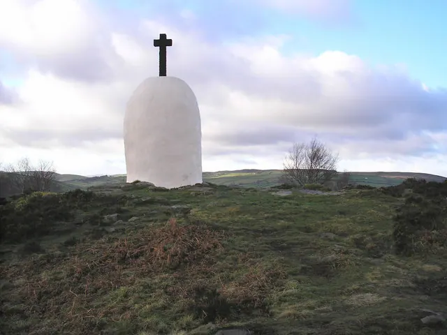
- Black Hill round cairn - 1.09 km
- Long barrow and superimposed round cairn on Black Hill - 1.14 km
Farnhill Today
Today Farnhill lies within the administrative area of Craven, and the settlement recorded a population of 476 at the 2021 census. Nine and a half centuries separate that figure from the small rural community the Domesday survey recorded here in 1086.
Read more about modern Farnhill on Wikipedia .
Nearby Domesday Settlements
Other places recorded in the 1086 survey within a few miles:
Heritage Around Farnhill
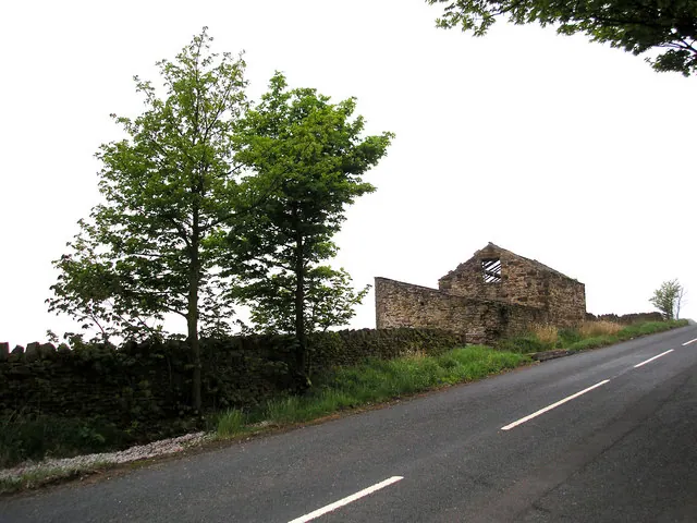
Photographs of churches, listed buildings and monuments in the vicinity, contributed by volunteers to the Geograph project and reused here under a Creative Commons licence.
© Dr Neil Clifton · Geograph · CC BY-SA 2.0
© Stephen Craven · Geograph · CC BY-SA 2.0
© John Illingworth · Geograph · CC BY-SA 2.0
Images © their respective photographers, licensed under CC BY-SA 2.0 and reused here with attribution. Photographs depict listed buildings, churches and monuments near this settlement and may show neighbouring villages.
Data derived from the Open Domesday project (opendomesday.org), based on the Domesday Book dataset compiled by Professor J.J.N. Palmer and team. The Domesday Book (1086) is in the public domain.
Found an inaccuracy? [email protected]