Farleton in the Domesday Book (1086)
The 1086 Domesday survey records the settlement of Farleton, entered under the hundred of Amounderness in Yorkshire. The survey assessed Farleton at 20 carucates of taxable land.
At the time of the survey, Farleton supported a recorded population of 18 villagers, 12 smallholders, 6 slaves, working 11 ploughs between them.
The survey records Farleton’s value at 19 shillings in 1086. No pre-Conquest figure survives – not unusual in the North, where records were disrupted by the Harrying and by the patchy coverage of the survey.
Resources Recorded at Farleton (1086)
- Mills: 1 mill (valued at 1d)
- Cattle: 4
- Pigs: 15
- Sheep: 340
- Horses (cobs): 1
- Meadow: 53 acres
- Woodland: 90 acres
Other Settlements in Amounderness
- Aighton
- Aldcliffe
- Aldingham
- Arkholme
- Aschebi
- Ashton [Hall]
- Ashton [on Ribble]
- Austwick
- Barbon
- Bardsea
- Bare
- Barnoldswick
- Barton
- Beetham
The Meaning of the Name
The name Farleton is of Anglo-Saxon origin. Its final element derives from the Old English word tūn, a farmstead or village. The first element is most likely a personal name or an early descriptive term, now difficult to recover with certainty. Taken together the name probably meant something close to ‘a farmstead’.
Remarkably, the name has changed little since 1086, when the Domesday scribes wrote it as Farleton.
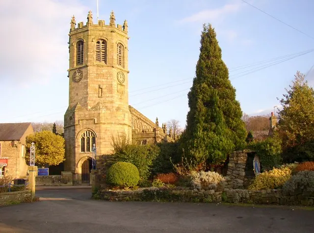
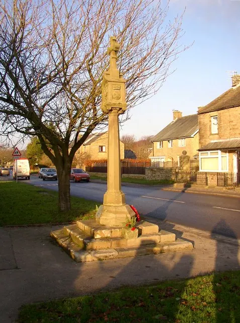
Listed Buildings Near Farleton
Historic England records 18 listed buildings within about a mile of Farleton. Listing protects structures of special architectural or historic interest, graded I (exceptional), II* (particularly important) and II.
Grade II
- Toll House - 0.1 km
- Milestone - 0.12 km
- Cross Base West of Turning to Farleton - 0.3 km
- Camp House Farmhouse - 0.32 km
- Farleton Farmhouse - 0.45 km
- Police Station - 1.14 km
- No 11 and Garage Adjoining to South - 1.17 km
- Drinking Fountain Adjoining No.2 (Lambs’ Garage) - 1.19 km
- Cross Base at Butt Yeats - 1.21 km
- 11 and 13, Main Street - 1.22 km
- Mossmire House and 21 Main Street - 1.24 km
- Shaw House - 1.24 km
- Yew Tree Cottage - 1.24 km
- Nos 26 and 28 (National Westminster Bank) and no 30 (Riverside Cottage) - 1.27 km
- Hornby Village Institute - 1.27 km
- Sandbeds Farmhouse - 1.28 km
- The Old Rectory - 1.28 km
- Hornby Bridge - 1.3 km
Scheduled Monuments Near Farleton
Scheduled monuments are nationally important archaeological sites given legal protection. 3 lie within roughly a mile of Farleton:
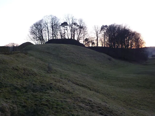
- Camp House moated site, moated outwork and connecting channels - 0.4 km
- Univallate prehistoric defended enclosure, hollow way and secondary enclosure 250m north of Claughton Hall - 1.19 km
- Hornby Bridge - 1.3 km
Farleton Today
Today Farleton lies within the administrative area of Hornby-with-Farleton.
Read more about modern Farleton on Wikipedia .
Nearby Domesday Settlements
Other places recorded in the 1086 survey within a few miles:
- Hornby - 1.4 km NE
- Claughton - 1.4 km SW
- Gressingham - 2.0 km N
- Tatham - 3.6 km NE
- Melling - 4.5 km NE
- Wennington - 5.0 km NE
Heritage Around Farleton
Photographs of churches, listed buildings and monuments in the vicinity, contributed by volunteers to the Geograph project and reused here under a Creative Commons licence.
© Karl and Ali · Geograph · CC BY-SA 2.0
© Humphrey Bolton · Geograph · CC BY-SA 2.0
© Humphrey Bolton · Geograph · CC BY-SA 2.0
Images © their respective photographers, licensed under CC BY-SA 2.0 and reused here with attribution. Photographs depict listed buildings, churches and monuments near this settlement and may show neighbouring villages.
Data derived from the Open Domesday project (opendomesday.org), based on the Domesday Book dataset compiled by Professor J.J.N. Palmer and team. The Domesday Book (1086) is in the public domain.
Found an inaccuracy? [email protected]