Eyam in the Domesday Book (1086)
The 1086 Domesday survey records the settlement of Eyam, entered under the hundred of Blackwell in Derbyshire.
Other Settlements in Blackwell
- Abney
- Ashford [-in-the-Water]
- Aston
- Bakewell
- Bamford
- Baslow
- Beeley
- Birchills
- Birchover
- Blackwell
- Bradwell
- Bubnell
- Burley
- Burton
The Meaning of the Name
The origin of the name Eyam is not securely established from its modern form alone; like many settlement names in the North it likely combines an Old English or Old Norse personal name with a landscape term.
Remarkably, the name has changed little since 1086, when the Domesday scribes wrote it as Eyam.
Listed Buildings Near Eyam
Historic England records 55 listed buildings within about a mile of Eyam. Listing protects structures of special architectural or historic interest, graded I (exceptional), II* (particularly important) and II.
Grade I
Grade II*
- Eyam Hall - 0.06 km
- Church of St Lawrence - 0.18 km
Grade II
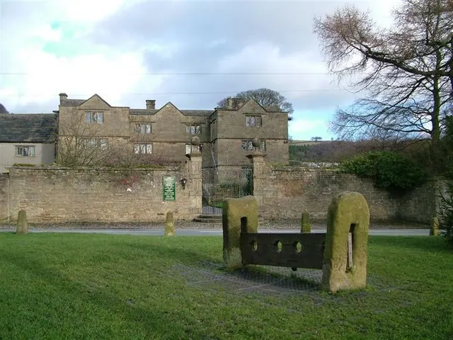
- Village Stocks - 0.03 km
- Outbuilding to South West of Eyam Hall - 0.03 km
- Gates and Attached Walls and Terrace to South of Eyam Hall - 0.04 km
- Barn to West of Eyam Hall - 0.04 km
- The Brick House and Railings - 0.05 km
- Barn North West of Eyam Hall - 0.06 km
- Walls, Gatepiers and Water Troughs to East of Eyam Hall - 0.08 km
- Hall Farmhouse - 0.08 km
- Garden House and Attached Garden Walls to Eyam Hall - 0.1 km
- Delf View and Attached Stables - 0.11 km
- Laburnum Cottage - 0.11 km
- Plague Cottage and Rose Cottage - 0.12 km
- Barn to North West of Coach House - 0.13 km
- Plague Cottage - 0.14 km
- 2 and 3, Church Avenue - 0.14 km
- 1, Church Avenue - 0.14 km
- Bagshaw House and Attached Outbuildings - 0.15 km
- Aughton House - 0.17 km
- Churchyard Tomb 7 Metres South of Church Porch - 0.19 km
- Edge Lea - 0.2 km
- Tomb of Catherine Mompesson, 7 metres East of Church Porch - 0.2 km
…and 31 more listed structures in the area.
Scheduled Monuments Near Eyam
Scheduled monuments are nationally important archaeological sites given legal protection. 2 lie within roughly a mile of Eyam:
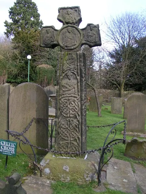
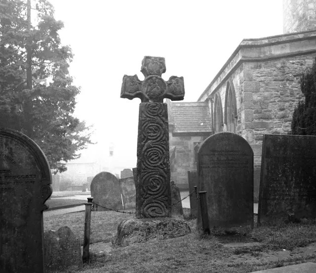
- Anglian high cross in St Laurence’s churchyard - 0.19 km
- Little Pasture Mine - 1.19 km
Eyam Today
Today Eyam lies within the administrative area of Derbyshire Dales, and the settlement recorded a population of 971 at the 2021 census. Nine and a half centuries separate that figure from the small rural community the Domesday survey recorded here in 1086.
Read more about modern Eyam on Wikipedia .
Nearby Domesday Settlements
Other places recorded in the 1086 survey within a few miles:
Heritage Around Eyam
Photographs of churches, listed buildings and monuments in the vicinity, contributed by volunteers to the Geograph project and reused here under a Creative Commons licence.
© Stephen G Taylor · Geograph · CC BY-SA 2.0
© Dave Dunford · Geograph · CC BY-SA 2.0
© Dr Neil Clifton · Geograph · CC BY-SA 2.0
Images © their respective photographers, licensed under CC BY-SA 2.0 and reused here with attribution. Photographs depict listed buildings, churches and monuments near this settlement and may show neighbouring villages.
Data derived from the Open Domesday project (opendomesday.org), based on the Domesday Book dataset compiled by Professor J.J.N. Palmer and team. The Domesday Book (1086) is in the public domain.
Found an inaccuracy? [email protected]