Elton in the Domesday Book (1086)
Elton is named in the Domesday Book, compiled by Norman commissioners in 1086, entered under the hundred of Ruloe in Cheshire.
Other Settlements in Ruloe
- Aldredelie
- Alvanley
- Conersley
- Done
- Dunham [on the Hill]
- Eddisbury
- Frodsham
- Hartford
- Helsby
- Ince
- Kingsley
- Manley
- Thornton [le Moors]
- Weaverham
The Meaning of the Name
The name Elton is of Anglo-Saxon origin. Its final element derives from the Old English word tūn, a farmstead or village. The first element is most likely a personal name or an early descriptive term, now difficult to recover with certainty. Taken together the name probably meant something close to ‘a farmstead’.
Remarkably, the name has changed little since 1086, when the Domesday scribes wrote it as Elton.
Listed Buildings Near Elton
Historic England records 23 listed buildings within about a mile of Elton. Listing protects structures of special architectural or historic interest, graded I (exceptional), II* (particularly important) and II.
Grade I
Grade II*
- Rock Farmhouse - 0.26 km
- Church of St James - 1.07 km
Grade II
- K6 Telephone Kiosk - 0.21 km
- Cross Cottage - 0.22 km
- Laurels Farmhouse - 0.23 km
- Farmbuildings at Laurel Farm - 0.24 km
- Barn, Now Workshops - 0.26 km
- Building 50 at Thornton Aero Engine Research Laboratory - 0.7 km
- Shippon at Lower Green Farm on East Side of Farmyard - 1.05 km
- Lower Green Farmhouse With Wall to Front Garden - 1.08 km
- Churchyard Wall at St James’ Church - 1.09 km
- Outbuilding Attached to South End of Village Green Farm Facing the Square - 1.1 km
- Lamp Post in Churchyard by North Gate - 1.11 km
- Coronation Lamp Post and Lantern - 1.13 km
- K6 Telephone Kiosk - 1.14 km
- 1, 2 and 3 With Attached Front Garden Walls - 1.14 km
- Portion of Boundary Wall Between Junction of Kinsey’s Lane With Pool Lane and Park Cottages - 1.15 km
- 7, 8 and 9, the Square - 1.15 km
- Portion of Boundary Wall Between the Square and Entrance to the Manor House - 1.18 km
- Park Cottages - 1.21 km
- Stocks Adjacent to Ince Manor House - 1.22 km
- Farm Buildings Abutting Manor Houses to South East - 1.24 km
Scheduled Monuments Near Elton
Scheduled monuments are nationally important archaeological sites given legal protection. 2 lie within roughly a mile of Elton:
- Moated site, fishpond and connnecting channel, Elton - 0.65 km
- Ince Manor monastic grange and fishpond - 1.25 km
Elton Today
Today Elton lies within the administrative area of Cheshire West and Chester, and the settlement recorded a population of 3,519 at the 2021 census. Nine and a half centuries separate that figure from the small rural community the Domesday survey recorded here in 1086.
Read more about modern Elton on Wikipedia .
Nearby Domesday Settlements
Other places recorded in the 1086 survey within a few miles:
- Ince - 1.4 km NW
- Thornton le Moors - 1.4 km SW
- Helsby - 3.0 km E
- Wimbolds Trafford - 3.2 km S
- Dunham on the Hill - 3.6 km SE
- Bridge Trafford - 4.0 km S
Heritage Around Elton
Photographs of churches, listed buildings and monuments in the vicinity, contributed by volunteers to the Geograph project and reused here under a Creative Commons licence.
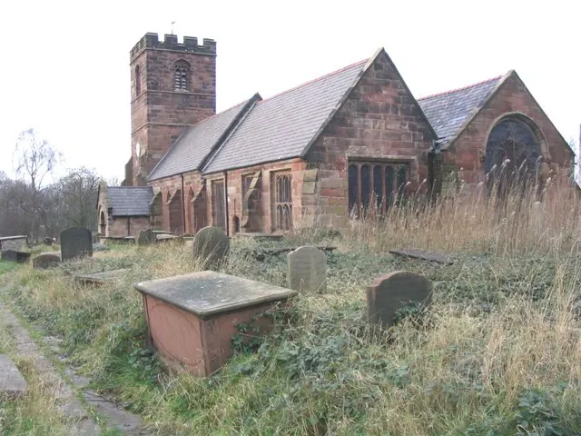
© John Lord · Geograph · CC BY-SA 2.0
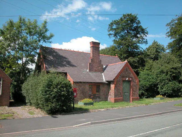
© Dennis Turner · Geograph · CC BY-SA 2.0
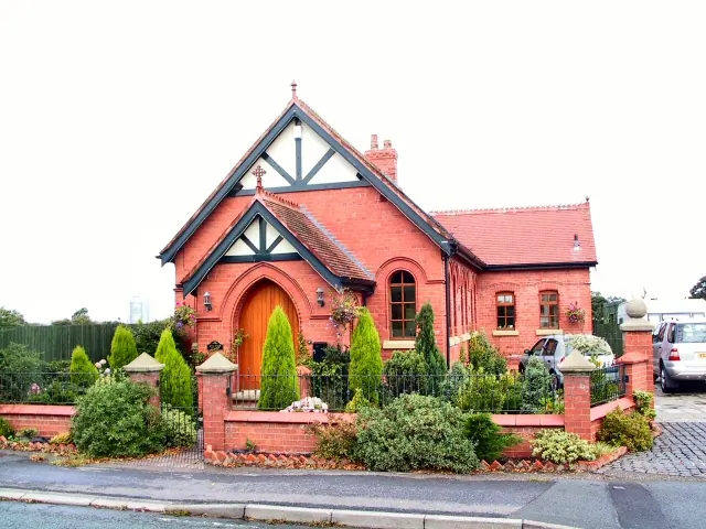
© Roger May · Geograph · CC BY-SA 2.0
Images © their respective photographers, licensed under CC BY-SA 2.0 and reused here with attribution. Photographs depict listed buildings, churches and monuments near this settlement and may show neighbouring villages.
Data derived from the Open Domesday project (opendomesday.org), based on the Domesday Book dataset compiled by Professor J.J.N. Palmer and team. The Domesday Book (1086) is in the public domain.
Found an inaccuracy? [email protected]