Elloughton in the Domesday Book (1086)
Elloughton is named in the Domesday Book, compiled by Norman commissioners in 1086, entered under the hundred of Welton in Yorkshire.
Other Settlements in Welton
- Bentley
- Brantingham
- Brantingham [Thorpe]
- Cottingham
- Ellerker
- Lund
- Pillwoods [Farm]
- Risby
- Skidby
- Toschetorp
- Walkington
- Wauldby
- Welton
- [Little] Weighton
The Meaning of the Name
The name Elloughton is of Anglo-Saxon origin. Its final element derives from the Old English word tūn, a farmstead or village. The first element is most likely a personal name or an early descriptive term, now difficult to recover with certainty. Taken together the name probably meant something close to ‘a farmstead’.
Remarkably, the name has changed little since 1086, when the Domesday scribes wrote it as Elloughton.
Listed Buildings Near Elloughton
Historic England records 13 listed buildings within about a mile of Elloughton. Listing protects structures of special architectural or historic interest, graded I (exceptional), II* (particularly important) and II.
Grade II*
- Church of St Mary - 0.29 km
Grade II
- 35, Church Lane - 0.28 km
- Manor House - 0.3 km
- Cross-base About 25 Metres South of Church of Saint Mary - 0.31 km
- Church Farmhouse - 0.31 km
- Elloughton Garth - 0.54 km
- Outbuilding at Elloughton Garth - 0.57 km
- Gateway and garden walls at Brantinghamthorpe - 0.68 km
- Brantinghamthorpe - 0.69 km
- Number 4 and Attached Outbuilding - 0.83 km
- Castle House - 0.86 km
- War Memorial and Screen Wall - 1.1 km
- Rose Cottage - 1.29 km
Scheduled Monuments Near Elloughton
Scheduled monuments are nationally important archaeological sites given legal protection. 1 lies within roughly a mile of Elloughton:
Elloughton Today
Today Elloughton lies within the administrative area of Elloughton-cum-Brough.
Read more about modern Elloughton on Wikipedia .
Nearby Domesday Settlements
Other places recorded in the 1086 survey within a few miles:
- Brantingham - 1.0 km N
- Brantingham Thorpe - 1.0 km N
- Toschetorp - 1.0 km N
- Welton - 1.4 km SE
- Wauldby - 2.2 km NE
- Ellerker - 2.2 km NW
Heritage Around Elloughton
Photographs of churches, listed buildings and monuments in the vicinity, contributed by volunteers to the Geograph project and reused here under a Creative Commons licence.
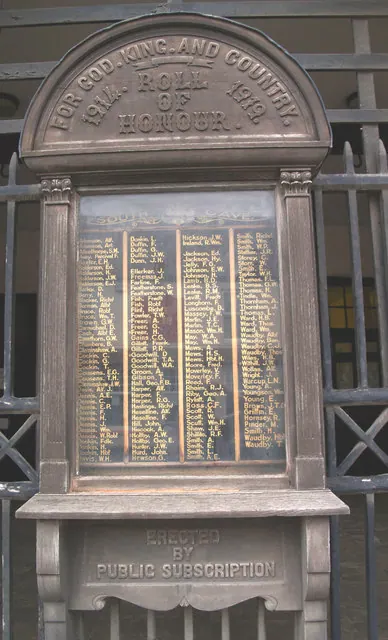
© David Wright · Geograph · CC BY-SA 2.0
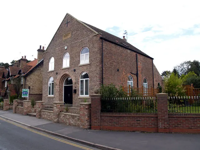
© David Wright · Geograph · CC BY-SA 2.0
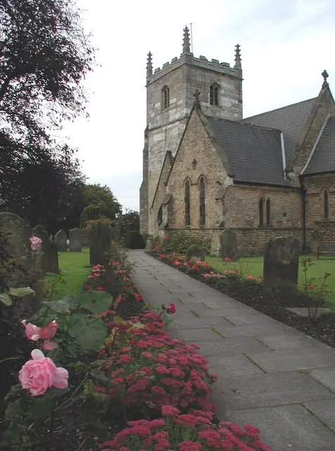
© Paul Glazzard · Geograph · CC BY-SA 2.0
Images © their respective photographers, licensed under CC BY-SA 2.0 and reused here with attribution. Photographs depict listed buildings, churches and monuments near this settlement and may show neighbouring villages.
Data derived from the Open Domesday project (opendomesday.org), based on the Domesday Book dataset compiled by Professor J.J.N. Palmer and team. The Domesday Book (1086) is in the public domain.
Found an inaccuracy? [email protected]