Ellerton Abbey in the Domesday Book (1086)
The settlement of Ellerton Abbey is recorded in William I’s Domesday survey of 1086, entered under the hundred of Land of Count Alan in Yorkshire.
Other Settlements in Land of Count Alan
- Achebi
- Agglethorpe
- Ainderby [Mires]
- Ainderby [Quernhow]
- Aiskew
- Aldbrough
- Allerthorpe [Hall]
- Ascam
- Ascham
- Asebi
- Aske [Hall]
- Askrigg
- Aysgarth
- Baldersby
The Meaning of the Name
The name Ellerton Abbey is of Anglo-Saxon origin. Its final element derives from the Old English word tūn, a farmstead or village. The first element is most likely a personal name or an early descriptive term, now difficult to recover with certainty. Taken together the name probably meant something close to ‘a farmstead’.
Remarkably, the name has changed little since 1086, when the Domesday scribes wrote it as Ellerton Abbey.
Listed Buildings Near Ellerton Abbey
Historic England records 6 listed buildings within about a mile of Ellerton Abbey. Listing protects structures of special architectural or historic interest, graded I (exceptional), II* (particularly important) and II.
Grade II*
- Marrick Priory Farmhouse - 0.95 km
Grade II
- Ellerton Abbey - 0.31 km
- Ellerton Priory - 0.35 km
- Swale Farmhouse and Attached Outbuildings - 0.44 km
- Former White Horse Inn - 0.79 km
- Church of St Andrew - 0.94 km
Scheduled Monuments Near Ellerton Abbey
Scheduled monuments are nationally important archaeological sites given legal protection. 2 lie within roughly a mile of Ellerton Abbey:
- Ellerton Priory: a Cistercian nunnery including fishponds, water management system, mill, field systems and Ellerton medieval settlement - 0.39 km
- Marrick Priory: a Benedictine nunnery and later parish church with fishponds, mill mound, ironworks, longhouse, trackways and an Iron-Age house platform - 0.94 km
Ellerton Abbey Today
Today Ellerton Abbey lies within the administrative area of North Yorkshire, and the settlement recorded a population of 21 at the 2021 census. Nine and a half centuries separate that figure from the small rural community the Domesday survey recorded here in 1086.
Read more about modern Ellerton Abbey on Wikipedia .
Nearby Domesday Settlements
Other places recorded in the 1086 survey within a few miles:
- Marrick - 1.0 km N
- Grinton - 3.2 km W
- Fremington - 3.6 km NW
- Downholme - 4.0 km E
- Reeth - 4.5 km NW
- Preston under Scar - 6.1 km S
Heritage Around Ellerton [Abbey]
Photographs of churches, listed buildings and monuments in the vicinity, contributed by volunteers to the Geograph project and reused here under a Creative Commons licence.
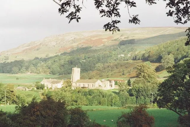
© Chris Downer · Geograph · CC BY-SA 2.0
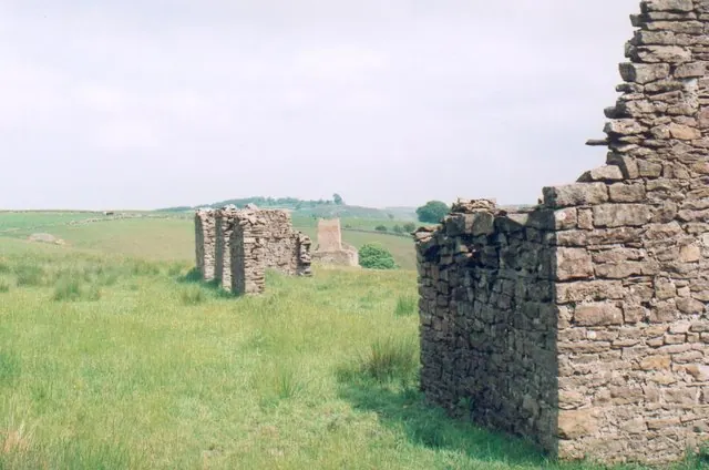
© Matthew Hatton · Geograph · CC BY-SA 2.0
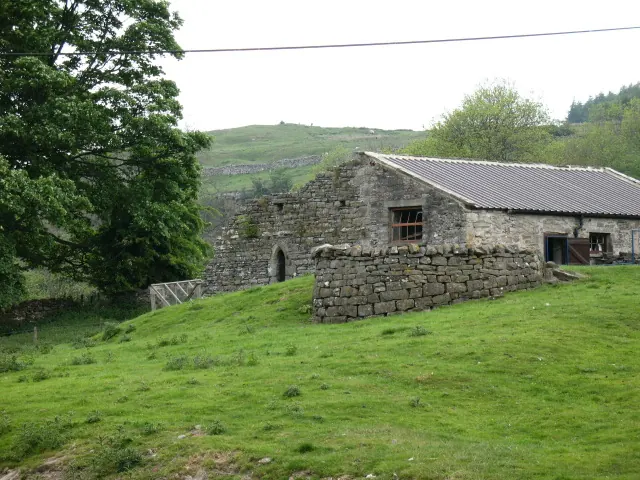
© Gordon Hatton · Geograph · CC BY-SA 2.0
Images © their respective photographers, licensed under CC BY-SA 2.0 and reused here with attribution. Photographs depict listed buildings, churches and monuments near this settlement and may show neighbouring villages.
Location
54.3728°N, -1.8845°W · Land of Count Alan hundred, Yorkshire
View larger map on OpenStreetMap →Data derived from the Open Domesday project (opendomesday.org), based on the Domesday Book dataset compiled by Professor J.J.N. Palmer and team. The Domesday Book (1086) is in the public domain.
Found an inaccuracy? [email protected]