Egton in the Domesday Book (1086)
The settlement of Egton is recorded in William I’s Domesday survey of 1086, entered under the hundred of Langbaurgh in Yorkshire.
Other Settlements in Langbaurgh
- Acklam
- Airy [Holme]
- Aislaby
- Arnodestorp
- Baldebi
- Barnaby
- Barwick
- Battersby
- Bergolbi
- Berguluesbi
- Blaten [Carr]
- Borrowby
- Breck
- Brotton
The Meaning of the Name
The name Egton is of Anglo-Saxon origin. Its final element derives from the Old English word tūn, a farmstead or village. The first element is most likely a personal name or an early descriptive term, now difficult to recover with certainty. Taken together the name probably meant something close to ‘a farmstead’.
Remarkably, the name has changed little since 1086, when the Domesday scribes wrote it as Egton.
Listed Buildings Near Egton
Historic England records 23 listed buildings within about a mile of Egton. Listing protects structures of special architectural or historic interest, graded I (exceptional), II* (particularly important) and II.
Grade II
- Outbuilding Approximately 2.5 Metres North of Arncliffe View High Street - 0.19 km
- 3, EGTON VILLAGE (See details for further address information) - 0.2 km
- Outbuilding Attached to Number 4 High Street - 0.2 km
- 1, EGTON VILLAGE (See details for further address information) - 0.2 km
- 4, EGTON VILLAGE (See details for further address information) - 0.2 km
- Arncliffe View and Garage Attached to Number 5 - 0.2 km
- Cross View - 0.22 km
- Wheatsheaf Inn - 0.24 km
- The Forge and Market Place Cottage - 0.25 km
- The Witching Post - 0.26 km
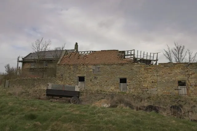
- Range of Former Farmbuildings, Including Wild Rose Barn, Approximately 5 Metres East of Wardles Farm House - 0.29 km
- Stone House - 0.32 km
- Range of Farmbuildings Appeoximately 12.5 Metres South West of Red House Farm House - 0.42 km
- Church View Hill View and Woodbine Cottage - 0.45 km
- Range of Farmbuildings Approximately Ten Metres South of Red House Farm House - 0.45 km
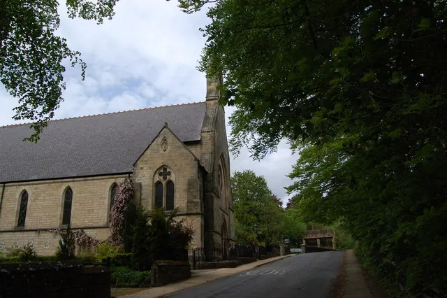
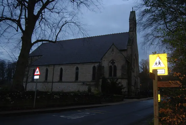
- Walls Piers and Gates to Churchyard of St Hilda - 0.75 km
- Church of St Hilda - 0.75 km
- Primary School and Part of Presbytery - 1.19 km
- Church of St Hedda (Roman Catholic) - 1.19 km
- Walled Garden and Attached Sheds Approximately Seventy Five Metres North East of Egton Manor House - 1.23 km
- Walls and Gate Piers Enclosing Grounds to Egton Manor House - 1.25 km
- Outbuildings Approximately Fifty Metres North of Egton Manor House - 1.26 km
- Outbuildings Approximately Five Metres North of Egton Manor House - 1.28 km
Egton Today
Today Egton lies within the administrative area of Scarborough, and the settlement recorded a population of 460 at the 2021 census. Nine and a half centuries separate that figure from the small rural community the Domesday survey recorded here in 1086.
Read more about modern Egton on Wikipedia .
Nearby Domesday Settlements
Other places recorded in the 1086 survey within a few miles:
- Hangton Hill - 4.0 km W
- Lealholm - 4.1 km W
- Hangton - 5.0 km SW
- Hutton Mulgrave - 5.0 km NE
- Crunkly Gill - 5.1 km W
- Ugthorpe - 5.1 km N
Heritage Around Egton
Photographs of churches, listed buildings and monuments in the vicinity, contributed by volunteers to the Geograph project and reused here under a Creative Commons licence.
© SMJ · Geograph · CC BY-SA 2.0
© N Chadwick · Geograph · CC BY-SA 2.0
© Colin Grice · Geograph · CC BY-SA 2.0
Images © their respective photographers, licensed under CC BY-SA 2.0 and reused here with attribution. Photographs depict listed buildings, churches and monuments near this settlement and may show neighbouring villages.
Data derived from the Open Domesday project (opendomesday.org), based on the Domesday Book dataset compiled by Professor J.J.N. Palmer and team. The Domesday Book (1086) is in the public domain.
Found an inaccuracy? [email protected]