Edale in the Domesday Book (1086)
The 1086 Domesday survey records the settlement of Edale, entered under the hundred of Blackwell in Derbyshire.
At the time of the survey, Edale supported a recorded population of 27 smallholders.
By 1086 Edale was worth 20 shillings, up from 10 shillings before the Conquest – which sets it apart from the many nearby villages left waste or devalued.
Resources Recorded at Edale (1086)
- Mills: 2 mills
- Salthouses: 2
Other Settlements in Blackwell
- Abney
- Ashford [-in-the-Water]
- Aston
- Bakewell
- Bamford
- Baslow
- Beeley
- Birchills
- Birchover
- Blackwell
- Bradwell
- Bubnell
- Burley
- Burton
The Meaning of the Name
The name Edale is of Scandinavian origin. Its final element derives from the Old Norse word dalr, a valley. The first element is most likely a personal name or an early descriptive term, now difficult to recover with certainty. Taken together the name probably meant something close to ‘a valley’.
Names of this type are a fingerprint of Scandinavian settlement: they cluster across the old Danelaw, where Norse-speaking settlers renamed or founded villages from the late 9th century onward.
Remarkably, the name has changed little since 1086, when the Domesday scribes wrote it as Edale.
Listed Buildings Near Edale
Historic England records 19 listed buildings within about a mile of Edale. Listing protects structures of special architectural or historic interest, graded I (exceptional), II* (particularly important) and II.
Grade II
- Sundial in Old Churchyard - 0.31 km
- Church Cottage - 0.33 km
- Edale War Memorial - 0.4 km
- Church of the Holy Trinity - 0.41 km
- Ollerbrook Farmhouse - 0.47 km
- K6 Telephone Kiosk - 0.57 km
- The Warren and Attached Cottage - 0.6 km
- The Old Nags Head - 0.61 km
- Lea House - 0.61 km
- Waterside Cottage - 0.61 km
- Gibralter Bridge - 0.62 km
- Carr Bank - 0.66 km
- Sycamore Cottage - 0.67 km
- The Old Parsonage - 0.73 km
- Edale House - 0.8 km
- The Mill and Attached Chimney - 0.83 km
- Small Clough Farmhouse and Attached Barn - 0.89 km
- Hollins Farmhouse and Attached Barn - 0.93 km
- Grindslow House - 1.0 km
Edale Today
Today Edale lies within the administrative area of High Peak, and the settlement recorded a population of 287 at the 2021 census. Nine and a half centuries separate that figure from the small rural community the Domesday survey recorded here in 1086.
Read more about modern Edale on Wikipedia .
Nearby Domesday Settlements
Other places recorded in the 1086 survey within a few miles:
Heritage Around Edale
Photographs of churches, listed buildings and monuments in the vicinity, contributed by volunteers to the Geograph project and reused here under a Creative Commons licence.
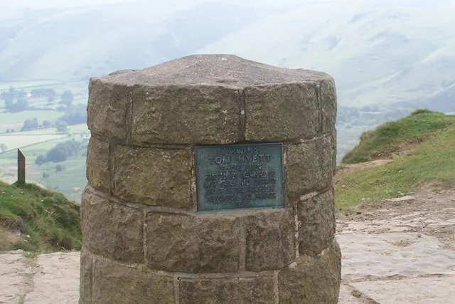
© Dennis simpson · Geograph · CC BY-SA 2.0
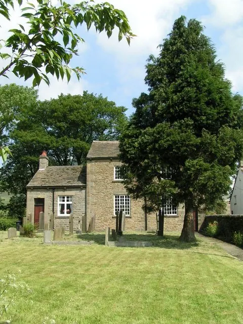
© Dave Dunford · Geograph · CC BY-SA 2.0
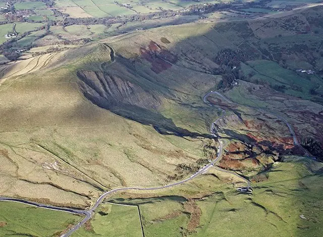
© Richard Bird · Geograph · CC BY-SA 2.0
Images © their respective photographers, licensed under CC BY-SA 2.0 and reused here with attribution. Photographs depict listed buildings, churches and monuments near this settlement and may show neighbouring villages.
Data derived from the Open Domesday project (opendomesday.org), based on the Domesday Book dataset compiled by Professor J.J.N. Palmer and team. The Domesday Book (1086) is in the public domain.
Found an inaccuracy? [email protected]