Eccleston in the Domesday Book (1086)
Eccleston is named in the Domesday Book, compiled by Norman commissioners in 1086, entered under the hundred of Duddeston in Cheshire. The survey assessed Eccleston at 4 carucates of taxable land.
At the time of the survey, Eccleston supported a recorded population of 41 villagers, 30 smallholders, 20 slaves, working 35 ploughs between them.
The survey records Eccleston’s value at 107 shillings in 1086. No pre-Conquest figure survives – not unusual in the North, where records were disrupted by the Harrying and by the patchy coverage of the survey.
The survey lists 2 manors at Eccleston under different lords. Splitting a single settlement between multiple tenants was common across the North – Saxon estates broken up and handed to William’s followers after 1066.
Resources Recorded at Eccleston (1086)
- Mills: 8 mills (valued at 4.14 shillings)
- Churches: 3
- Cattle: 9
- Pigs: 108
- Sheep: 800
- Horses (cobs): 6
- Meadow: 111 acres
- Woodland: 3 * 1 leagues
Other Settlements in Duddeston
- Bettisfield
- Bickerton
- Bickley
- Boughton
- Broxton
- Burwardestone
- Burwardsley and [Higher] Burwardsley
- Caldecott
- Calvintone
- Cheaveley
- Cholmondeley
- Chowley
- Christleton
- Clutton
The Meaning of the Name
The name Eccleston is of Anglo-Saxon origin. Its final element derives from the Old English word tūn, a farmstead or village. The first element is most likely a personal name or an early descriptive term, now difficult to recover with certainty. Taken together the name probably meant something close to ‘a farmstead’.
Remarkably, the name has changed little since 1086, when the Domesday scribes wrote it as Eccleston.
Listed Buildings Near Eccleston
Historic England records 54 listed buildings within about a mile of Eccleston. Listing protects structures of special architectural or historic interest, graded I (exceptional), II* (particularly important) and II.
Grade I
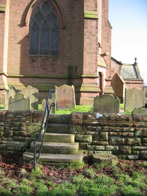
- Church of St Mary - 0.34 km
Grade II*
- Eccleston Paddocks - 0.42 km
Grade II
- Coachman’s Cottage and Attached Coach-house Riverside House - 0.21 km
- Riverside House - 0.22 km
- Garden Walls, Gateposts and Gates Along Church Road to Riverside and Coach-house - 0.25 km
- The Rectory and Attached Coach House - 0.28 km
- Bee House in Rectory Garden - 0.28 km
- Church House - 0.3 km
- Churchyard Gates, Piers and Wing Walls - 0.31 km
- Eccleston Ferry Farmhouse - 0.31 km
- Manor House - 0.33 km
- Bandstand in Eccleston Ferry Farmhouse Garden - 0.33 km
- Former Institute (Now Office of Chartered Surveyor) - 0.35 km
- Walls and Gates Between Old Church Lane and Old Churchyard - 0.35 km
- Church Villas and Linked Storshed and Domestic Offices - 0.35 km
- Shelter (At Junction With Paddock Road - Forming Island in Road) - 0.36 km
- Post Office With Postmaster’s House and Attached House to Right - 0.37 km
- Tomb of Edward George Hugh, Earl Grosvenor - 0.37 km
- House and Attached Cottage (Northernmost on West Side of Paddock Rd) - 0.37 km
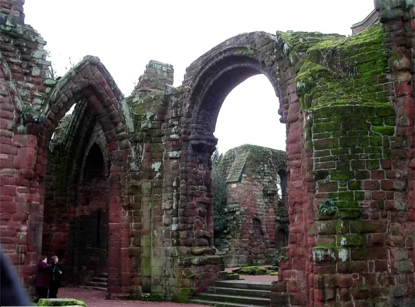
- Remains of Former Church of St Mary - 0.38 km
- Police House - 0.39 km
- Morris Oak Cottages - 0.41 km
- Old Church Way the Cottage - 0.42 km
- Hill Road With Storeshed and Domestic Offices Attached - 0.44 km
…and 30 more listed structures in the area.
Scheduled Monuments Near Eccleston
Scheduled monuments are nationally important archaeological sites given legal protection. 5 lie within roughly a mile of Eccleston:
- Motte and associated earthworks east of Old Rectory - 0.35 km
- Huntington Hall moated site - 1.07 km
- Heronbridge Roman site - 1.33 km
- Moated site and fishpond S of Huntington Hall - 1.44 km
- Moated site north-west of Mill Hill House Farm - 1.5 km
Eccleston Today
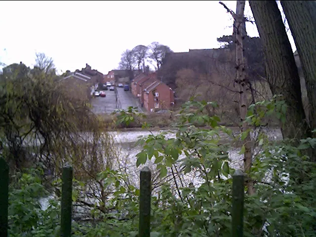
Today Eccleston lies within the administrative area of Eaton and Eccleston, and the settlement recorded a population of 246 at the 2011 census. Nine and a half centuries separate that figure from the small rural community the Domesday survey recorded here in 1086.
Read more about modern Eccleston on Wikipedia .
Nearby Domesday Settlements
Other places recorded in the 1086 survey within a few miles:
- Huntington - 1.0 km E
- Claverton - 1.4 km NW
- Cheaveley - 1.4 km SE
- Handbridge - 2.0 km N
- Eaton - 2.0 km S
- Marlston - 2.2 km NW
Heritage Around Eccleston
Photographs of churches, listed buildings and monuments in the vicinity, contributed by volunteers to the Geograph project and reused here under a Creative Commons licence.
© Tom Pennington · Geograph · CC BY-SA 2.0
© John S Turner · Geograph · CC BY-SA 2.0
© chestertouristcom · Geograph · CC BY-SA 2.0
Images © their respective photographers, licensed under CC BY-SA 2.0 and reused here with attribution. Photographs depict listed buildings, churches and monuments near this settlement and may show neighbouring villages.
Data derived from the Open Domesday project (opendomesday.org), based on the Domesday Book dataset compiled by Professor J.J.N. Palmer and team. The Domesday Book (1086) is in the public domain.
Found an inaccuracy? [email protected]