Eastwick in the Domesday Book (1086)
Eastwick appears in the Domesday Book of 1086, entered under the hundred of Burghshire in Yorkshire.
Other Settlements in Burghshire
- Addlethorpe
- Aismunderby
- Aldfield
- Allerton [Mauleverer]
- Arkendale
- Askwith
- Azerley
- Barrowby [Grange]
- Beckwith [House]
- Besthaim
- Bestham
- Bewerley
- Bilton
- Birstwith
The Meaning of the Name
The name Eastwick is of Anglo-Saxon origin. Its final element derives from the Old English word wīc, a dwelling, dairy farm or trading settlement, while the first element appears to represent the eastern. Taken together the name probably meant something close to ’the eastern specialised farm’.
Remarkably, the name has changed little since 1086, when the Domesday scribes wrote it as Eastwick.
Listed Buildings Near Eastwick
Historic England records 25 listed buildings within about a mile of Eastwick. Listing protects structures of special architectural or historic interest, graded I (exceptional), II* (particularly important) and II.
Grade I
- Newby Hall - 0.19 km
- Stables Approximately 150 Metres North of Newby Hall - 0.2 km
Grade II
- Garden Ornament Approximately 30 Metres West of Newby Hall - 0.15 km
- Urn and Pedestal to North of West End of of Statue Walk - 0.16 km
- Bench at West End of Statue Walk - 0.17 km
- Two Lead Urns on Terrace West of Newby Hall - 0.17 km
- Garden Ornament Approximately 10 Metres West of Hall - 0.17 km
- Two Lead Water Tanks on Terrace West of Newby Hall - 0.18 km
- Watering Trough in Centre of Stable Yard at Newby Hall - 0.18 km
- Former Orangery and Gateway With Gate to Right Approximately 100 Metres North East of Stable Block at Newby Hall - 0.19 km
- Urn and Pedestal to South of West End of Statue Walk - 0.19 km
- Balustrade, Two Sets of Steps and Stone Bench on South Side of Newby Hall - 0.2 km
- Statue Walk With 6 Statues, and 5 Sets of Steps With Flanking Balustrades - 0.2 km
- Four Urns and Pedestals on Vista South of Newby Hall - 0.21 km
- Inner and Outer Pairs of Gate Piers, With Gates, Approximately 50 Metres East of Newby Hall - 0.26 km
- Memorial of the Nidd Ferry Disater in Grounds to South of Newby Hall - 0.27 km
- Urn and Pedestal to North of East End of Statue Walk - 0.27 km
- Equestrian Statue Approximately 150 Metres East of Newby Hall - 0.36 km
- Urn and Pedestal in Orchard Approximately 10 Metres West of West Kitchen Garden Wall - 0.42 km
- Walls on East and West Sides of Kitchen Gardens, With Linking Wall Between - 0.44 km
- Wheelhouse to West of West Garden Wall - 0.45 km
- Lodge to Newby Hall - 0.89 km
- Gates, Gate Piers and Flanking Walls at Lodge to Newby Hall - 0.9 km
- The Old Corn Mill With Attached Pigsty and Stable - 1.1 km
…and 1 more listed structures in the area.
Eastwick Today
Today Eastwick lies within the administrative area of Harrogate, and the settlement recorded a population of 28 at the 2021 census. Nine and a half centuries separate that figure from the small rural community the Domesday survey recorded here in 1086.
Read more about modern Newby with Mulwith on Wikipedia .
Nearby Domesday Settlements
Other places recorded in the 1086 survey within a few miles:
- Westwick - 1.0 km S
- Skelton - 2.0 km E
- Bishop Monkton - 2.2 km SW
- Brampton Hall - 2.2 km SE
- Givendale - 2.2 km NW
- Littlethorpe - 2.8 km NW
Heritage Around Eastwick
Photographs of churches, listed buildings and monuments in the vicinity, contributed by volunteers to the Geograph project and reused here under a Creative Commons licence.
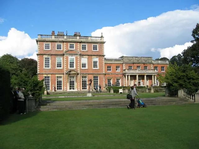
© Lynne Glazzard · Geograph · CC BY-SA 2.0
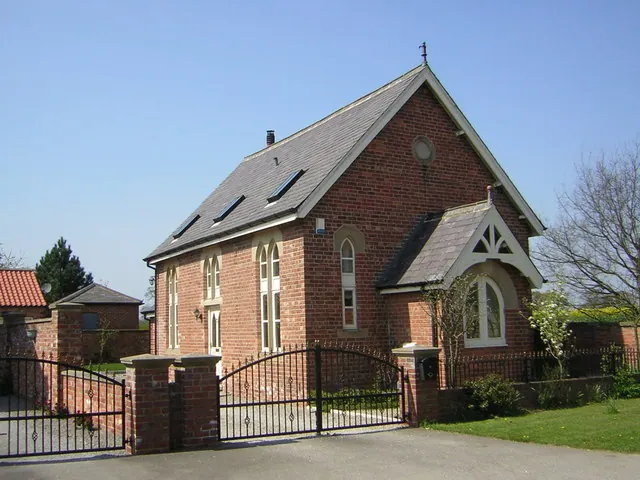
© manonabike · Geograph · CC BY-SA 2.0
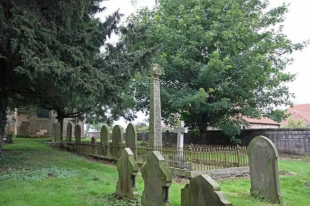
© John Salmon · Geograph · CC BY-SA 2.0
Images © their respective photographers, licensed under CC BY-SA 2.0 and reused here with attribution. Photographs depict listed buildings, churches and monuments near this settlement and may show neighbouring villages.
Data derived from the Open Domesday project (opendomesday.org), based on the Domesday Book dataset compiled by Professor J.J.N. Palmer and team. The Domesday Book (1086) is in the public domain.
Found an inaccuracy? [email protected]