Eastham in the Domesday Book (1086)
The settlement of Eastham is recorded in William I’s Domesday survey of 1086, entered under the hundred of Willaston in Cheshire.
Other Settlements in Willaston
The Meaning of the Name
The name Eastham is of Anglo-Saxon origin. Its final element derives from the Old English word hām, a homestead or village, while the first element appears to represent the eastern. Taken together the name probably meant something close to ’the eastern homestead’.
Remarkably, the name has changed little since 1086, when the Domesday scribes wrote it as Eastham.
Listed Buildings Near Eastham
Historic England records 12 listed buildings within about a mile of Eastham. Listing protects structures of special architectural or historic interest, graded I (exceptional), II* (particularly important) and II.
Grade II
- 31-35, Stanley Lane - 0.58 km
- St Marys Primary School and Number 69 Old Masters House - 0.6 km
- 93, Eastham Village Road - 0.62 km
- Eastham War Memorial - 0.62 km
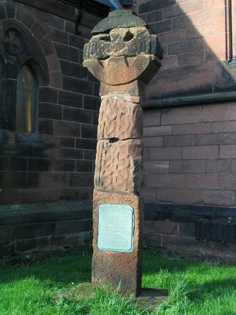
- Village Cross at Junction With Eastham Village Road - 0.62 km
- Hall Farmhouse - 0.62 km
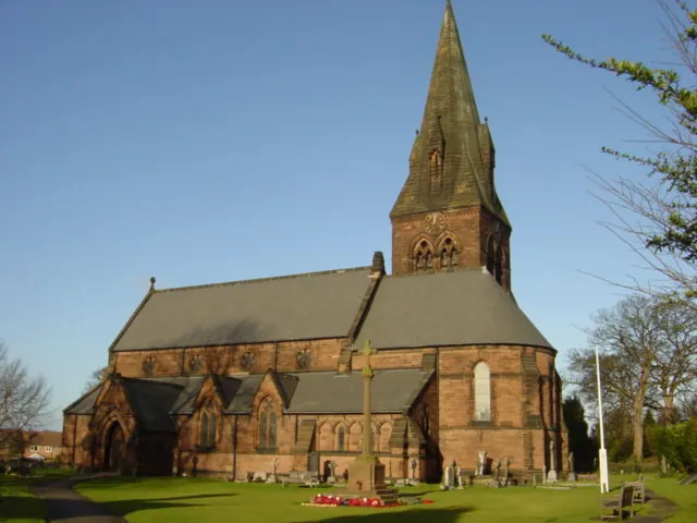
- Church of St Mary - 0.63 km
- Sundial to South of Porch to St Mary’s Church - 0.65 km
- Grove House - 0.66 km
- 111, Eastham Village Road - 0.69 km
- 3, Church Lane - 0.7 km
- Chapel at Carlett Park Technical College - 0.88 km
Eastham Today
Today Eastham lies within the administrative area of Wirral, and the settlement recorded a population of 13,882 at recent figures. Nine and a half centuries separate that figure from the small rural community the Domesday survey recorded here in 1086.
Read more about modern Eastham on Wikipedia .
Nearby Domesday Settlements
Other places recorded in the 1086 survey within a few miles:
- Hooton - 1.4 km SE
- Poulton Lancelyn - 2.2 km NW
- Hargrave - 3.2 km W
- Great and Little Sutton - 3.6 km SE
- Hadlow - 3.6 km SW
- Raby - 4.1 km W
Heritage Around Eastham
Photographs of churches, listed buildings and monuments in the vicinity, contributed by volunteers to the Geograph project and reused here under a Creative Commons licence.
© Peter Craine · Geograph · CC BY-SA 2.0
© Sue Adair · Geograph · CC BY-SA 2.0
© Peter Craine · Geograph · CC BY-SA 2.0
Images © their respective photographers, licensed under CC BY-SA 2.0 and reused here with attribution. Photographs depict listed buildings, churches and monuments near this settlement and may show neighbouring villages.
Data derived from the Open Domesday project (opendomesday.org), based on the Domesday Book dataset compiled by Professor J.J.N. Palmer and team. The Domesday Book (1086) is in the public domain.
Found an inaccuracy? [email protected]