Dunsley in the Domesday Book (1086)
The 1086 Domesday survey records the settlement of Dunsley, entered under the hundred of Langbaurgh in Yorkshire.
Other Settlements in Langbaurgh
- Acklam
- Airy [Holme]
- Aislaby
- Arnodestorp
- Baldebi
- Barnaby
- Barwick
- Battersby
- Bergolbi
- Berguluesbi
- Blaten [Carr]
- Borrowby
- Breck
- Brotton
The Meaning of the Name
The name Dunsley is of Anglo-Saxon origin. Its final element derives from the Old English word lēah, a woodland clearing or glade. The first element is most likely a personal name or an early descriptive term, now difficult to recover with certainty. Taken together the name probably meant something close to ‘a clearing’.
Remarkably, the name has changed little since 1086, when the Domesday scribes wrote it as Dunsley.
Listed Buildings Near Dunsley
Historic England records 22 listed buildings within about a mile of Dunsley. Listing protects structures of special architectural or historic interest, graded I (exceptional), II* (particularly important) and II.
Grade II
- Fairfax Farm House - 0.3 km
- Hodgson Haggs Farmhouse and Byre Range Adjoining - 0.32 km
- South Lodge With Wall and Gate Piers Adjoining - 0.94 km
- Raven Hill Farmhouse and Barn Adjoining - 1.06 km
- Mulgrave Cottage - 1.13 km
- Roman Cement Mill and Mill House - 1.15 km
- Lime Kiln to North of Roman Cement Mill - 1.16 km
- Mulgrave Lodge - 1.17 km
- Thordisa Cottage - 1.18 km
- Laurel Cottage and Beech Cottage - 1.18 km
- Low Heulah Cottage - 1.19 km
- Estbek House - 1.2 km
- St Mary’s Cottage - 1.23 km
- House to East of Public House - 1.23 km
- Lumley Cottage - 1.24 km
- Langholm - 1.24 km
- Daneholm - 1.24 km
- Ivy Cottage - 1.25 km
- Primrose Cottage - 1.25 km
- Cottage to East of Primrose Cottage - 1.26 km
- Rock Head Cottage - 1.27 km
- Rigg Cottage and the Cottage - 1.28 km
Scheduled Monuments Near Dunsley
Scheduled monuments are nationally important archaeological sites given legal protection. 2 lie within roughly a mile of Dunsley:
- Ash Holm alum works, 350m south east of Mulgrave Castle - 1.39 km
- Sandsend alum house - 1.51 km
Dunsley Today
Today Dunsley lies within the administrative area of Newholm-cum-Dunsley.
Nearby Domesday Settlements
Other places recorded in the 1086 survey within a few miles:
- Newholm - 1.4 km SE
- Mulgrave Castle - 2.0 km W
- Hutton Mulgrave - 2.2 km SW
- Lythe - 2.2 km NW
- Aislaby - 3.0 km S
- High Stakesby - 3.2 km E
Heritage Around Dunsley
Photographs of churches, listed buildings and monuments in the vicinity, contributed by volunteers to the Geograph project and reused here under a Creative Commons licence.
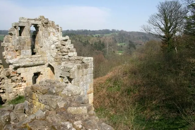
© Mick Garratt · Geograph · CC BY-SA 2.0
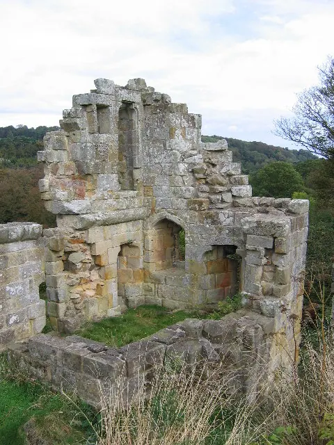
© Stephen Horncastle · Geograph · CC BY-SA 2.0
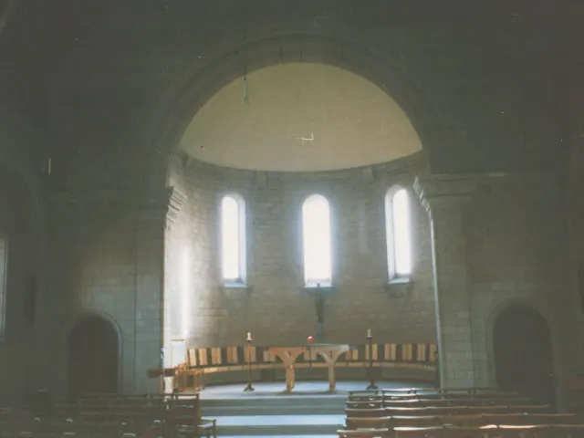
© Stephen Craven · Geograph · CC BY-SA 2.0
Images © their respective photographers, licensed under CC BY-SA 2.0 and reused here with attribution. Photographs depict listed buildings, churches and monuments near this settlement and may show neighbouring villages.
Data derived from the Open Domesday project (opendomesday.org), based on the Domesday Book dataset compiled by Professor J.J.N. Palmer and team. The Domesday Book (1086) is in the public domain.
Found an inaccuracy? [email protected]