Drighlington in the Domesday Book (1086)
Drighlington is named in the Domesday Book, compiled by Norman commissioners in 1086, entered under the hundred of Morley in Yorkshire.
Other Settlements in Morley
- Allerton
- Armley
- Batley
- Beeston
- Bolton
- Bowling
- Bradford
- Bramley
- Calverley
- Carlton
- Chellow [Grange]
- Clayton
- Clifton
- Cruttonstall
The Meaning of the Name
The name Drighlington is of Anglo-Saxon origin. Its final element derives from the Old English word tūn, a farmstead or village. The first element is most likely a personal name or an early descriptive term, now difficult to recover with certainty. Taken together the name probably meant something close to ‘a farmstead’.
Remarkably, the name has changed little since 1086, when the Domesday scribes wrote it as Drighlington.
Listed Buildings Near Drighlington
Historic England records 28 listed buildings within about a mile of Drighlington. Listing protects structures of special architectural or historic interest, graded I (exceptional), II* (particularly important) and II.
Grade I
- Lumb Hall - 0.16 km
Grade II
- Dutch Barn With Adjustable Roof Immediately North West of Lumb Hall Barn - 0.18 km
- Lumb Hall Barn - 0.19 km
- Stable and Cartshed immediately opposite the Lumb Hall Barn - 0.19 km
- Lumb House - 0.19 km
- Church of St Paul - 0.32 km
- Longlands - 0.38 km
- 2, Old Lane - 0.43 km
- Former Drighlington Junior School - 0.46 km
- The Kings Cantonese Restaurant and Attached Stable Block to Rear - 0.52 km
- No. 42 Old Lane - 0.66 km
- Milestone Approximately 50 Metres South West of no 74 - 0.66 km
- Dale Farmhouse - 0.83 km
- Post Office and Tong Parish Room - 1.2 km
- Numbers 16 and 16A and the Barn - 1.2 km
- 9, Tong Lane - 1.22 km
- Barn at Shawfield Farm - 1.23 km
- 3 and 5, Tong Lane - 1.23 km
- The Greyhound Public House - 1.23 km
- Church Farmhouse - 1.23 km
- Stocks to Right Hand of Gates to Churchyard of Church of St James - 1.24 km
- The Old Vicarage - 1.24 km
- Gates and Gate Piers to Churchyard of Church of St James - 1.25 km
- Wyre Hall - 1.25 km
…and 4 more listed structures in the area.
Drighlington Today
Today Drighlington lies within the administrative area of Leeds, and the settlement recorded a population of 5,725 at the 2021 census. Nine and a half centuries separate that figure from the small rural community the Domesday survey recorded here in 1086.
Read more about modern Drighlington on Wikipedia .
Nearby Domesday Settlements
Other places recorded in the 1086 survey within a few miles:
Heritage Around Drighlington
Photographs of churches, listed buildings and monuments in the vicinity, contributed by volunteers to the Geograph project and reused here under a Creative Commons licence.
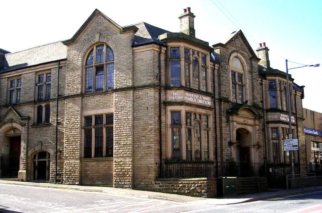
© Betty Longbottom · Geograph · CC BY-SA 2.0
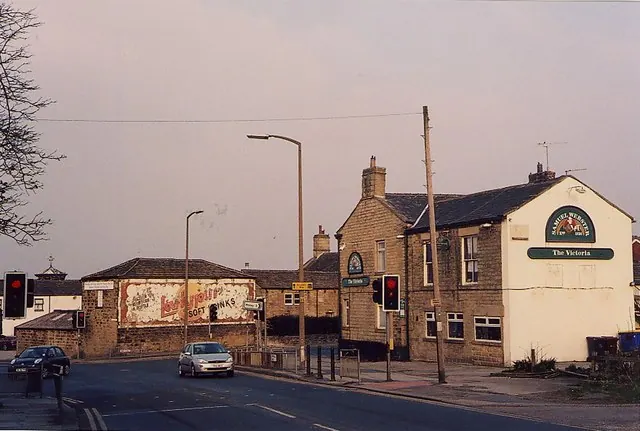
© Michael Woodhead · Geograph · CC BY-SA 2.0
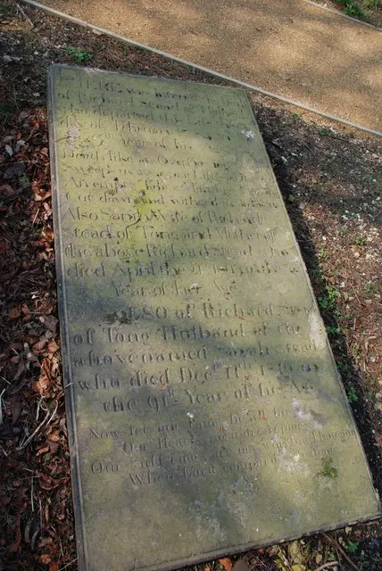
© Michael Woodhead · Geograph · CC BY-SA 2.0
Images © their respective photographers, licensed under CC BY-SA 2.0 and reused here with attribution. Photographs depict listed buildings, churches and monuments near this settlement and may show neighbouring villages.
Data derived from the Open Domesday project (opendomesday.org), based on the Domesday Book dataset compiled by Professor J.J.N. Palmer and team. The Domesday Book (1086) is in the public domain.
Found an inaccuracy? [email protected]